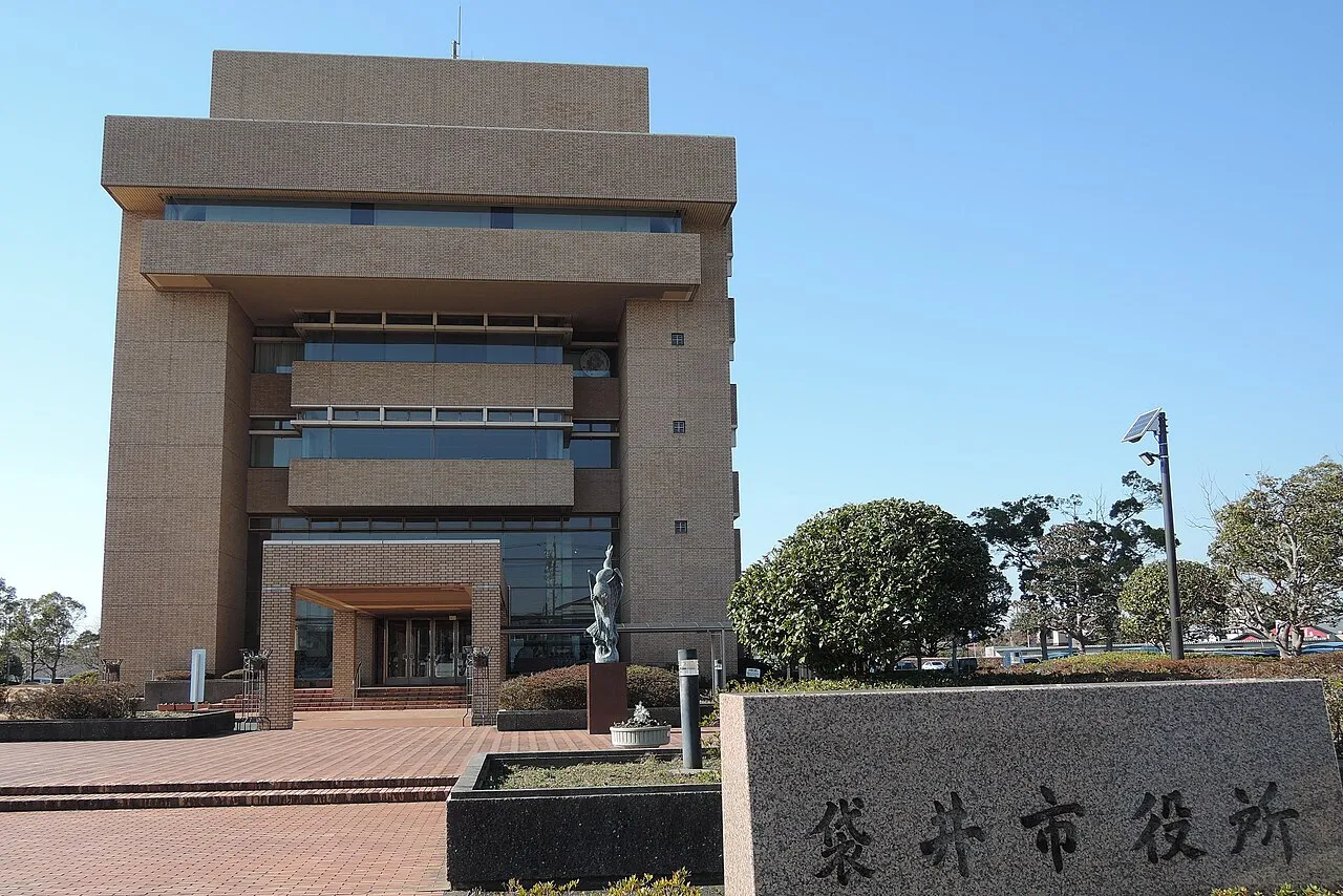
- Population
- 88,395
- 88.4K
- Elevation
- 11 m
- above sea level
- Local time
- UTC+09:00
- Asia/Tokyo · UTC+09:00
- Airports
- FSZ Mount Fuji Shizuoka Airport26 km
- NGO Chubu Centrair International Airport102 km
About Fukuroi
Fukuroi is a city. Location: Fukuroi Shi, Shizuoka. Population: 88,395. Elevation: 11 m.
Fukuroi (袋井市, Fukuroi-shi) is a city located in Shizuoka Prefecture, Japan. As of 1 July 2019, the city had an estimated population of 88,395 in 34,842 households, and a population density of 820 persons per km2. The total area of the city was 108.33 square kilometres (41.83 sq mi). Fukuroi is a member of the World Health Organization’s Alliance for Healthy Cities (AFHC).
Source: Wikipedia · CC BY-SA 4.0
Travel notes for Fukuroi
From Wikivoyage
Fukuroi (袋井) is a city in Shizuoka.
Understand+
Tourist information site:
The local tourist association has a Japanese-only guide site. with integrated Google Translate.
Get in+
Fukuroi is located on the JR Tokaido Line between Shizuoka and Hamamatsu.
The nearest Tokaido Shinkansen stations to Fukuroi are at Kakegawa and Hamamatsu. If coming from the east (i.e. Tokyo), take a Shinkansen Kodama train to Kakegawa and change to the JR Tokaido Line (2 hours from Tokyo, ¥7650). From the west (i.e. Nagoya, Kyoto, Osaka), take a Shinkansen Hikari or Kodama to Hamamatsu and change there to the JR Tokaido Line. (90 minutes from Kyoto via Hikari, 2 hours via Kodama, ¥8380).
There is no charge to use these trains with the Japan Rail Pass.
Source: Wikivoyage · CC BY-SA 4.0 · abridged
Places bordering Fukuroi
- Kakegawa
- Iwata
- Mori
Twin towns and sister cities of Fukuroi
- Shiojiri-shi· Japan
- Iwanuma· Japan
Source: Wikidata. Only places with a page on this site are shown.
Population of Fukuroi over time
| 2010 | 84,846 | |
|---|---|---|
| 2015 | 85,789 | |
| 2021 | 86,851 |
Censuses and official estimates; source: Wikidata.
Climate of Fukuroi
Best months for sightseeingBest months for sightseeing: May–June, October.
This month · November
A wet month
Day 18° · Night 9° · Rain 128 mm
Better nearby cities in November
- Fujinomiya · 82 km northeast18°
- Fuji · 84 km northeast20°
- Numazu · 95 km northeast18°
- Hottest month
- August (day 30°)
- Coldest month
- January (night 2°)
- Wettest month
- June (289 mm)
- Driest month
- December (77 mm)
Bars: average monthly low and high temperature. Below: precipitation. Monthly averages for 1970–2000 at about 18 km resolution, adjusted for elevation. Highlighted months are mild and relatively dry. Source: WorldClim 2.1 (CC BY 4.0).
Show values as a table
| Month | Jan | Feb | Mar | Apr | May | Jun | Jul | Aug | Sep | Oct | Nov | Dec |
|---|---|---|---|---|---|---|---|---|---|---|---|---|
| Average high (°C) | 10° | 11° | 14° | 19° | 23° | 25° | 29° | 30° | 27° | 23° | 18° | 13° |
| Average low (°C) | 2° | 2° | 5° | 10° | 14° | 19° | 22° | 23° | 20° | 15° | 9° | 4° |
| Precipitation (mm) | 80 | 98 | 168 | 202 | 213 | 289 | 227 | 214 | 235 | 201 | 128 | 77 |
How to get to Fukuroi
The nearest airport is Mount Fuji Shizuoka Airport (FSZ), 26 km to the east as the crow flies. The nearest large city is Iwata, 8 km to the southwest.
Airports
- Mount Fuji Shizuoka Airport (FSZ) Makinohara / Shimada 26 kmeast
- Chubu Centrair International Airport (NGO) Tokoname 102 kmwest
- Nagoya Airport / JASDF Komaki Air Base (NKM) Nagoya 107 kmnorthwest
Nearby large cities
- Iwata Population: 166.7K 8 kmsouthwest
- Kakegawa Population: 117.9K 9 kmeast
- Fujieda Population: 145K 35 kmeast
- Yaizu Population: 139.6K 39 kmeast
- Toyokawa Population: 184.7K 48 kmwest
Straight-line distances; road distances are longer. Airport data: OurAirports.
Day trips from Fukuroi
Within 100 km: 4 historic and cultural sites, 17 natural sites, 16 lakes, rivers and coasts.
0–25 km2 places
- Kiku River River 18 kmSE
- Tenryu River River 16 kmSW
25–60 km7 places
- Suruga Bay Natural site 59 kmE
- Oi River River 34 kmE
- Abe River River 48 kmNE
- Toro Iseki Historic site 50 kmNE
60–100 km28 places
- Tōshi-jima Island 98 kmW
- Himakajima Island 84 kmW
- Kami-jima Island 89 kmW
- Mount Echizen-dake Mountain 97 kmNE
Straight-line distances.
Fukuroi and similar cities
Side by side with cities of similar size in the same country: population, elevation and climate.
| Measure | Fukuroi | Mobara | Takayama | Iga |
|---|---|---|---|---|
| Population | 88.4K | 88.3K | 88.5K | 88.9K |
| Elevation | 11 m | 14 m | 583 m | 152 m |
| Summer day (hottest month) | 30° | 29° | 29° | 31° |
| Winter night (coldest month) | 2° | 0° | -5° | -1° |
| Annual rainfall | 2,132 mm | 1,562 mm | 1,891 mm | 1,621 mm |
| Best months | May–Jun, Oct | May–Jul, Sep–Oct | May–Jun, Sep | May–Jun, Sep–Oct |
| Distance | — | 230 km | 165 km | 163 km |
Climate values are 1970–2000 monthly averages; straight-line distance.
Nearby attractions & nature
Everything nearby-
Kiku River River, Shizuoka18 km SE
-
Tenryu River River, Shizuoka16 km SW
Sources & licences
Data last updated: · 2 independent sources