
- Elevation
- 1 m
- above sea level
- Local time
- UTC+09:00
- Asia/Tokyo · UTC+09:00
- Airports
- FSZ Mount Fuji Shizuoka Airport59 km
- NGO Chubu Centrair International Airport68 km
About Mikkabi
Mikkabi is a village. Location: Kita Ku, Hamamatsu. Elevation: 1 m.
Mikkabi (三ヶ日町, Mikkabi-chō) was a town located in Inasa District, Shizuoka Prefecture, Japan. At the time of its merger, the town had an estimated population of 16,059 and a density of 212.28 persons per km2. The total area was 75.65 km2.
Source: Wikipedia · CC BY-SA 4.0
At a glance
- Built
- 1955
- Area
- 75.7 km²
Source: Wikidata
Climate of Mikkabi
Best months for sightseeingBest months for sightseeing: May–June, September–November.
This month · November
A good month to visit
Day 17° · Night 9° · Rain 109 mm
- Hottest month
- August (day 30°)
- Coldest month
- January (night 2°)
- Wettest month
- June (263 mm)
- Driest month
- January (62 mm)
Bars: average monthly low and high temperature. Below: precipitation. Monthly averages for 1970–2000 at about 18 km resolution, adjusted for elevation. Highlighted months are mild and relatively dry. Source: WorldClim 2.1 (CC BY 4.0).
Show values as a table
| Month | Jan | Feb | Mar | Apr | May | Jun | Jul | Aug | Sep | Oct | Nov | Dec |
|---|---|---|---|---|---|---|---|---|---|---|---|---|
| Average high (°C) | 10° | 10° | 13° | 18° | 22° | 25° | 28° | 30° | 27° | 22° | 17° | 12° |
| Average low (°C) | 2° | 2° | 5° | 10° | 14° | 19° | 22° | 23° | 20° | 15° | 9° | 4° |
| Precipitation (mm) | 62 | 82 | 141 | 189 | 206 | 263 | 225 | 213 | 215 | 179 | 109 | 64 |
Other places to visit in this season: May June September October November
How to get to Mikkabi
The nearest airport is Mount Fuji Shizuoka Airport (FSZ), 59 km to the east as the crow flies. The nearest large city is Toyokawa, 14 km to the west.
Airports
- Mount Fuji Shizuoka Airport (FSZ) Makinohara / Shimada 59 kmeast
- Chubu Centrair International Airport (NGO) Tokoname 68 kmwest
- Nagoya Airport / JASDF Komaki Air Base (NKM) Nagoya 76 kmnorthwest
Nearby large cities
- Toyokawa Population: 184.7K 14 kmwest
- Toyohashi Population: 377.5K 16 kmwest
- Iwata Population: 166.7K 30 kmeast
- Okazaki Population: 384.7K 39 kmnorthwest
- Kakegawa Population: 117.9K 43 kmeast
Straight-line distances; road distances are longer. Airport data: OurAirports.
Day trips from Mikkabi
Within 100 km: 8 historic and cultural sites, 15 natural sites, 27 lakes, rivers and coasts.
0–25 km2 places
- Toyo River River 20 kmW
- Hongū-zan Mountain 16 kmNW
25–60 km12 places
- Himakajima Island 51 kmW
- Kami-jima Island 59 kmSW
- Mount Akiha Mountain 35 kmNE
- Kiku River River 50 kmE
60–100 km36 places
- Tōshi-jima Island 68 kmSW
- Sakate-jima Island 72 kmSW
- Kashiko Island Island 87 kmSW
- Suruga Bay Natural site 92 kmE
Straight-line distances.
Nearby attractions & nature
Everything nearby-
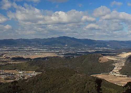 Hongū-zan Mountain, Toyokawa-shi16 km NW
-
Toyo River River, Japan20 km W
Sources & licences
Data last updated: · 2 independent sources