- Population
- 30,678
- 30.7K
- Elevation
- 55 m
- above sea level
- Local time
- UTC+09:00
- Asia/Tokyo · UTC+09:00
- Airports
- OIM Oshima Airport43 km
- FSZ Mount Fuji Shizuoka Airport72 km
About Izu
Izu is a city. Location: Izu-shi, Shizuoka. Population: 30,678. Elevation: 55 m.
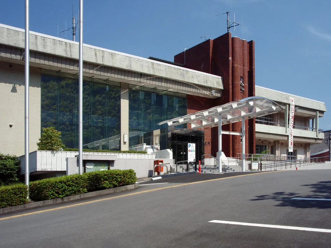
Izu (伊豆市, Izu-shi; Japanese pronunciation: [ì.(d͡)zɨ́(.ɕì)]) is a city located in central Izu Peninsula in Shizuoka Prefecture, Japan. As of 1 April 2019, the city had an estimated population of 30,678 in 13,390 households, and a population density of 84 persons per km2. The total area of the city was 363.97 square kilometres (140.53 sq mi).
Source: Wikipedia · CC BY-SA 4.0
Photos of Izu
-

pcs34560 · Public domain -

小池 隆 · CC BY 4.0 -

Project Kei · CC BY-SA 4.0


Travel notes for Izu
From Wikivoyage
Izu (伊豆市 Izu-shi) is a city in Shizuoka. People often use the word "Izu" to refer to the entire Izu Peninsula, located in eastern Shizuoka Prefecture.
Shuzenji (修善寺) is a major hot spring town. Officially, it merged with other towns in 2004 to form Izu, but the area is still more commonly called Shuzenji.
Understand+
In 2007, Shuzenji celebrated the 1200th anniversary of its founding. The original town was built around Shuzen-ji Temple, from which it gains its name. It is a pleasant little town with many hot spring hotels overlooking the river.
There are two official tourist information sites (both are Japanese-only with integrated Google Translate):
merged city's official site and
info site for Shuzenji onsen area.
Get in+
1 Shuzenji Station is the last station on a ride through a broad valley on the Izuhakone Railway Sunzu Line, connecting to Mishima on the Tokaido Shinkansen and the JR Tokaido Main Line. From Mishima, it takes about 35 minutes and costs ¥510. A trip from Tokyo on the Hikari or Kodama Shinkansen takes 1½-2 hours (¥4,830; with Japan Rail Pass you only have to pay the ¥510 for the Izuhakone Railway segment). From Tokyo, there is also a twice-daily (departing 09:00 and 12:00, returning 12:35 and 15:39) Odoriko limited express, completing the trip in about 2 hours for ¥4,510.
Shuzenji can also be reached by Tokai Bus from other places on the Izu Peninsula.
Source: Wikivoyage · CC BY-SA 4.0 · abridged
Places bordering Izu
- Numazu
- Itō
- Izunokuni
- Higashiizu Chō
- Kōchi
- Nishiizu Chō
Twin towns and sister cities of Izu
- Shizuoka· Japan
Source: Wikidata. Only places with a page on this site are shown.
Population of Izu over time
| 2010 | 34,202 | |
|---|---|---|
| 2015 | 31,317 | |
| 2021 | 28,493 |
Censuses and official estimates; source: Wikidata.
Climate of Izu
Best months for sightseeingBest months for sightseeing: April–June, October–November.
This month · November
A good month to visit
Day 19° · Night 10° · Rain 114 mm
- Hottest month
- August (day 31°)
- Coldest month
- January (night 3°)
- Wettest month
- June (253 mm)
- Driest month
- December (63 mm)
Bars: average monthly low and high temperature. Below: precipitation. Monthly averages for 1970–2000 at about 18 km resolution, adjusted for elevation. Highlighted months are mild and relatively dry. Source: WorldClim 2.1 (CC BY 4.0).
Show values as a table
| Month | Jan | Feb | Mar | Apr | May | Jun | Jul | Aug | Sep | Oct | Nov | Dec |
|---|---|---|---|---|---|---|---|---|---|---|---|---|
| Average high (°C) | 12° | 12° | 14° | 19° | 23° | 26° | 29° | 31° | 27° | 23° | 19° | 14° |
| Average low (°C) | 3° | 3° | 6° | 11° | 15° | 19° | 23° | 24° | 21° | 16° | 10° | 5° |
| Precipitation (mm) | 67 | 85 | 146 | 170 | 178 | 253 | 202 | 248 | 250 | 187 | 114 | 63 |
Other places to visit in this season: April May June October November
How to get to Izu
The nearest airport is Oshima Airport (OIM), 43 km to the southeast as the crow flies. For international flights: Mount Fuji Shizuoka Airport (FSZ) (72 km). The nearest large city is Numazu, 16 km to the northwest.
Airports
- Oshima Airport (OIM) Izu Oshima 43 kmsoutheast
- Mount Fuji Shizuoka Airport (FSZ) Makinohara / Shimada 72 kmwest
- Tokyo Haneda International Airport (HND) Tokyo 100 kmnortheast
Nearby large cities
- Numazu Population: 189.5K 16 kmnorthwest
- Mishima Population: 107.9K 16 kmnorth
- Fuji Population: 245.4K 32 kmnorthwest
- Odawara Population: 188.9K 37 kmnortheast
- Fujinomiya Population: 132.5K 41 kmnorthwest
Straight-line distances; road distances are longer. Airport data: OurAirports.
Day trips from Izu
Within 100 km: 20 historic and cultural sites, 43 natural sites, 39 lakes, rivers and coasts.
0–25 km4 places
- Hatsu-shima Island 22 kmE
- Izu Hantō Natural site 12 kmS
- Banzaburō Dake Mountain 13 kmSE
- Kano River River 15 kmNW
25–60 km28 places
- Ō Shima Island 49 kmSE
- To Shima Island 58 kmSE
- Mount Echizen-dake Mountain 33 kmNW
- Suruga Bay Natural site 39 kmW
60–100 km70 places
- Izu Islands Island 97 kmSE
- Nii-jima Island 72 kmSE
- Kōzu Shima Island 86 kmS
- Shikine-jima Island 76 kmS
Straight-line distances.
Nearby attractions & nature
Everything nearby-
 Banzaburō Dake Mountain, Izu-shi13 km SE
-
 Izu Hantō Natural site, Shizuoka12 km S
-
Kano River River, Shizuoka15 km NW
-
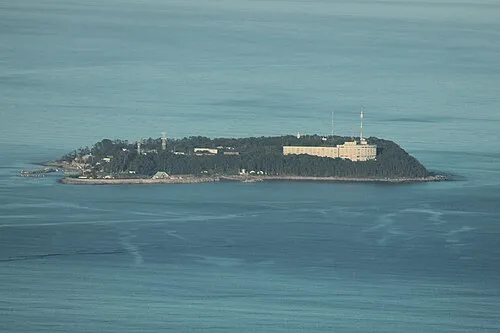 Hatsu-shima Island, Shizuoka22 km E
Sources & licences
Data last updated: · 2 independent sources