- Population
- 36,794
- 36.8K
- Elevation
- 28 m
- above sea level
- Local time
- UTC+09:00
- Asia/Tokyo · UTC+09:00
- Airports
- OIM Oshima Airport51 km
- FSZ Mount Fuji Shizuoka Airport78 km
About Kamizawa
Kamizawa is a town. Location: Kannami Chō, Tagata. Population: 36,794. Elevation: 28 m. The best months to visit are May–June, October. The nearest airport is Oshima Airport (51 km). Nearby sights include Kano River and Hakone Yama.
Climate of Kamizawa
Best months for sightseeingBest months for sightseeing: May–June, October.
This month · November
A wet month
Day 18° · Night 9° · Rain 106 mm
Better nearby cities in November
- Numazu · 8 km west18°
- Odawara · 25 km northeast19°
- Fuji · 26 km west20°
- Hottest month
- August (day 31°)
- Coldest month
- January (night 1°)
- Wettest month
- June (240 mm)
- Driest month
- December (60 mm)
Bars: average monthly low and high temperature. Below: precipitation. Monthly averages for 1970–2000 at about 18 km resolution, adjusted for elevation. Highlighted months are mild and relatively dry. Source: WorldClim 2.1 (CC BY 4.0).
Show values as a table
| Month | Jan | Feb | Mar | Apr | May | Jun | Jul | Aug | Sep | Oct | Nov | Dec |
|---|---|---|---|---|---|---|---|---|---|---|---|---|
| Average high (°C) | 11° | 12° | 14° | 19° | 23° | 25° | 29° | 31° | 27° | 22° | 18° | 14° |
| Average low (°C) | 1° | 2° | 5° | 10° | 14° | 18° | 22° | 23° | 20° | 14° | 9° | 4° |
| Precipitation (mm) | 65 | 83 | 142 | 162 | 165 | 240 | 194 | 222 | 225 | 162 | 106 | 60 |
How to get to Kamizawa
The nearest airport is Oshima Airport (OIM), 51 km to the southeast as the crow flies. For international flights: Mount Fuji Shizuoka Airport (FSZ) (78 km). The nearest large city is Mishima, 4 km to the northwest.
Airports
- Oshima Airport (OIM) Izu Oshima 51 kmsoutheast
- Mount Fuji Shizuoka Airport (FSZ) Makinohara / Shimada 78 kmsouthwest
- Tokyo Haneda International Airport (HND) Tokyo 91 kmnortheast
Nearby large cities
- Mishima Population: 107.9K 4 kmnorthwest
- Numazu Population: 189.5K 8 kmwest
- Odawara Population: 188.9K 25 kmnortheast
- Fuji Population: 245.4K 26 kmwest
- Fujinomiya Population: 132.5K 33 kmnorthwest
Straight-line distances; road distances are longer. Airport data: OurAirports.
Day trips from Kamizawa
Within 100 km: 41 historic and cultural sites, 48 natural sites, 40 lakes, rivers and coasts.
0–25 km8 places
- Hatsu-shima Island 21 kmE
- Mount Echizen-dake Mountain 21 kmNW
- Tama Gawa River 22 kmNE
- Mount Ashitaka Mountain 17 kmNW
25–60 km38 places
- Ō Shima Island 58 kmSE
- Enoshima Island 53 kmNE
- Lake Shoji Lake 53 kmNW
- Suruga Bay Natural site 46 kmSW
60–100 km83 places
- Nii-jima Island 85 kmS
- Shikine-jima Island 89 kmS
- Jōga Shima Island 61 kmE
- To Shima Island 71 kmSE
Straight-line distances.
Nearby attractions & nature
Everything nearby-
 Kano River River, Shizuoka9.3 km W
-
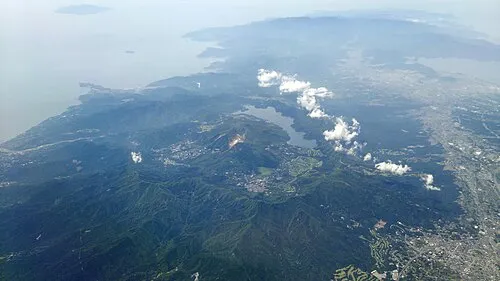 Hakone Yama Mountain, Japan16 km NE
-
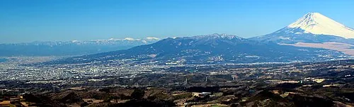 Mount Ashitaka Mountain, Numazu-shi17 km NW
-
Nangō San Mountain, Yugawara Machi16 km NE
-
Tama Gawa River, Kanagawa22 km NE
-
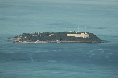 Hatsu-shima Island, Shizuoka21 km E
-
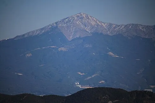 Mount Echizen-dake Mountain, Fuji Shi21 km NW
-
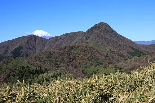 Kintoki Zan Mountain, Hakone-machi21 km N
Sources & licences
Data last updated: