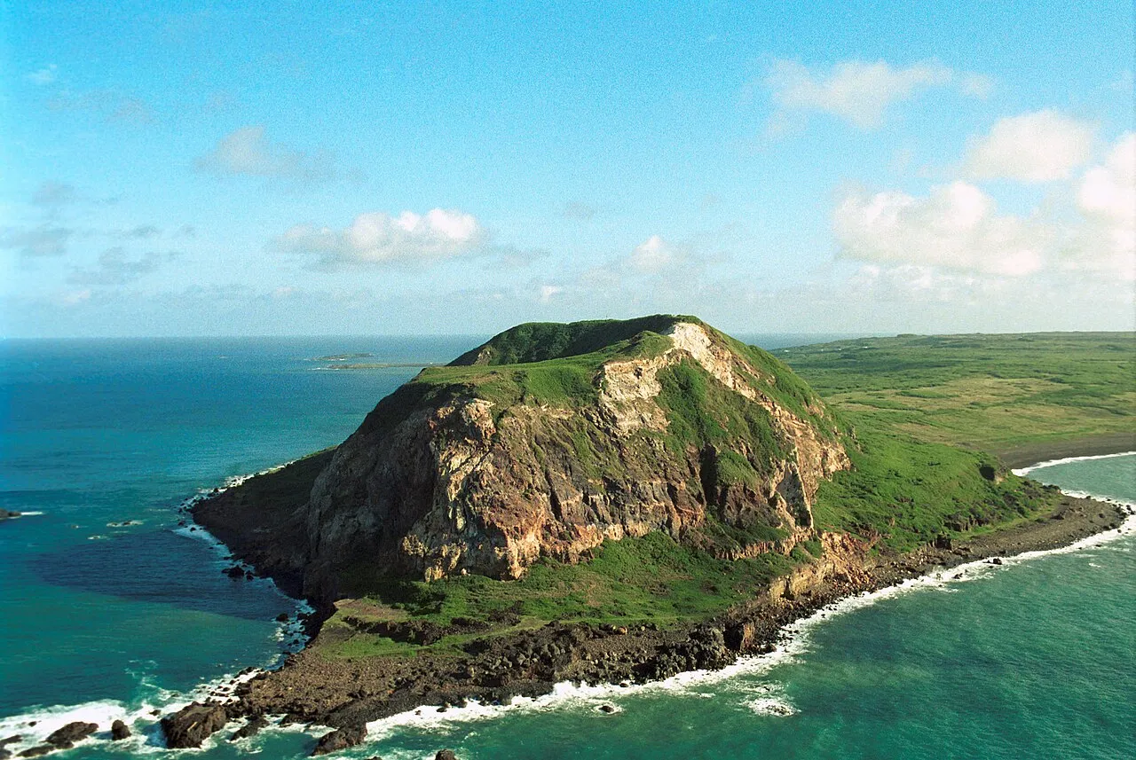
- Elevation
- 169 m
- above sea level
- Local time
- UTC+09:00
- Asia/Tokyo · UTC+09:00
About Mount Suribachi
Mount Suribachi is a mountain. Location: Tokyo, Japan. Elevation: 169 m.
Mount Suribachi (摺鉢山, Suribachiyama) is a 169-metre (554 ft)-high hill on the southwest end of Iwo Jima in the northwest Pacific Ocean under the administration of Ogasawara Subprefecture, Tokyo Metropolis, Japan. The hill's name derives from its shape, resembling a suribachi or grinding bowl. It is also known as "Mount Pipe" (パイプ山, paipu-yama), since the volcanic gas and water vapor that rolls in from the summit, alongside the rest of the island, give the appearance of a smoking pipe when viewed from the sea.
Read more on Wikipedia Text: Wikipedia contributors · CC BY-SA 4.0 · shortened
At a glance
- Topographic prominence
- 169 m
Source: Wikidata
Climate of Mount Suribachi
Best months for sightseeingBest months for sightseeing: December–April.
Bars: average monthly low and high temperature. Below: precipitation. Monthly averages for 1970–2000 at about 18 km resolution, adjusted for elevation. Highlighted months are mild and relatively dry. Source: WorldClim 2.1 (CC BY 4.0).
Show values as a table
| Month | Jan | Feb | Mar | Apr | May | Jun | Jul | Aug | Sep | Oct | Nov | Dec |
|---|---|---|---|---|---|---|---|---|---|---|---|---|
| Average high (°C) | 21° | 21° | 22° | 24° | 26° | 28° | 29° | 29° | 29° | 28° | 26° | 23° |
| Average low (°C) | 18° | 18° | 18° | 21° | 22° | 25° | 26° | 25° | 25° | 25° | 22° | 19° |
| Precipitation (mm) | 82 | 70 | 54 | 89 | 110 | 83 | 163 | 166 | 125 | 162 | 122 | 117 |
Other places to visit in this season: January February March April December
Sources & licences
Data last updated: · 2 independent sources