Marcus Island
Local name: 南鳥島
Located in Ogasawara-shichō, Tokyo Coordinates: 24°17′18″ N 153°58′53″ E
- Elevation
- 8 m
- above sea level
- Local time
- UTC+09:00
- Asia/Tokyo · UTC+09:00
About Marcus Island
Marcus Island is an island. Location: Ogasawara-shichō, Tokyo.
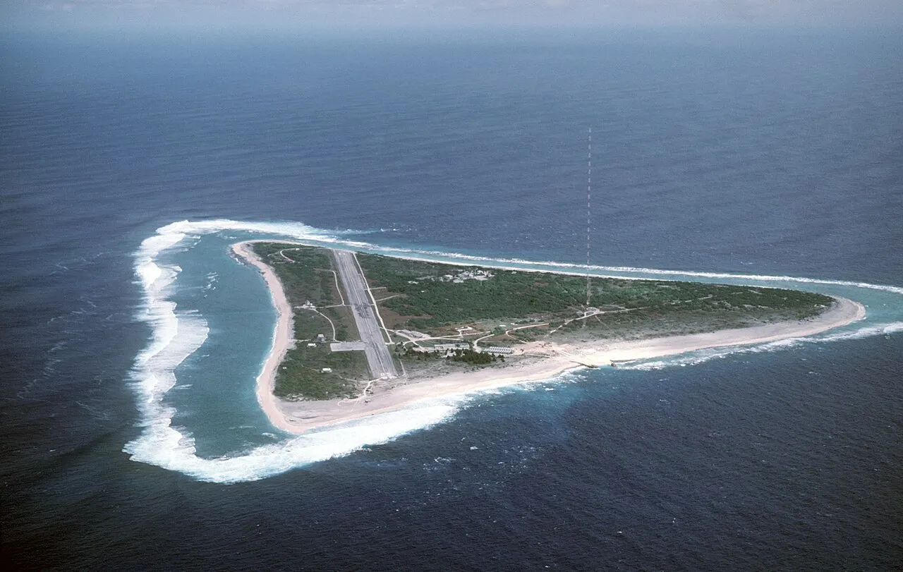
Minamitorishima (南鳥島; lit. "Southern Bird Island"), sometimes known as Minami-Tori-shima or Minami-Torishima and also known as Marcus Island, is an isolated Japanese coral atoll in the northwestern Pacific Ocean. It is the easternmost and most isolated territory belonging to Japan, and the only Japanese territory on the Pacific Plate, past the Japan Trench.
Source: Wikipedia · CC BY-SA 4.0
At a glance
- Length
- 1.5 km
- Area
- 1.5 km²
Source: Wikidata
Climate of Marcus Island
Best months for sightseeingBest months for sightseeing: January–March.
This month · November
Outside the best season
Day 28° · Night 24° · Rain 82 mm
- Hottest month
- July (day 31°)
- Coldest month
- February (night 19°)
- Wettest month
- July (167 mm)
- Driest month
- February (42 mm)
Bars: average monthly low and high temperature. Below: precipitation. Monthly averages for 1970–2000 at about 18 km resolution, adjusted for elevation. Highlighted months are mild and relatively dry. Source: WorldClim 2.1 (CC BY 4.0).
Show values as a table
| Month | Jan | Feb | Mar | Apr | May | Jun | Jul | Aug | Sep | Oct | Nov | Dec |
|---|---|---|---|---|---|---|---|---|---|---|---|---|
| Average high (°C) | 24° | 24° | 25° | 27° | 29° | 30° | 31° | 31° | 31° | 30° | 28° | 26° |
| Average low (°C) | 20° | 19° | 20° | 22° | 23° | 25° | 26° | 26° | 26° | 25° | 24° | 22° |
| Precipitation (mm) | 81 | 42 | 54 | 67 | 71 | 59 | 167 | 166 | 108 | 90 | 82 | 96 |
Other places to visit in this season: January February March
Sources & licences
Data last updated: · 2 independent sources