- Population
- 12,417
- 12.4K
- Elevation
- 118 m
- above sea level
- Local time
- UTC+09:00
- Asia/Tokyo · UTC+09:00
- Airports
- TTJ Tottori Sand Dunes Conan Airport18 km
- TJH Konotori Tajima Airport39 km
About Iwami Chō
Iwami Chō is a municipality. Location: Iwami-gun, Tottori. Population: 12,417. Elevation: 118 m.
Iwami (岩美町, Iwami-chō) is a town located in Iwami District, Tottori Prefecture, Japan. As of 1 December 2022, the town had an estimated population of 10,998 in 4429 households and a population density of 90 persons per km2. The total area of the town is 122.32 square kilometres (47.23 sq mi). Iwami lies entirely within the San'in Kaigan Geopark. Iwami is San'in Kaigan's biggest international beach resort.
Source: Wikipedia · CC BY-SA 4.0
Places bordering Iwami Chō
- Tottori-shi
- Shin’onsen Chō
Twin towns and sister cities of Iwami Chō
- Musashino· Japan
Source: Wikidata. Only places with a page on this site are shown.
Population of Iwami Chō over time
| 2010 | 12,362 | |
|---|---|---|
| 2015 | 11,485 | |
| 2021 | 10,675 |
Censuses and official estimates; source: Wikidata.
Climate of Iwami Chō
Best months for sightseeingBest months for sightseeing: May–June, September–October.
This month · November
A wet month
Day 15° · Night 7° · Rain 145 mm
Better nearby cities in November
- Kochi · 235 km south18°
- Ōita · 361 km southwest18°
- Beppu · 364 km southwest17°
- Hottest month
- August (day 30°)
- Coldest month
- February (night -1°)
- Wettest month
- September (235 mm)
- Driest month
- April (119 mm)
Bars: average monthly low and high temperature. Below: precipitation. Monthly averages for 1970–2000 at about 18 km resolution, adjusted for elevation. Highlighted months are mild and relatively dry. Source: WorldClim 2.1 (CC BY 4.0).
Show values as a table
| Month | Jan | Feb | Mar | Apr | May | Jun | Jul | Aug | Sep | Oct | Nov | Dec |
|---|---|---|---|---|---|---|---|---|---|---|---|---|
| Average high (°C) | 7° | 7° | 11° | 17° | 22° | 25° | 29° | 30° | 26° | 20° | 15° | 10° |
| Average low (°C) | 0° | -1° | 2° | 7° | 12° | 17° | 21° | 22° | 18° | 12° | 7° | 2° |
| Precipitation (mm) | 177 | 154 | 128 | 119 | 128 | 173 | 196 | 128 | 235 | 141 | 145 | 156 |
Other places to visit in this season: May June September October
How to get to Iwami Chō
The nearest airport is Tottori Sand Dunes Conan Airport (TTJ), 18 km to the west as the crow flies. For international flights: Okayama Momotaro Airport (OKJ) (99 km). The nearest large city is Tottori-shi, 13 km to the southwest.
Airports
- Tottori Sand Dunes Conan Airport (TTJ) Tottori 18 kmwest
- Konotori Tajima Airport (TJH) Toyooka 39 kmeast
- Okayama Momotaro Airport (OKJ) Okayama 99 kmsouthwest
Nearby large cities
- Tottori-shi Population: 188.5K 13 kmsouthwest
- Tsuyama Population: 102.3K 64 kmsouthwest
- Himeji Population: 530.5K 87 kmsouth
- Yonago Population: 148.7K 94 kmwest
- Kakogawa Population: 271.6K 96 kmsoutheast
Straight-line distances; road distances are longer. Airport data: OurAirports.
Nearby attractions & nature
Everything nearby-
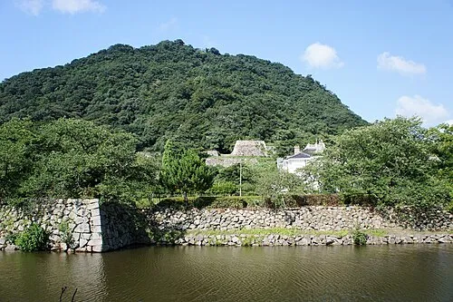 Tottori Castle ruins Historic site, Tottori Shi12 km W
-
Sendai River River, Tottori15 km W
Sources & licences
Data last updated: · 2 independent sources