Obanazawa
Local name: 尾花沢市
Located in Obanazawa Shi, Yamagata Coordinates: 38°36′12″ N 140°24′07″ E
- Population
- 20,821
- 20.8K
- Elevation
- 93 m
- above sea level
- Local time
- UTC+09:00
- Asia/Tokyo · UTC+09:00
- Airports
- GAJ Yamagata Airport21 km
- SYO Shonai Airport58 km
About Obanazawa
Obanazawa is a city. Location: Obanazawa Shi, Yamagata. Population: 20,821. Elevation: 93 m.
Obanazawa (尾花沢市, Obanazawa-shi; Japanese pronunciation: [ò̞.bä́.nä́.(d͡)zä̀.β̞ä̀, -(d͡)zä́.β̞ä́.ɕì]) is a city located in Yamagata Prefecture, Japan. As of 1 February 2020, the city had an estimated population of 15,237, and a population density of 40.9 persons per km2. The total area of the city is 372.32 square kilometres (144 sq mi).
Source: Wikipedia · CC BY-SA 4.0
Photos of Obanazawa
-

Ebiebi2 · CC BY-SA 4.0 -

Ebiebi2 · CC BY-SA 4.0 -

hidekun2006 · CC BY 3.0 -

contri from Yonezawa-Shi, Yamagata, Japan · CC BY-SA 2.0 -

MWE · CC BY-SA 4.0


Travel notes for Obanazawa
From Wikivoyage
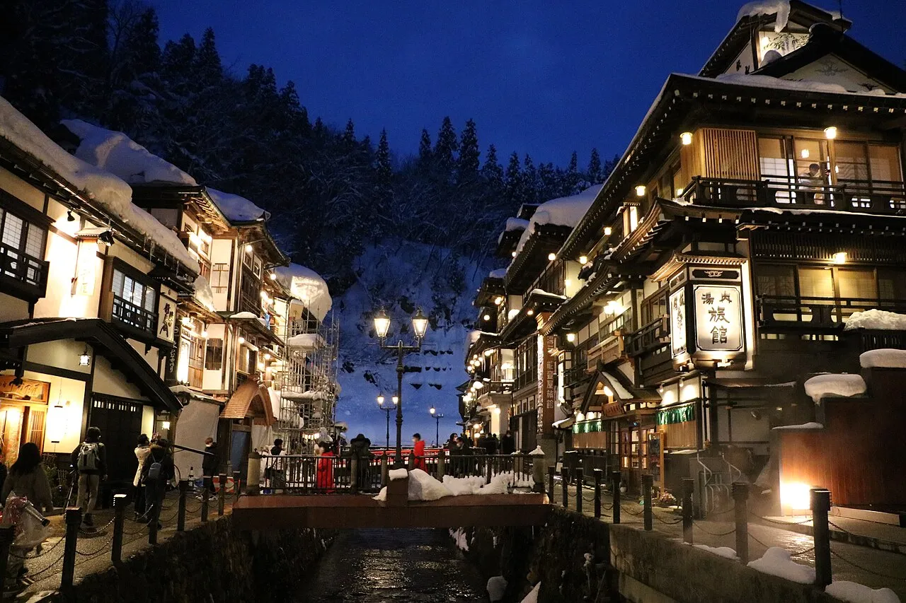
Obanazawa (尾花沢) is a city in Yamagata. Obanazawa's main claim to fame is that it has one of the highest snowfalls in the entire world, with over two meters falling in an average winter, and they've even developed a special sharply peaked "flower hat" (hanagasa) to stop snow accumulating on your head.
Understand+
Haiku poet Matsuo Basho spent ten days here on his journey along the Narrow Road to the Deep North.
Tourist Information Site:
The local tourist association has a Japanese-only guide site. It says Obanazawa is the city of snow, watermelon and hanagasa.
Get in+
By air:
The nearest airport is Yamagata, which receives flights from Tokyo Haneda, Osaka Itami, Sapporo Chitose and Nagoya Komaki. There are three buses a day to Ōishida Station and Obanazawa City Hall (of which two continue to Ginzan Onsen), taking 50 minutes and ¥1000 (1 hr 20 min and ¥1500 to Ginzan Onsen).
The nearest international airport is Sendai.
By train:
Obanazawa is served by Ōishida Station, in the adjacent town of that name, and is served by the Yamagata Line and Yamagata Shinkansen from Tokyo. Tsubasa trains run eight times a day from Tokyo, with additional trains terminating at Yamagata.
Times and prices are typically as follows:
Shinjō (by Shinkansen): 14 minutes and ¥1880
Shinjō (by local train): 20 minutes and ¥410
Yamagata (by Shinkansen): 35 minutes and ¥2140
Yamagata (by local train): 50 minutes and ¥670
Tokyo (by Shinkansen): 3 hours 10 minutes and ¥12,670
From Sendai, take the Senzan Line to either Uzen-Chitose (for a local train) or Yamagata (for the Shinkansen); check the timetable to see which is faster. This should take roughly 2 hours and cost ¥1660 (¥3130 if taking the Shinkansen). Taking the Shinkansen via Fukushima may be slightly faster, but will be much more expensive.
On weekends, public holidays and certain holiday periods, the Chiisana-tabi Holiday Pass allows free travel on local and rapid trains in an area stretching to places such as Shinjō, Sendai, Hiraizumi, Kesennuma, Shirakawa, and Aizu-Wakamatsu for ¥2670. If you buy a limited express ticket, you can also use the Yamagata Shinkansen between Shinjō and Fukushima.
By bus:
Yamakō Bus and Tōhoku Express run the overnight Tokyo Sunrise
(suspended as of March 2024) from Hamamatsuchō, Tokyo Station Yaesu-dōri, Ueno, and Asakusa, taking 7 hours 30 mins and costing between ¥7400 and ¥6600.
Yamakō Bus above also runs 10 Tokkyū Yonpachi Liner buses a day from Sendai, taking 1 hour 45 minutes and costing ¥1750. These buses can also be used from Shinjō (35 minutes, ¥990).
Source: Wikivoyage · CC BY-SA 4.0 · abridged
Places bordering Obanazawa
- Murayama
- Mogami Machi
- Funagata-machi
- Ōishida
- Sendai
- Kami Machi
- Shikama-cho
Twin towns and sister cities of Obanazawa
- Iwanuma· Japan
Source: Wikidata. Only places with a page on this site are shown.
Population of Obanazawa over time
| 2010 | 18,955 | |
|---|---|---|
| 2014 | 17,378 | |
| 2015 | 16,953 | |
| 2021 | 14,760 |
Censuses and official estimates; source: Wikidata.
Climate of Obanazawa
Best months for sightseeingBest months for sightseeing: May–June, September.
This month · November
A wet month
Day 11° · Night 3° · Rain 129 mm
Better nearby cities in November
- Kofu · 365 km southwest17°
- Isehara · 369 km south18°
- Odawara · 388 km south19°
- Hottest month
- August (day 29°)
- Coldest month
- January (night -4°)
- Wettest month
- August (160 mm)
- Driest month
- March (82 mm)
Bars: average monthly low and high temperature. Below: precipitation. Monthly averages for 1970–2000 at about 18 km resolution, adjusted for elevation. Highlighted months are mild and relatively dry. Source: WorldClim 2.1 (CC BY 4.0).
Show values as a table
| Month | Jan | Feb | Mar | Apr | May | Jun | Jul | Aug | Sep | Oct | Nov | Dec |
|---|---|---|---|---|---|---|---|---|---|---|---|---|
| Average high (°C) | 2° | 2° | 5° | 14° | 20° | 23° | 27° | 29° | 24° | 18° | 11° | 5° |
| Average low (°C) | -4° | -4° | -1° | 4° | 10° | 15° | 20° | 21° | 16° | 9° | 3° | -1° |
| Precipitation (mm) | 124 | 94 | 82 | 93 | 87 | 119 | 152 | 160 | 148 | 118 | 129 | 127 |
How to get to Obanazawa
The nearest airport is Yamagata Airport (GAJ), 21 km to the south as the crow flies. For international flights: Sendai Airport (SDJ) (68 km). The nearest large city is Yamagata, 41 km to the south.
Airports
- Yamagata Airport (GAJ) Higashine 21 kmsouth
- Shonai Airport (SYO) Shonai 58 kmnorthwest
- Sendai Airport (SDJ) Natori 68 kmsoutheast
Nearby large cities
- Yamagata Population: 248.8K 41 kmsouth
- Ōsaki Population: 128.8K 50 kmeast
- Tsuruoka Population: 125.4K 52 kmwest
- Sendai Population: 1.1M 55 kmsoutheast
- Sakata Population: 100.3K 59 kmnorthwest
Straight-line distances; road distances are longer. Airport data: OurAirports.
Day trips from Obanazawa
Within 100 km: 2 historic and cultural sites, 15 natural sites, 15 lakes, rivers and coasts.
25–60 km9 places
- Mount Funagata Mountain 25 kmSE
- Asahi Dake Mountain 56 kmSW
- Haguro Yama Mountain 38 kmW
- Mount Yudono Mountain 37 kmW
60–100 km23 places
- Miyago Jima Island 72 kmSE
- Tobi Shima Island 99 kmNW
- Tashiro Jima Island 95 kmE
- Koyoshi River River 94 kmN
Straight-line distances.
Sources & licences
Data last updated: · 2 independent sources