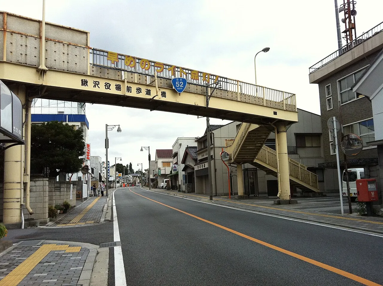
- Population
- 14,219
- 14.2K
- Elevation
- 276 m
- above sea level
- Local time
- UTC+09:00
- Asia/Tokyo · UTC+09:00
- Airports
- MMJ Shinshu-Matsumoto Airport83 km
- FSZ Mount Fuji Shizuoka Airport87 km
About Kajikazawa
Kajikazawa is a town. Location: Fujikawa Town, Minamikoma-gun. Population: 14,219. Elevation: 276 m.
Kajikazawa (鰍沢町, Kajikazawa-chō) was a town located in Minamikoma District, Yamanashi Prefecture, Japan. As of 2003, the town had an estimated population of 4,402 and a density of 94.04 persons per km2. The total area was 46.81 km2. On March 8, 2010, Kajikazawa, along with the town of Masuho (also from Minamikoma District), was merged to create the town of Fujikawa.
Source: Wikipedia · CC BY-SA 4.0
At a glance
- Built
- 1896
Source: Wikidata
Photos of Kajikazawa
-

Sakaori · CC BY 3.0 -

Sakaori · CC BY 3.0 -

さかおり · CC BY 3.0 -

浅野ます? · CC BY 3.0 -

浅野ます? · CC BY 3.0


Climate of Kajikazawa
Best months for sightseeingBest months for sightseeing: May–June, October.
This month · November
Outside the best season
Day 16° · Night 6° · Rain 68 mm
Better nearby cities in November
- Kofu · 17 km northeast17°
- Fujinomiya · 40 km south18°
- Fuji · 48 km southeast20°
- Hottest month
- August (day 31°)
- Coldest month
- January (night -2°)
- Wettest month
- September (211 mm)
- Driest month
- December (33 mm)
Bars: average monthly low and high temperature. Below: precipitation. Monthly averages for 1970–2000 at about 18 km resolution, adjusted for elevation. Highlighted months are mild and relatively dry. Source: WorldClim 2.1 (CC BY 4.0).
Show values as a table
| Month | Jan | Feb | Mar | Apr | May | Jun | Jul | Aug | Sep | Oct | Nov | Dec |
|---|---|---|---|---|---|---|---|---|---|---|---|---|
| Average high (°C) | 9° | 9° | 13° | 19° | 23° | 26° | 29° | 31° | 26° | 21° | 16° | 11° |
| Average low (°C) | -2° | -2° | 2° | 7° | 12° | 17° | 21° | 21° | 18° | 12° | 6° | 0° |
| Precipitation (mm) | 39 | 56 | 97 | 121 | 130 | 202 | 175 | 198 | 211 | 135 | 68 | 33 |
How to get to Kajikazawa
The nearest airport is Shinshu-Matsumoto Airport (MMJ), 83 km to the northwest as the crow flies. For international flights: Mount Fuji Shizuoka Airport (FSZ) (87 km). The nearest large city is Kofu, 17 km to the northeast.
Airports
- Shinshu-Matsumoto Airport (MMJ) Matsumoto 83 kmnorthwest
- Mount Fuji Shizuoka Airport (FSZ) Makinohara / Shimada 87 kmsouth
- Oshima Airport (OIM) Izu Oshima 119 kmsoutheast
Nearby large cities
- Kofu Population: 189.6K 17 kmnortheast
- Fujinomiya Population: 132.5K 40 kmsouth
- Fuji Population: 245.4K 48 kmsoutheast
- Iida Population: 101.5K 57 kmwest
- Numazu Population: 189.5K 63 kmsoutheast
Straight-line distances; road distances are longer. Airport data: OurAirports.
Day trips from Kajikazawa
Within 100 km: 6 historic and cultural sites, 54 natural sites, 23 lakes, rivers and coasts.
0–25 km8 places
- Lake Shoji Lake 16 kmSE
- Mount Aino Mountain 23 kmNW
- Mount Shiomi Mountain 24 kmW
- Saiko Lake Lake 22 kmE
25–60 km25 places
- Mount Senjō Mountain 31 kmNW
- Mount Nokogiri Mountain 33 kmNW
- Mount Echizen-dake Mountain 47 kmSE
- Fuji River River 51 kmS
60–100 km50 places
- Honshu Island 64 kmNW
- Enoshima Island 98 kmE
- Hatsu-shima Island 87 kmSE
- Chausu-yama Mountain 64 kmNW
Straight-line distances.
Nearby attractions & nature
Everything nearby-
 Fuefuki River River, Japan3 km E
-
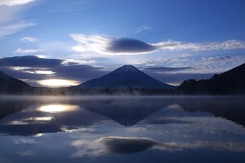 Lake Shoji Lake, Fuji-yoshida Shi16 km SE
-
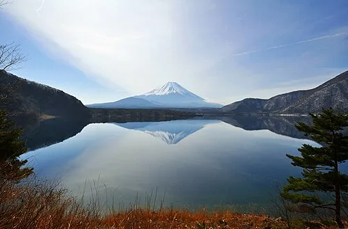 Lake Motosu Lake, Fuji-yoshida Shi15 km SE
-
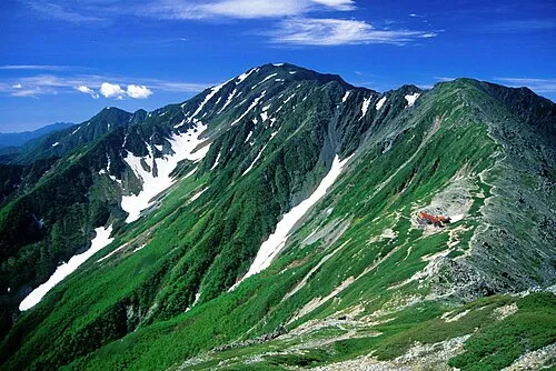 Mount Aino Mountain, Aoi-ku23 km NW
-
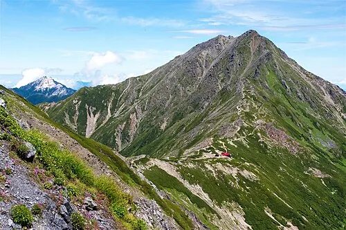 Kita-dake Mountain, Nagano24 km NW
-
Saiko Lake Lake, Fuji-yoshida Shi22 km E
-
Mount Kenashi Mountain, Fujinomiya Shi17 km SE
-
 Mount Shiomi Mountain, Aoi-ku24 km W
Sources & licences
Data last updated: · 2 independent sources