Minobu Town
Local name: 身延町
Located in Minamikoma-gun, Yamanashi Coordinates: 35°24′55″ N 138°28′04″ E
- Population
- 13,992
- 14K
- Elevation
- 415 m
- above sea level
- Local time
- UTC+09:00
- Asia/Tokyo · UTC+09:00
- Airports
- FSZ Mount Fuji Shizuoka Airport73 km
- MMJ Shinshu-Matsumoto Airport97 km
About Minobu Town
Minobu Town is a municipality. Location: Minamikoma-gun, Yamanashi. Population: 13,992. Elevation: 415 m.
Minobu (身延町, Minobu-chō) is a town located in Yamanashi Prefecture, Japan. As of 1 June 2019, the town had an estimated population of 11,674 in 5447 households, and a population density of 39 persons per km2. The total area of the town is 302.00 square kilometres (116.60 sq mi).
Source: Wikipedia · CC BY-SA 4.0
Travel notes for Minobu Town
From Wikivoyage
Minobu (身延町 Minobu-chō) is a major town in Yamanashi prefecture.
Understand+
Minobu is where the anime Laid-Back Camp (ゆるキャン△) was set, and is rich in natural terrain, including Lake Motosu (本栖湖).
Tourist information sites:
The town has an official Japanese-only guide site with integrated Google Translate.
The Mt. Minobu/temple area's tourist association has a Japanese-only guide site.
If you are a fan of Laid-Back Camp, a Japanese-only special site is available. Consider its spin-off Room Camp as well.
Get in+
By train:
Minobu lies roughly in the center of the aptly named Minobu Line (身延線), a single tracked JR rail line. Local trains regularly run on this line between Kofu to the north and Fuji in Shizuoka to the south. Express trains also run several times a day between Kofu and Shizuoka. This line is operated by JR Central and most stations are unmanned with a one man car system in operation.
By bus:
There are regular bus services connecting Minobu with Shinjuku and many bus tours are operated to the town.
Source: Wikivoyage · CC BY-SA 4.0 · abridged
Places bordering Minobu Town
- Shizuoka
- Kofu
- Ichikawamisato Town
- Nambu
- Fujikawa Town
- Hayakawa Town
- Fujikawaguchiko
- Fujinomiya
Population of Minobu Town over time
| 2010 | 14,462 | |
|---|---|---|
| 2015 | 12,669 | |
| 2021 | 10,440 |
Censuses and official estimates; source: Wikidata.
Climate of Minobu Town
Best months for sightseeingBest months for sightseeing: May–June, September–October.
This month · November
Outside the best season
Day 15° · Night 5° · Rain 74 mm
Better nearby cities in November
- Fujinomiya · 26 km southeast18°
- Kofu · 29 km north17°
- Fuji · 34 km southeast20°
- Hottest month
- August (day 29°)
- Coldest month
- January (night -3°)
- Wettest month
- September (212 mm)
- Driest month
- December (39 mm)
Bars: average monthly low and high temperature. Below: precipitation. Monthly averages for 1970–2000 at about 18 km resolution, adjusted for elevation. Highlighted months are mild and relatively dry. Source: WorldClim 2.1 (CC BY 4.0).
Show values as a table
| Month | Jan | Feb | Mar | Apr | May | Jun | Jul | Aug | Sep | Oct | Nov | Dec |
|---|---|---|---|---|---|---|---|---|---|---|---|---|
| Average high (°C) | 8° | 8° | 11° | 17° | 21° | 24° | 27° | 29° | 25° | 20° | 15° | 10° |
| Average low (°C) | -3° | -2° | 1° | 7° | 11° | 16° | 20° | 20° | 17° | 11° | 5° | 0° |
| Precipitation (mm) | 44 | 62 | 109 | 133 | 138 | 209 | 174 | 198 | 212 | 139 | 74 | 39 |
Other places to visit in this season: May June September October
How to get to Minobu Town
The nearest airport is Mount Fuji Shizuoka Airport (FSZ), 73 km to the south as the crow flies. The nearest large city is Fujinomiya, 26 km to the southeast.
Airports
- Mount Fuji Shizuoka Airport (FSZ) Makinohara / Shimada 73 kmsouth
- Shinshu-Matsumoto Airport (MMJ) Matsumoto 97 kmnorthwest
- Oshima Airport (OIM) Izu Oshima 107 kmsoutheast
Nearby large cities
- Fujinomiya Population: 132.5K 26 kmsoutheast
- Kofu Population: 189.6K 29 kmnorth
- Fuji Population: 245.4K 34 kmsoutheast
- Shizuoka Population: 693.4K 49 kmsouth
- Numazu Population: 189.5K 50 kmsoutheast
Straight-line distances; road distances are longer. Airport data: OurAirports.
Day trips from Minobu Town
Within 100 km: 12 historic and cultural sites, 50 natural sites, 25 lakes, rivers and coasts.
0–25 km7 places
- Mount Kenashi Mountain 6 kmE
- Taiseki Ji Attraction 18 kmSE
- Lake Motosu Lake 12 kmNE
- Fuefuki River River 15 kmN
25–60 km23 places
- Kimpō-zan Mountain 52 kmN
- Chichibu Tama Kai National Park Natural site 57 kmNE
- Mount Daibosatsu Mountain 51 kmNE
- Kita-dake Mountain 35 kmNW
60–100 km57 places
- Honshu Island 77 kmNW
- Enoshima Island 93 kmE
- Hatsu-shima Island 76 kmSE
- Mount Bukō Mountain 83 kmNE
Straight-line distances.
Nearby attractions & nature
Everything nearby-
Mount Kenashi Mountain, Fujinomiya Shi6.4 km E
-
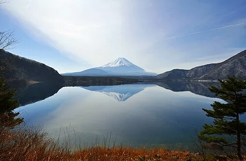 Lake Motosu Lake, Fuji-yoshida Shi12 km NE
-
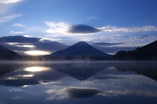 Lake Shoji Lake, Fuji-yoshida Shi15 km NE
-
Saiko Lake Lake, Fuji-yoshida Shi22 km NE
-
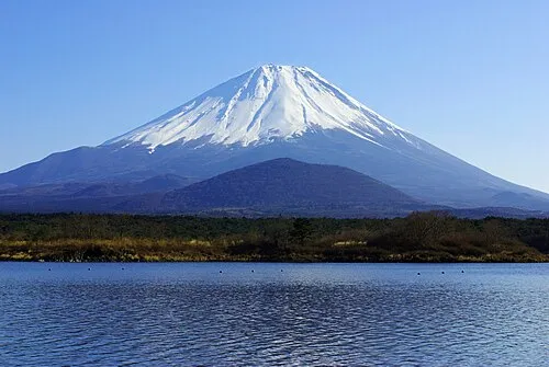 Mount Fuji Mountain, Japan24 km E
-
Fuefuki River River, Japan15 km N
-
Taiseki Ji Attraction, Fujinomiya Shi18 km SE
Sources & licences
Data last updated: · 2 independent sources