
- Elevation
- 168 m
- above sea level
- Local time
- UTC+02:00
- Europe/Vilnius · UTC+02:00
- Airports
- KUN Kaunas International Airport106 km
- KGD Khrabrovo Airport147 km
About Vištyčio ežeras
Vištyčio ežeras is a lake. Location: Lithuania. Elevation: 168 m.
Lake Vištytis is a lake on the border between Lithuania (Vilkaviškis district) and Russia (Kaliningrad Oblast), near the tripoint with Poland. The small Lithuanian town of Vištytis on the northern shore was named after the lake. In the west, the extended Romincka Forest stretches along the Russian-Polish border. On the Lithuanian side, the lake and its environs are part of a protected area named Vištytis Regional Park.
Source: Wikipedia · CC BY-SA 4.0
At a glance
- Maximum depth
- 50 m
- Length
- 8.1 km
- Area
- 17.9 km²
Source: Wikidata
Climate of Vištyčio ežeras
Best months for sightseeingBest months for sightseeing: May–August.
This month · November
A cold month
Day 4° · Night 0° · Rain 54 mm
- Hottest month
- July (day 22°)
- Coldest month
- January (night -6°)
- Wettest month
- July (85 mm)
- Driest month
- February (27 mm)
Bars: average monthly low and high temperature. Below: precipitation. Monthly averages for 1970–2000 at about 18 km resolution, adjusted for elevation. Highlighted months are mild and relatively dry. Source: WorldClim 2.1 (CC BY 4.0).
Show values as a table
| Month | Jan | Feb | Mar | Apr | May | Jun | Jul | Aug | Sep | Oct | Nov | Dec |
|---|---|---|---|---|---|---|---|---|---|---|---|---|
| Average high (°C) | -1° | 0° | 4° | 11° | 17° | 20° | 22° | 21° | 16° | 10° | 4° | 0° |
| Average low (°C) | -6° | -6° | -3° | 2° | 7° | 10° | 12° | 11° | 8° | 4° | 0° | -4° |
| Precipitation (mm) | 37 | 27 | 35 | 39 | 54 | 74 | 85 | 71 | 57 | 52 | 54 | 46 |
How to get to Vištyčio ežeras
The nearest airport is Kaunas International Airport (KUN), 106 km to the northeast as the crow flies. The nearest large city is Kaunas, 93 km to the northeast.
Airports
- Kaunas International Airport (KUN) Kaunas 106 kmnortheast
- Khrabrovo Airport (KGD) Kaliningrad 147 kmwest
- Olsztyn-Mazury Airport (SZY) Szymany 158 kmsouthwest
Nearby large cities
- Kaunas Population: 289.4K 93 kmnortheast
- Vilnius Population: 542.4K 168 kmeast
- Klaipėda Population: 172.3K 175 kmnorthwest
- Riga Population: 742.6K 294 kmnorth
Straight-line distances; road distances are longer. Airport data: OurAirports.
Day trips from Vištyčio ežeras
Within 100 km: 11 historic and cultural sites, 9 natural sites, 14 lakes, rivers and coasts.
0–25 km2 places
- Góra Leszczynowa Mountain 19 kmS
- Góra Zamkowa Mountain 23 kmSE
25–60 km6 places
- Audyniskie Góra Mountain 41 kmW
- Ežeras Žuvintas Lake 59 kmE
- Jezioro Gaładuś Lake 52 kmSE
- Lepona River 29 kmN
60–100 km26 places
- Ežeras Veisiejis Lake 70 kmSE
- Ežeras Metelys Lake 69 kmE
- Kauno pilis Historic site 91 kmNE
- Kovno Ghetto Historic site 93 kmNE
Straight-line distances.
Nearest towns and villages
-
 Vištytis Village, Vilkaviškis District Municipality3.8 km N
-
 Wiżajny Village, Wiżajny11 km SE
-
Wiżajny Municipality, Powiat suwalski13 km SE
-
 Gražiškiai Village, Vilkaviškis District Municipality13 km NE
-
Gmina Dubeninki Municipality, Gołdap County16 km SW
-
Wysokie Village, Wiżajny14 km SE
Nearby attractions & nature
Everything nearby-
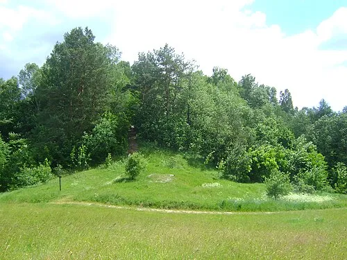 Góra Zamkowa Mountain, Gmina Jeleniewo23 km SE
-
Góra Leszczynowa Mountain, Przerośl19 km S
More lakes, rivers and coasts in Lithuania
-
 Lepona River, Lithuania29 km N
-
 Jezioro Gaładuś Lake, Lithuania52 km SE
-
 Ežeras Žuvintas Lake, Alytus District Municipality59 km E
-
 Ežeras Dusia Lake, Lazdijai District Municipality64 km E
-
 Ežeras Metelys Lake, Lazdijai District Municipality69 km E
-
 Ežeras Veisiejis Lake, Lazdijai District Municipality70 km SE
Sources & licences
Data last updated: · 2 independent sources