
- Population
- 31,421
- 31.4K
- Elevation
- 315 m
- above sea level
- Local time
- UTC+01:00
- Europe/Luxembourg · UTC+01:00
- Places inside
- 4
- listed under Differdange
- Airports
- LUX Luxembourg-Findel International Airport27 km
- ETZ Metz-Nancy-Lorraine Airport66 km
About Differdange
Differdange is a district. Location: Esch-sur-Alzette, Luxembourg. Population: 31,421.
Differdange (French pronunciation: [difɛʁdɑ̃ʒ]; Luxembourgish: Déifferdeng [ˈdɜɪ̯fɐdeŋ] or locally Déifferdang [ˈdɜɪ̯fɐdɑŋ] ; German: Differdingen [ˈdɪfɐdɪŋən]) is a commune with city status in south-western Luxembourg, 27 kilometres (17 mi) west from the country's capital. It lies near the borders with Belgium and France and it is located in the canton of Esch-sur-Alzette. With a population of over 30,000, Differdange is the country's third largest city.
Source: Wikipedia · CC BY-SA 4.0
Photos of Differdange
-
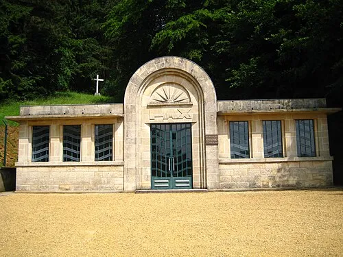
Thil Concentration Camp Aimelaime at French Wikipedia · Public domain

Travel notes for Differdange
From Wikivoyage
The Land of the Red Rocks (French: Région Terres Rouges), also known as the Esch-sur-Alzette canton, is the southwestmost region of Luxembourg.
Understand+
The Land of the Red Rocks, also known as the Esch-sur-Alzette Canton, is a former mining region in southern Luxembourg that is filled to its brim with industrial heritage.
The name Land of the Red Rocks comes from the reddish iron ore that was found and extracted from the ground in high amounts. The growth the region experienced during the 1900s can still be seen in numbers: Six of the ten biggest cities and towns of Luxembourg are located in the Land of the Red Rocks.
Get in+
By car:
The A13 services the entire canton, starting at Pétange, combining with the A4 near Esch-sur-Alzette to continue eastward as the A13 again in the direction of Mondorf-les-Bains. After passing the German border, the Autobahn 8 connects to Saarlouis, Neunkirchen and Homburg.
From Luxembourg City:
The Land of Red Rocks can be accessed via three main highways when travelling from Luxembourg City, namely the A3, which links up to the A13 near Dudelange, the A4, which connects to Esch and the E44, which connects to Pétange.
From Belgium:
Coming from Belgium, use the E25 (when travelling from Liège or the E411 (when traveling from Namur) to head for Luxembourg, but before the border, at exit 32, turn right onto the N81. When the road turns into the A28, take the first exit (Pétange), and take a left onto the N88. After the border crossing, you will find yourself on a roundabout in the west of Pétange. Turning left here will get you onto the E44/A13, which connects to the rest of the canton. Alternatively, the A6 can be used to get to Luxembourg City, followed with the E44, A4 or A3 as described above. This does however result in a longer route.
From France:
When travelling from France, first get to Metz or Thionville, from which you take the A31 heading north. Not long after crossing the border you will find yourself at the Croix de Bettembourg, from which you can turn left onto the A13 heading for Esch-sur-Alzette to connect to the entire canton.
By train:
Most of the region is covered in railway tracks, most of which service(d) the mines. The bigger cities such as 1 Dudelange, 2 Esch-sur-Alzette, 3 Differdange and 4 Pétange can easily be accessed by rail. Trains from Luxembourg to Nancy (and vice versa) both stop in 5 Bettembourg, from where the entire canton can be reached.
Source: Wikivoyage · CC BY-SA 4.0 · abridged
Places bordering Differdange
- Pétange
- Käerjeng
- Sanem
Twin towns and sister cities of Differdange
- Waterloo· Belgium
Source: Wikidata. Only places with a page on this site are shown.
Population of Differdange over time
| 2015 | 24,304 | |
|---|---|---|
| 2016 | 24,805 | |
| 2017 | 25,402 | |
| 2018 | 26,193 | |
| 2019 | 26,796 | |
| 2020 | 27,409 | |
| 2021 | 27,869 | |
| 2022 | 28,641 | |
| 2023 | 29,536 | |
| 2024 | 30,364 | |
| 2025 | 30,789 | |
| 2026 | 31,421 |
Censuses and official estimates; source: Wikidata.
Climate of Differdange
Best months for sightseeingBest months for sightseeing: June–August.
This month · November
A cold month
Day 7° · Night 2° · Rain 90 mm
- Hottest month
- July (day 23°)
- Coldest month
- February (night -1°)
- Wettest month
- December (108 mm)
- Driest month
- August (57 mm)
Bars: average monthly low and high temperature. Below: precipitation. Monthly averages for 1970–2000 at about 18 km resolution, adjusted for elevation. Highlighted months are mild and relatively dry. Source: WorldClim 2.1 (CC BY 4.0).
Show values as a table
| Month | Jan | Feb | Mar | Apr | May | Jun | Jul | Aug | Sep | Oct | Nov | Dec |
|---|---|---|---|---|---|---|---|---|---|---|---|---|
| Average high (°C) | 4° | 5° | 9° | 13° | 18° | 21° | 23° | 23° | 19° | 13° | 7° | 5° |
| Average low (°C) | -1° | -1° | 1° | 3° | 8° | 11° | 13° | 12° | 9° | 6° | 2° | 0° |
| Precipitation (mm) | 99 | 75 | 80 | 59 | 71 | 75 | 65 | 57 | 69 | 88 | 90 | 108 |
How to get to Differdange
The nearest airport is Luxembourg-Findel International Airport (LUX), 27 km to the northeast as the crow flies. The nearest large city is Metz, 49 km to the southeast.
Airports
- Luxembourg-Findel International Airport (LUX) Luxembourg 27 kmnortheast
- Metz-Nancy-Lorraine Airport (ETZ) Goin 66 kmsoutheast
- Saarbrücken Airport (SCN) Saarbrücken 95 kmeast
Nearby large cities
- Metz Population: 123.9K 49 kmsoutheast
- Trier Population: 100.1K 61 kmnortheast
- Saarbrücken Population: 183K 88 kmeast
- Nancy Population: 105.1K 96 kmsouth
- Liège Population: 195.3K 126 kmnorth
Straight-line distances; road distances are longer. Airport data: OurAirports.
Day trips from Differdange
Within 100 km: 208 historic and cultural sites, 1,655 natural sites, 483 lakes, rivers and coasts.
0–25 km57 places
- Montagne de Stockem Mountain 20 kmNW
- Bois de Willancourt Natural site 16 kmNW
- Weid Busch Natural site 20 kmNW
- Bois de Vance Natural site 20 kmNW
25–60 km472 places
- Château de Berg Historic site 36 kmNE
- Étang des Épioux Lake 50 kmNW
- Bois de Wavre Natural site 52 kmNW
- Bois de Watinsart Natural site 42 kmW
60–100 km1,817 places
- Étang de Boiron Lake 88 kmNW
- Lac de Nisramont Lake 71 kmN
- Mont de la Tour de Coo Mountain 98 kmN
- Steinkopf Mountain 78 kmN
Straight-line distances.
Places in Differdange
4 places
Differdange
Population: 5.3K

Obercorn
Population: 4.7K

Niedercorn
Population: 3.2K

Lasauvage
Population: 402
Nearby attractions & nature
Everything nearby-
Tëtelbierg Mountain, Pétange2.7 km NW
-
Forêt Domaniale de Selomont Natural site, Meurthe et Moselle4.2 km SW
-
Thil Concentration Camp Historic site, Thil5.5 km S
-
Bois de Frihaut Natural site, Luxembourg Province5.7 km NW
-
Bois d'Athus Natural site, Luxembourg Province5.8 km NW
-
Messancy River, Luxembourg Province6.2 km NW
Other regions in Esch-sur-Alzette
-
 Sanem District, Esch-sur-Alzette4.1 km E
-
Pétange District, Esch-sur-Alzette3.8 km NW
-
Mondercange District, Esch-sur-Alzette7.7 km E
-
Schifflange District, Esch-sur-Alzette9.7 km E
-
Reckange-sur-Mess District, Esch-sur-Alzette10 km NE
-
Kayl District, Esch-sur-Alzette12 km SE
Sources & licences
Data last updated: · 2 independent sources