
- Elevation
- 311 m
- above sea level
- Local time
- UTC+01:00
- Europe/Luxembourg · UTC+01:00
- Airports
- LUX Luxembourg-Findel International Airport23 km
- ETZ Metz-Nancy-Lorraine Airport63 km
About Belval
Belval is a village. Location: Sanem, Esch-sur-Alzette. Elevation: 311 m.
Belval is a neighbourhood in the communes of Esch-sur-Alzette and Sanem, in south-western Luxembourg. Belval is the site of the large steelworks that dominate the city. Due to the dominance of the steelworks, Belval suffered from the abandonment of steel production in Luxembourg, and is undergoing an extensive regeneration programme to help diversify beyond steel production.
Source: Wikipedia · CC BY-SA 4.0
Photos of Belval
-
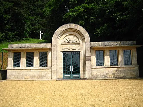
Thil Concentration Camp Aimelaime at French Wikipedia · Public domain -

Mess Johnny Chicago at lb.wikipedia · CC BY-SA 3.0


Climate of Belval
Best months for sightseeingBest months for sightseeing: June–August.
This month · November
A cold month
Day 7° · Night 2° · Rain 90 mm
- Hottest month
- July (day 23°)
- Coldest month
- February (night -1°)
- Wettest month
- December (108 mm)
- Driest month
- August (57 mm)
Bars: average monthly low and high temperature. Below: precipitation. Monthly averages for 1970–2000 at about 18 km resolution, adjusted for elevation. Highlighted months are mild and relatively dry. Source: WorldClim 2.1 (CC BY 4.0).
Show values as a table
| Month | Jan | Feb | Mar | Apr | May | Jun | Jul | Aug | Sep | Oct | Nov | Dec |
|---|---|---|---|---|---|---|---|---|---|---|---|---|
| Average high (°C) | 4° | 5° | 9° | 13° | 18° | 21° | 23° | 23° | 19° | 13° | 7° | 5° |
| Average low (°C) | -1° | -1° | 1° | 3° | 8° | 11° | 13° | 12° | 9° | 6° | 2° | 0° |
| Precipitation (mm) | 99 | 75 | 80 | 59 | 71 | 75 | 65 | 57 | 69 | 88 | 90 | 108 |
How to get to Belval
The nearest airport is Luxembourg-Findel International Airport (LUX), 23 km to the northeast as the crow flies. The nearest large city is Metz, 47 km to the south.
Airports
- Luxembourg-Findel International Airport (LUX) Luxembourg 23 kmnortheast
- Metz-Nancy-Lorraine Airport (ETZ) Goin 63 kmsouth
- Saarbrücken Airport (SCN) Saarbrücken 91 kmeast
Nearby large cities
- Metz Population: 123.9K 47 kmsouth
- Trier Population: 100.1K 57 kmnortheast
- Saarbrücken Population: 183K 83 kmeast
- Nancy Population: 105.1K 94 kmsouth
- Liège Population: 195.3K 128 kmnorth
Straight-line distances; road distances are longer. Airport data: OurAirports.
Day trips from Belval
Within 100 km: 208 historic and cultural sites, 1,691 natural sites, 491 lakes, rivers and coasts.
0–25 km45 places
- Montagne de Stockem Mountain 24 kmNW
- Bois de Willancourt Natural site 20 kmNW
- Weid Busch Natural site 24 kmNW
- Bois de Vance Natural site 24 kmNW
25–60 km503 places
- Château de Berg Historic site 35 kmN
- Étang des Épioux Lake 54 kmNW
- Bois de Wavre Natural site 55 kmNW
- Bois de Watinsart Natural site 46 kmW
60–100 km1,842 places
- Étang de Boiron Lake 92 kmNW
- Lac de Nisramont Lake 73 kmN
- Mont de la Tour de Coo Mountain 99 kmN
- Steinkopf Mountain 78 kmN
Straight-line distances.
Nearby attractions & nature
Everything nearby-
Thil Concentration Camp Historic site, Thil4.9 km SW
-
Deutsch-Oth Concentration Camp Historic site, Audun-le-Tiche4.4 km S
-
Tëtelbierg Mountain, Pétange6.9 km NW
-
 Mont Saint-Jean Mountain, Dudelange8.9 km E
-
Forêt Domaniale de Selomont Natural site, Meurthe et Moselle8.2 km W
-
Mess River, Esch-sur-Alzette7.4 km E
Sources & licences
Data last updated: · 2 independent sources