Bni Chiker
Local name: جماعة بني شيكر
Located in Nador Province, Oriental Coordinates: 35°18′57″ N 3°01′15″ W

- Population
- 26,884
- 26.9K
- Elevation
- 229 m
- above sea level
- Local time
- UTC+00:00
- Africa/Casablanca · UTC+00:00
- Airports
- MLN Melilla Airport7 km
- NDR Nador Al Aaroui International Airport36 km
About Bni Chiker
Bni Chiker is a municipality. Location: Nador Province, Oriental. Population: 26,884. Elevation: 229 m.
Bni Chiker or Beni Chiker is a town in Nador Province, Morocco. At the time of the 2024 census, it had a population of 22,763. It is the birthplace of the writer Mohammed Choukri (1935-2003) and of Najat Vallaud-Belkacem, who on 16 May 2012 was appointed Minister of Women's Rights and Government spokesperson in the Ayrault government in France. Bni Chiker is known largely for its tourist hotspots such as the beaches Charrana, Cara Blanca and Mina Rosita.
Source: Wikipedia · CC BY-SA 4.0
Photos of Bni Chiker
-
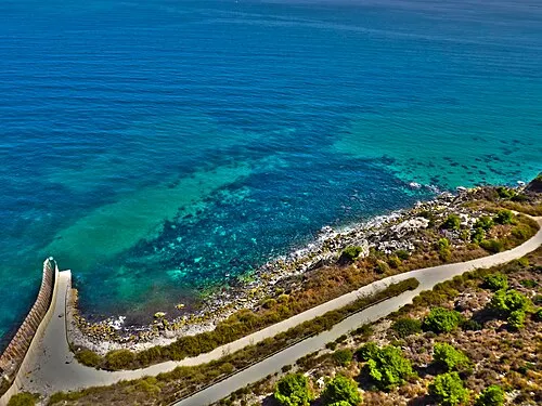
Playa del Quemado Lord_SKY · CC BY-SA 2.0

Places bordering Bni Chiker
- Beni Enzar
- Ihaddadene
- Bni Sidel Jbel
- Iaazzanene
Population of Bni Chiker over time
| 1994 | 22,327 | |
|---|---|---|
| 2004 | 23,050 | |
| 2014 | 26,884 | |
| 2024 | 22,763 |
Censuses and official estimates; source: Wikidata.
Climate of Bni Chiker
Best months for sightseeingBest months for sightseeing: May–June, September–October.
This month · November
Outside the best season
Day 19° · Night 11° · Rain 27 mm
Better nearby cities in November
- Al Hoceima · 83 km west20°
- Ksar El Kebir · 264 km west21°
- Salé Al Jadida · 370 km west21°
- Hottest month
- August (day 30°)
- Coldest month
- January (night 7°)
- Wettest month
- January (54 mm)
- Driest month
- July (1 mm)
Bars: average monthly low and high temperature. Below: precipitation. Monthly averages for 1970–2000 at about 18 km resolution, adjusted for elevation. Highlighted months are mild and relatively dry. Source: WorldClim 2.1 (CC BY 4.0).
Show values as a table
| Month | Jan | Feb | Mar | Apr | May | Jun | Jul | Aug | Sep | Oct | Nov | Dec |
|---|---|---|---|---|---|---|---|---|---|---|---|---|
| Average high (°C) | 15° | 16° | 18° | 20° | 22° | 26° | 29° | 30° | 27° | 23° | 19° | 16° |
| Average low (°C) | 7° | 8° | 9° | 11° | 13° | 17° | 19° | 20° | 18° | 14° | 11° | 8° |
| Precipitation (mm) | 54 | 46 | 39 | 46 | 27 | 6 | 1 | 3 | 13 | 25 | 27 | 44 |
Other places to visit in this season: May June September October
How to get to Bni Chiker
The nearest airport is Melilla Airport (MLN), 7 km to the southeast as the crow flies. For international flights: Nador Al Aaroui International Airport (NDR) (36 km). The nearest large city is Al Hoceima, 84 km to the west.
Airports
- Melilla Airport (MLN) Melilla 7 kmsoutheast
- Nador Al Aaroui International Airport (NDR) Al Aaroui 36 kmsouth
- Cherif Al Idrissi Airport (AHU) Al Hoceima 76 kmwest
Nearby large cities
- Al Hoceima Population: 395.6K 84 kmwest
- Almería Population: 196.9K 176 kmnorth
- Málaga Population: 592.3K 200 kmnorthwest
- Marbella Population: 156.3K 215 kmnorthwest
- Tétouan Population: 415.8K 215 kmwest
Straight-line distances; road distances are longer. Airport data: OurAirports.
Day trips from Bni Chiker
Within 100 km: 30 historic and cultural sites, 9 natural sites, 16 lakes, rivers and coasts.
0–25 km40 places
- Playa de San Lorenzo Beach 8 kmSE
- Playa de los Cárabos Beach 9 kmSE
- Playa de la Hípica Beach 9 kmSE
- Playa de Horcas Coloradas Beach 7 kmE
25–60 km6 places
- Chafarinas Islands Island 56 kmE
- Isabel II Island Lighthouse Landmark 56 kmE
- Isla del Rey Island 56 kmE
- Isabel II Island Island 56 kmE
60–100 km9 places
- Isla de Mar Island 81 kmW
- Peñón de Alhucemas Island 80 kmW
- Alhucemas Lighthouse Landmark 80 kmW
- Isla de Tierra Island 81 kmW
Straight-line distances.
Nearby attractions & nature
Everything nearby-
Melilla High Point Mountain, Melilla Municipality5.5 km E
-
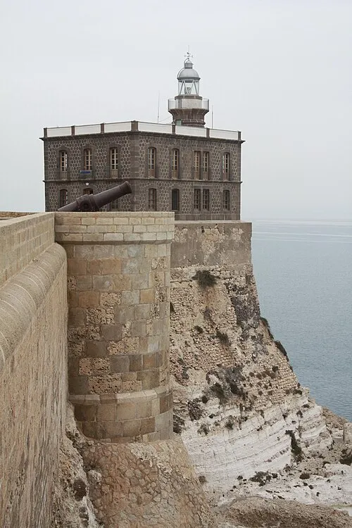 Melilla Lighthouse Landmark, Melilla Municipality8.4 km E
-
Playa del Quemado Beach, Melilla Municipality6.4 km E
-
Fuerte de Cabrerizas Altas Historic site, Melilla Municipality5.7 km E
-
Fuerte de Rostrogordo Historic site, Melilla Municipality5.8 km E
-
Melilla Mediumwave Transmitter ( 1485 kHz) Landmark, Melilla Municipality6.1 km SE
-
Museo del Automóvil Museum, Melilla Municipality6.3 km E
-
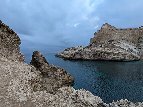 Cabo Trapana Natural site, Melilla Municipality8.2 km E
Other cities and towns in Nador Province
-
Iaazzanene Municipality, Nador Province14 km SW
-
Bni Ansar Municipality, Nador Province13 km SE
-
Bni Sidel Jbel Municipality, Nador Province15 km S
-
 Zeghanghane Town, Nador Province18 km S
-
Nador Municipality, Nador Province17 km SE
-
Bni Bouifrour Municipality, Nador Province18 km S
Sources & licences
Data last updated: · 2 independent sources