Imzouren
Local name: إمزورن
Located in Al-Hoceima, Tanger-Tetouan-Al Hoceima Coordinates: 35°08′41″ N 3°51′02″ W

- Population
- 26,474
- 26.5K
- Elevation
- 80 m
- above sea level
- Local time
- UTC+00:00
- Africa/Casablanca · UTC+00:00
- Places inside
- 1
- listed under Imzouren
- Airports
- AHU Cherif Al Idrissi Airport4 km
- NDR Nador Al Aaroui International Airport77 km
About Imzouren
Imzouren is a municipality. Location: Al-Hoceima, Tanger-Tetouan-Al Hoceima. Population: 26,474. Elevation: 80 m.
Imzouren (Arabic: إمزورن) is a town in the north of Morocco. It is located near the city of Al Hoceima and now stretches almost to the town of Bni Bouayach. The inhabitants of Imzouren are Riffians. The February 2004 Al Hoceima earthquake occurred near Imzouren and registered 6.3 on the moment magnitude scale. At least 564 people died there, with over 250 people wounded. According to the 2014 census, the city has a population of 33,852.
Source: Wikipedia · CC BY-SA 4.0
Population of Imzouren over time
| 1994 | 25,547 | |
|---|---|---|
| 2004 | 26,575 | |
| 2014 | 33,852 | |
| 2024 | 34,848 |
Censuses and official estimates; source: Wikidata.
Climate of Imzouren
Best months for sightseeingBest months for sightseeing: March–May, October–November.
This month · November
A good month to visit
Day 21° · Night 12° · Rain 29 mm
- Hottest month
- August (day 32°)
- Coldest month
- January (night 8°)
- Wettest month
- December (53 mm)
- Driest month
- July (1 mm)
Bars: average monthly low and high temperature. Below: precipitation. Monthly averages for 1970–2000 at about 18 km resolution, adjusted for elevation. Highlighted months are mild and relatively dry. Source: WorldClim 2.1 (CC BY 4.0).
Show values as a table
| Month | Jan | Feb | Mar | Apr | May | Jun | Jul | Aug | Sep | Oct | Nov | Dec |
|---|---|---|---|---|---|---|---|---|---|---|---|---|
| Average high (°C) | 17° | 18° | 20° | 22° | 25° | 29° | 32° | 32° | 29° | 25° | 21° | 18° |
| Average low (°C) | 8° | 9° | 10° | 12° | 15° | 18° | 21° | 21° | 19° | 15° | 12° | 9° |
| Precipitation (mm) | 50 | 50 | 52 | 51 | 33 | 9 | 1 | 4 | 12 | 21 | 29 | 53 |
Other places to visit in this season: March April May October November
How to get to Imzouren
The nearest airport is Cherif Al Idrissi Airport (AHU), 4 km to the north as the crow flies. For international flights: Nador Al Aaroui International Airport (NDR) (77 km). The nearest large city is Al Hoceima, 14 km to the northwest.
Airports
- Cherif Al Idrissi Airport (AHU) Al Hoceima 4 kmnorth
- Nador Al Aaroui International Airport (NDR) Al Aaroui 77 kmeast
- Melilla Airport (MLN) Melilla 83 kmeast
Nearby large cities
- Al Hoceima Population: 395.6K 14 kmnorthwest
- Tétouan Population: 415.8K 146 kmwest
- Marbella Population: 156.3K 179 kmnorthwest
- Algeciras Population: 121.4K 182 kmnorthwest
- Málaga Population: 592.3K 182 kmnorth
Straight-line distances; road distances are longer. Airport data: OurAirports.
Day trips from Imzouren
Within 100 km: 28 historic and cultural sites, 11 natural sites, 11 lakes, rivers and coasts.
0–25 km6 places
- Isla de Mar Island 9 kmNW
- Peñón de Alhucemas Island 8 kmNW
- Alhucemas Lighthouse Landmark 8 kmNW
- Isla de Tierra Island 9 kmNW
25–60 km2 places
- Peñón de Vélez de la Gomera Island 41 kmW
- Al Hoceima National Park Natural site 26 kmW
60–100 km42 places
- Koudiet Tirbîrhîne Mountain 70 kmSW
- Playa de San Lorenzo Beach 85 kmE
- Playa de los Cárabos Beach 85 kmE
- Playa de la Hípica Beach 85 kmE
Straight-line distances.
Places in Imzouren
1 placeBar: population relative to the most populous place in this list.
Nearby attractions & nature
Everything nearby-
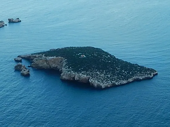 Isla de Tierra Island, Spain9.1 km NW
-
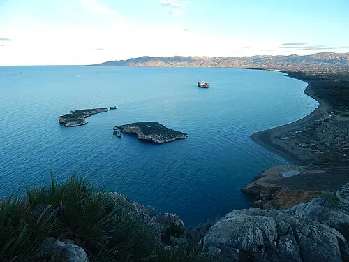 Alhucemas Islands Island, Spain8.8 km NW
-
Alhucemas Lighthouse Landmark, Spain8.4 km NW
-
Peñón de Alhucemas Island, Spain8.4 km NW
-
Isla de Mar Island, Spain9.3 km NW
-
 Rif Mountain, Tanger-Tetouan-Al Hoceima21 km SW
Other cities and towns in Al-Hoceima
-
 Al Hoceima City, Al-Hoceima14 km NW
-
Al Hoceima Municipality, Al-Hoceima13 km NW
-
Tirhanimîne Town, Al-Hoceima14 km NW
-
Nekkour Municipality, Al-Hoceima15 km S
-
Ait Kamra Municipality, Al-Hoceima15 km W
-
Imrabten Municipality, Al-Hoceima17 km SW
Sources & licences
Data last updated: · 2 independent sources