Adamów
Located in Gmina Łęki Szlacheckie, Piotrków County Coordinates: 51°10′01″ N 19°44′51″ E
- Population
- 98
- 98
- Elevation
- 217 m
- above sea level
- Local time
- UTC+01:00
- Europe/Warsaw · UTC+01:00
- Airports
- LCJ Łódź Władysław Reymont Airport66 km
- KTW Katowice Wojciech Korfanty International Airport90 km
About Adamów
Adamów is a village. Location: Gmina Łęki Szlacheckie, Piotrków County. Population: 98. Elevation: 217 m. The best months to visit are May–August. The nearest airport is Łódź Władysław Reymont Airport (66 km). Nearby sights include Góra Chełmo and Przedbórz Ghetto.
Climate of Adamów
Best months for sightseeingBest months for sightseeing: May–August.
This month · November
A cold month
Day 6° · Night 0° · Rain 37 mm
- Hottest month
- July (day 24°)
- Coldest month
- January (night -6°)
- Wettest month
- July (78 mm)
- Driest month
- February (23 mm)
Bars: average monthly low and high temperature. Below: precipitation. Monthly averages for 1970–2000 at about 18 km resolution, adjusted for elevation. Highlighted months are mild and relatively dry. Source: WorldClim 2.1 (CC BY 4.0).
Show values as a table
| Month | Jan | Feb | Mar | Apr | May | Jun | Jul | Aug | Sep | Oct | Nov | Dec |
|---|---|---|---|---|---|---|---|---|---|---|---|---|
| Average high (°C) | 0° | 2° | 7° | 13° | 19° | 22° | 24° | 24° | 18° | 13° | 6° | 2° |
| Average low (°C) | -6° | -5° | -1° | 3° | 8° | 11° | 12° | 12° | 9° | 5° | 0° | -3° |
| Precipitation (mm) | 28 | 23 | 30 | 38 | 53 | 74 | 78 | 71 | 52 | 38 | 37 | 36 |
How to get to Adamów
The nearest airport is Łódź Władysław Reymont Airport (LCJ), 66 km to the north as the crow flies. The nearest large city is Košice, 294 km to the south.
Airports
- Łódź Władysław Reymont Airport (LCJ) Łódź 66 kmnorth
- Katowice Wojciech Korfanty International Airport (KTW) Katowice 90 kmsouthwest
- Warsaw Radom Airport (RDO) Radom 105 kmeast
Nearby large cities
- Košice Population: 225K 294 kmsouth
- Brno Population: 404.3K 314 kmsouthwest
- Miskolc Population: 154.5K 349 kmsouth
- Nyíregyháza Population: 117.7K 385 kmsouth
- Bratislava Population: 423.7K 386 kmsouthwest
Straight-line distances; road distances are longer. Airport data: OurAirports.
Day trips from Adamów
Within 100 km: 73 historic and cultural sites, 28 natural sites.
0–25 km6 places
- Góra Diabla Mountain 19 kmE
- Pasmo Przedborskie Mountain 20 kmSE
- Góra Kozłowa Mountain 24 kmSE
- Góra Chełmo Mountain 12 kmS
25–60 km18 places
- Pasmo Małogoskie Mountain 43 kmSE
- Kamieniarska Góra Mountain 54 kmE
- Zielona Góra Mountain 56 kmSW
- Borowa Góra Mountain 25 kmNW
60–100 km77 places
- Góra Miejska Mountain 87 kmE
- Pasmo Masłowskie Mountain 76 kmE
- Łysogóry Mountain 90 kmE
- Zamczysko Mountain 96 kmSE
Straight-line distances.
Nearby attractions & nature
Everything nearby-
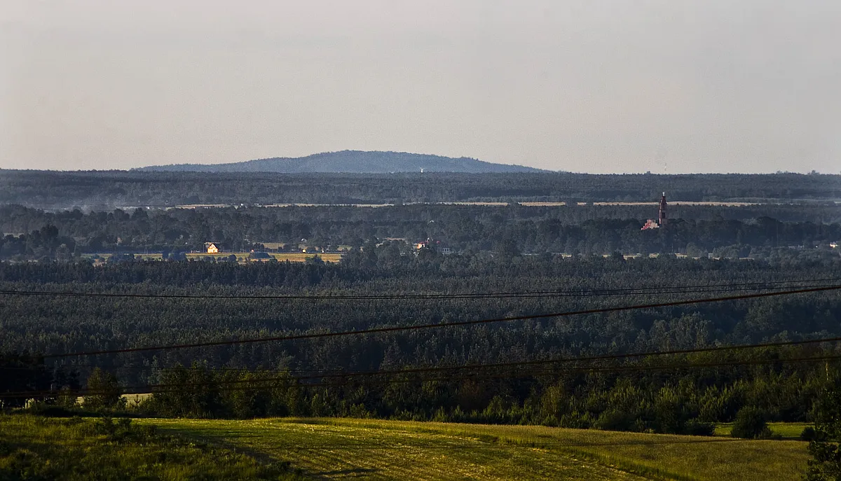 Góra Chełmo Mountain, Masłowice12 km S
-
Przedbórz Ghetto Historic site, Przedbórz13 km SE
-
Pasmo Przedborskie Mountain, Łódź Voivodeship20 km SE
-
Góra Diabla Mountain, Żarnów19 km E
-
Góra Kozłowa Mountain, Przedbórz24 km SE
-
Radomsko Ghetto Historic site, Radomsko24 km SW
Sources & licences
Data last updated: