Lubartów Ghetto
Located in Lubartów, Lubartów County Coordinates: 51°28′00″ N 22°38′00″ E
- Local time
- UTC+01:00
- Europe/Warsaw · UTC+01:00
- Elevation
- 145 m
- above sea level
- Airports
- LUZ Lublin Airport26 km
- RDO Warsaw Radom Airport99 km
About Lubartów Ghetto
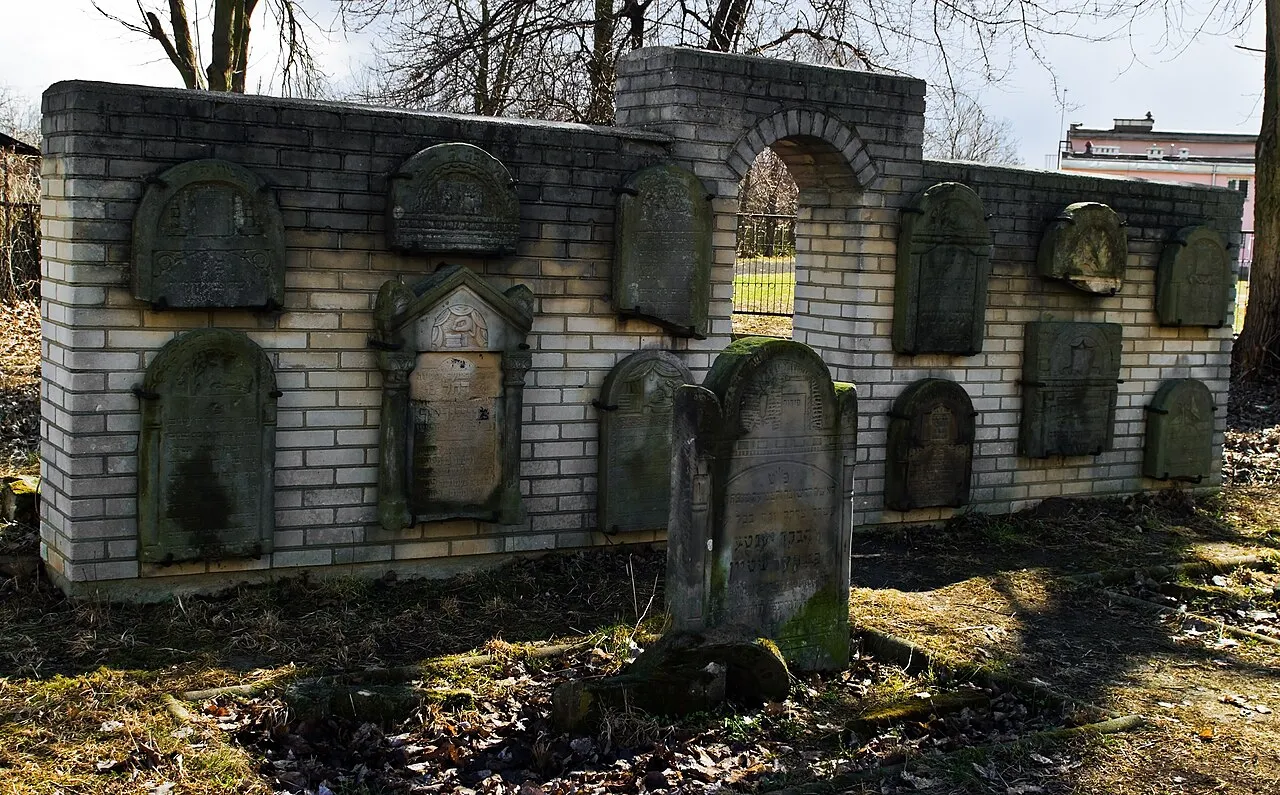
Lubartów Ghetto is a historic site. Location: Lubartów, Lubartów County.
Lubartów Ghetto was established by Nazi Germany in occupied Poland during World War II, and existed officially from 1941 until October 1942. The Polish Jews of the town of Lubartów were confined there initially. The ghetto inmates also included Jews deported from other cities in the vicinity including Lublin and Ciechanów and the rest of German-occupied Europe for the total of 3,500 Jews in its initial stages including 2,000 Jews from Slovakia.
Source: Wikipedia · CC BY-SA 4.0
Climate of Lubartów Ghetto
Best months for sightseeingBest months for sightseeing: May–August.
This month · November
A cold month
Day 5° · Night 0° · Rain 34 mm
- Hottest month
- July (day 24°)
- Coldest month
- January (night -6°)
- Wettest month
- July (68 mm)
- Driest month
- January (25 mm)
Bars: average monthly low and high temperature. Below: precipitation. Monthly averages for 1970–2000 at about 18 km resolution, adjusted for elevation. Highlighted months are mild and relatively dry. Source: WorldClim 2.1 (CC BY 4.0).
Show values as a table
| Month | Jan | Feb | Mar | Apr | May | Jun | Jul | Aug | Sep | Oct | Nov | Dec |
|---|---|---|---|---|---|---|---|---|---|---|---|---|
| Average high (°C) | -1° | 1° | 7° | 14° | 19° | 22° | 24° | 23° | 18° | 13° | 5° | 1° |
| Average low (°C) | -6° | -5° | -1° | 4° | 8° | 11° | 13° | 12° | 9° | 5° | 0° | -4° |
| Precipitation (mm) | 25 | 26 | 28 | 34 | 49 | 63 | 68 | 57 | 53 | 33 | 34 | 31 |
How to get to Lubartów Ghetto
The nearest airport is Lublin Airport (LUZ), 26 km to the south as the crow flies. The nearest large city is Košice, 322 km to the south.
Airports
- Lublin Airport (LUZ) Lublin 26 kmsouth
- Warsaw Radom Airport (RDO) Radom 99 kmwest
- Brest International Airport (BQT) Brest 113 kmnortheast
Nearby large cities
- Košice Population: 225K 322 kmsouth
- Kaunas Population: 289.4K 392 kmnorth
- Nyíregyháza Population: 117.7K 396 kmsouth
- Miskolc Population: 154.5K 397 kmsouth
Straight-line distances; road distances are longer. Airport data: OurAirports.
Day trips from Lubartów Ghetto
Within 100 km: 74 historic and cultural sites, 1 natural site.
0–25 km5 places
- Firlej Ghetto Historic site 14 kmNW
- Kamionka Ghetto Historic site 12 kmW
- Michów Ghetto Historic site 24 kmW
- Ostrów Ghetto Historic site 15 kmE
25–60 km25 places
- Wisznice Ghetto Historic site 55 kmNE
- Adamów Ghetto Historic site 39 kmNW
- Radzyń Ghetto Historic site 35 kmN
- Gniewoszów Ghetto Historic site 58 kmW
60–100 km45 places
- Łaskarzew Ghetto Historic site 81 kmNW
- Magnuszew Ghetto Historic site 92 kmW
- Sławatycze Ghetto Historic site 72 kmNE
- Sobolew Ghetto Historic site 73 kmNW
Straight-line distances.
Nearby attractions & nature
Everything nearby-
Kamionka Ghetto Historic site, Kamionka12 km W
-
Firlej Ghetto Historic site, Gmina Firlej14 km NW
-
Ostrów Ghetto Historic site, Gmina Ostrów Lubelski15 km E
-
Kock Ghetto Historic site, Gmina Kock22 km NW
-
Michów Ghetto Historic site, Michów24 km W
Nearest towns and villages
-
Lubartów Municipality, Lubartów County2.1 km SW
-
Łucka Village, Lubartów3.4 km S
-
Pałecznica Village, Gmina Niedźwiada3.3 km NE
-
Wola Sernicka Village, Gmina Serniki4 km SE
Sources & licences
Data last updated: · 2 independent sources