
- Elevation
- 87 m
- above sea level
- Local time
- UTC+01:00
- Europe/Warsaw · UTC+01:00
- Airports
- WAW Warsaw Chopin Airport6 km
- WMI Warsaw Modlin Airport41 km
About Stegny
Stegny is a neighbourhood. Location: Mokotów, Warsaw.
Stegny (Polish: [ˈstɛɡ.nɘ̟]) is a neighbourhood, and a City Information System area, in Warsaw, Poland, within the Mokotów district. The area is part of its eastern half, known as the Lower Mokotów. It is a residential area, predominantly consisting of housing estates of apartment buildings, including Arbuzowa, Nova Królikarnia, Osiedle Ażurowych Okiennic, Stegny, and Wilanówek. It also includes low-rise single-family housing, predominantly in the neighbourhood of Królikarnia.
Source: Wikipedia · CC BY-SA 4.0
Photos of Stegny
-

Lukasz2 · CC0 -

Wistula · CC BY-SA 4.0 -

Wistula · CC BY-SA 4.0 -

Emptywords · CC BY-SA 4.0 -

Emptywords · CC BY-SA 4.0


Climate of Stegny
Best months for sightseeingBest months for sightseeing: May–August.
This month · November
A cold month
Day 6° · Night 0° · Rain 37 mm
- Hottest month
- July (day 24°)
- Coldest month
- January (night -5°)
- Wettest month
- July (72 mm)
- Driest month
- January (23 mm)
Bars: average monthly low and high temperature. Below: precipitation. Monthly averages for 1970–2000 at about 18 km resolution, adjusted for elevation. Highlighted months are mild and relatively dry. Source: WorldClim 2.1 (CC BY 4.0).
Show values as a table
| Month | Jan | Feb | Mar | Apr | May | Jun | Jul | Aug | Sep | Oct | Nov | Dec |
|---|---|---|---|---|---|---|---|---|---|---|---|---|
| Average high (°C) | 1° | 2° | 7° | 13° | 19° | 22° | 24° | 23° | 18° | 12° | 6° | 2° |
| Average low (°C) | -5° | -4° | -1° | 3° | 8° | 11° | 13° | 12° | 9° | 4° | 0° | -3° |
| Precipitation (mm) | 23 | 23 | 25 | 33 | 51 | 65 | 72 | 56 | 44 | 34 | 37 | 33 |
How to get to Stegny
The nearest airport is Warsaw Chopin Airport (WAW), 6 km to the west as the crow flies. The nearest large city is Kaunas, 358 km to the northeast.
Airports
- Warsaw Chopin Airport (WAW) Warsaw 6 kmwest
- Warsaw Modlin Airport (WMI) Nowy Dwór Mazowiecki 41 kmnorthwest
- Warsaw Radom Airport (RDO) Radom 88 kmsouth
Nearby large cities
- Kaunas Population: 289.4K 358 kmnortheast
- Košice Population: 225K 386 kmsouth
- Klaipėda Population: 172.3K 393 kmnorth
- Vilnius Population: 542.4K 396 kmnortheast
Straight-line distances; road distances are longer. Airport data: OurAirports.
Day trips from Stegny
Within 100 km: 93 historic and cultural sites, 1 natural site.
0–25 km13 places
- Wawer Ghetto Historic site 9 kmNE
- Karczew Ghetto Historic site 17 kmSE
- Falenica-Miedzeszyn Ghetto Historic site 7 kmE
- Fort Solipse Ghetto Historic site 9 kmW
25–60 km29 places
- Magnuszew Ghetto Historic site 52 kmSE
- Sobienie-Jeziory Ghetto Historic site 33 kmSE
- Sochaczew Ghetto Historic site 55 kmW
- Tarczyn Ghetto Historic site 28 kmSW
60–100 km52 places
- Krzyżewskie Góry Mountain 84 kmN
- Maciejowice Ghetto Historic site 63 kmSE
- Maków Mazowiecki Ghetto Historic site 77 kmN
- Rawa Mazowiecka Ghetto Historic site 71 kmSW
Straight-line distances.
Nearby attractions & nature
Everything nearby-
Falenica-Miedzeszyn Ghetto Historic site, Wawer7.1 km E
-
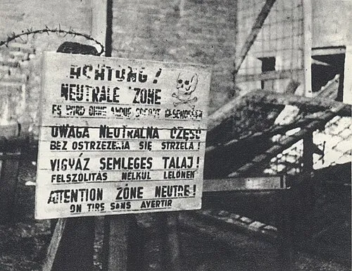 Warsaw Concentration Camp Historic site, Śródmieście8.2 km NW
-
Fort Solipse Ghetto Historic site, Włochy9.3 km W
-
Wawer Ghetto Historic site, Wawer9.3 km NE
-
Rembertów Ghetto Historic site, Rembertów11 km NE
-
Jeziorna Królewska Ghetto Historic site, Gmina Konstancin-Jeziorna11 km S
Sources & licences
Data last updated: · 2 independent sources