- Population
- 10,659
- 10.7K
- Elevation
- 127 m
- above sea level
- Local time
- UTC+01:00
- Europe/Warsaw · UTC+01:00
- Airports
- SZY Olsztyn-Mazury Airport66 km
- WMI Warsaw Modlin Airport137 km
About Kolno
Kolno is a town. Location: Kolno, Kolno County. Population: 10,659. Elevation: 127 m.
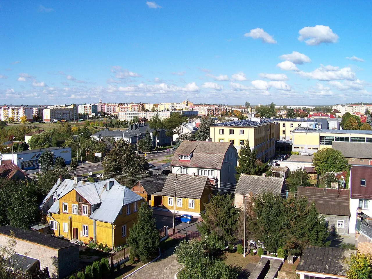
Kolno pronounced [ˈkɔlnɔ] is a town in northeastern Poland, located in the Podlaskie Voivodeship, about 150 km (93 mi) northeast of Warsaw. It is the seat of Kolno County, and the seat of the smaller administrative district (gmina) called Gmina Kolno, but it is not part of this district, as the town has gmina status in its own right. Kolno has 10,730 inhabitants (2007).
Source: Wikipedia · CC BY-SA 4.0
Photos of Kolno
-

Sylwester Górski · CC BY-SA 4.0 -

rybkamaster · CC BY 3.0 -

PanSG · CC BY-SA 4.0 -

PanSG · CC BY-SA 4.0


Climate of Kolno
Best months for sightseeingBest months for sightseeing: May–August.
This month · November
A cold month
Day 5° · Night -1° · Rain 36 mm
- Hottest month
- July (day 24°)
- Coldest month
- January (night -7°)
- Wettest month
- July (71 mm)
- Driest month
- February (23 mm)
Bars: average monthly low and high temperature. Below: precipitation. Monthly averages for 1970–2000 at about 18 km resolution, adjusted for elevation. Highlighted months are mild and relatively dry. Source: WorldClim 2.1 (CC BY 4.0).
Show values as a table
| Month | Jan | Feb | Mar | Apr | May | Jun | Jul | Aug | Sep | Oct | Nov | Dec |
|---|---|---|---|---|---|---|---|---|---|---|---|---|
| Average high (°C) | -2° | -1° | 5° | 13° | 19° | 22° | 24° | 24° | 18° | 12° | 5° | 0° |
| Average low (°C) | -7° | -6° | -2° | 3° | 8° | 11° | 13° | 12° | 8° | 4° | -1° | -5° |
| Precipitation (mm) | 27 | 23 | 27 | 31 | 47 | 67 | 71 | 59 | 47 | 39 | 36 | 33 |
How to get to Kolno
The nearest airport is Olsztyn-Mazury Airport (SZY), 66 km to the west as the crow flies. For international flights: Warsaw Modlin Airport (WMI) (137 km). The nearest large city is Kaunas, 210 km to the northeast.
Airports
- Olsztyn-Mazury Airport (SZY) Szymany 66 kmwest
- Warsaw Modlin Airport (WMI) Nowy Dwór Mazowiecki 137 kmsouthwest
- Warsaw Chopin Airport (WAW) Warsaw 153 kmsouthwest
Nearby large cities
- Kaunas Population: 289.4K 210 kmnortheast
- Klaipėda Population: 172.3K 261 kmnorth
- Vilnius Population: 542.4K 261 kmnortheast
Straight-line distances; road distances are longer. Airport data: OurAirports.
Day trips from Kolno
Within 100 km: 27 historic and cultural sites, 14 natural sites.
0–25 km1 place
- Stawiski Ghetto Historic site 16 kmE
25–60 km10 places
- Jedwabne Ghetto Historic site 29 kmSE
- Łomża Ghetto Historic site 27 kmS
- Góra Jelonka Mountain 32 kmNE
- Grajewo Ghetto Historic site 44 kmNE
60–100 km30 places
- Treblinka Extermination Camp Historic site 87 kmS
- Góry Lénce Mountain 81 kmE
- Będziuzne Góry Mountain 75 kmSE
- Wasilków Ghetto Historic site 89 kmE
Straight-line distances.
Sources & licences
Data last updated: · 2 independent sources