Gmina Dywity
Located in Olsztyn County, Warmian-Masurian Voivodeship Coordinates: 53°50′00″ N 20°28′31″ E
- Population
- 11,533
- 11.5K
- Elevation
- 119 m
- above sea level
- Local time
- UTC+01:00
- Europe/Warsaw · UTC+01:00
- Places inside
- 2
- listed under Gmina Dywity
- Airports
- SZY Olsztyn-Mazury Airport50 km
- KGD Khrabrovo Airport118 km
About Gmina Dywity
Gmina Dywity is a municipality. Location: Olsztyn County, Warmian-Masurian Voivodeship. Population: 11,533. Elevation: 119 m.
Gmina Dywity is a rural gmina (administrative district) in Olsztyn County, Warmian-Masurian Voivodeship, in northern Poland. Its seat is the village of Dywity, which lies approximately 8 kilometres (5 mi) north of the regional capital Olsztyn. The gmina covers an area of 160.68 square kilometres (62.0 sq mi), and as of 2006 its total population is 9,148.
Source: Wikipedia · CC BY-SA 4.0
Places bordering Gmina Dywity
- Gmina Dobre Miasto
Climate of Gmina Dywity
Best months for sightseeingBest months for sightseeing: May–August.
This month · November
A cold month
Day 5° · Night 0° · Rain 51 mm
- Hottest month
- July (day 23°)
- Coldest month
- January (night -6°)
- Wettest month
- June (82 mm)
- Driest month
- February (26 mm)
Bars: average monthly low and high temperature. Below: precipitation. Monthly averages for 1970–2000 at about 18 km resolution, adjusted for elevation. Highlighted months are mild and relatively dry. Source: WorldClim 2.1 (CC BY 4.0).
Show values as a table
| Month | Jan | Feb | Mar | Apr | May | Jun | Jul | Aug | Sep | Oct | Nov | Dec |
|---|---|---|---|---|---|---|---|---|---|---|---|---|
| Average high (°C) | -1° | 1° | 5° | 12° | 19° | 21° | 23° | 22° | 17° | 12° | 5° | 1° |
| Average low (°C) | -6° | -5° | -2° | 3° | 7° | 11° | 13° | 12° | 8° | 5° | 0° | -3° |
| Precipitation (mm) | 38 | 26 | 36 | 38 | 51 | 82 | 74 | 68 | 62 | 53 | 51 | 50 |
How to get to Gmina Dywity
The nearest airport is Olsztyn-Mazury Airport (SZY), 50 km to the southeast as the crow flies. For international flights: Khrabrovo Airport (KGD) (118 km). The nearest large city is Klaipėda, 213 km to the north.
Airports
- Olsztyn-Mazury Airport (SZY) Szymany 50 kmsoutheast
- Khrabrovo Airport (KGD) Kaliningrad 118 kmnorth
- Gdańsk Lech Wałęsa Airport (GDN) Gdańsk 145 kmnorthwest
Nearby large cities
- Klaipėda Population: 172.3K 213 kmnorth
- Kaunas Population: 289.4K 253 kmnortheast
- Vilnius Population: 542.4K 327 kmeast
Straight-line distances; road distances are longer. Airport data: OurAirports.
Day trips from Gmina Dywity
Within 100 km: 13 historic and cultural sites, 8 natural sites.
25–60 km3 places
- Jabłońskie Góry Mountain 44 kmSE
- Złote Góry Mountain 45 kmS
- Schippenbeil Concentration Camp Historic site 60 kmNE
60–100 km18 places
- Mława Ghetto Historic site 80 kmS
- Wzgorze nad Rumunkami Mountain 84 kmW
- Rosenberg Concentration Camp Historic site 76 kmW
- Quesendorf Concentration Camp Historic site 73 kmSW
Straight-line distances.
Places in Gmina Dywity
2 placesBar: population relative to the most populous place in this list.
Other cities and towns in Olsztyn County
-
Gmina Gietrzwałd Municipality, Olsztyn County19 km SW
-
Świątki Municipality, Olsztyn County19 km NW
-
Stawiguda Municipality, Olsztyn County20 km S
-
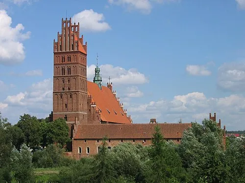 Dobre Miasto Town, Gmina Dobre Miasto18 km N
-
Purda Municipality, Olsztyn County23 km SE
-
Jeziorany Municipality, Olsztyn County24 km NE
Sources & licences
Data last updated: · 2 independent sources