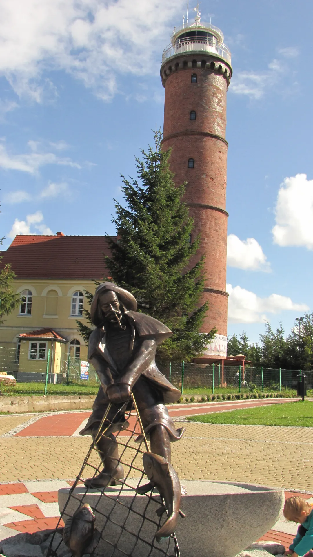
Jarosławiec Lighthouse
Located in Gmina Postomino, Sławno County Coordinates: 54°32′23″ N 16°32′32″ E
- Local time
- UTC+01:00
- Europe/Warsaw · UTC+01:00
- Elevation
- 19 m
- above sea level
- Airports
- GDN Gdańsk Lech Wałęsa Airport126 km
- RNN Bornholm Airport129 km
About Jarosławiec Lighthouse
Jarosławiec Lighthouse is a landmark. Location: Gmina Postomino, Sławno County.
Jarosławiec Lighthouse (Polish: Latarnia Morska Jarosławiec) is a lighthouse located on the Polish coast of the Baltic Sea. The lighthouse is located in Jarosławiec, West Pomeranian Voivodeship; in Poland. The lighthouse is located in between the Darłowo (15 km to the west), and the lighthouse in Ustka.
Source: Wikipedia · CC BY-SA 4.0
At a glance
- Built
- 1838
- Heritage designation
- immovable monument in Poland
Source: Wikidata
Photos of Jarosławiec Lighthouse
-

Tomasz Lerczak · CC BY-SA 4.0 -

RobboRobby · CC BY-SA 4.0 -

Mirand · CC BY-SA 3.0 pl -

Maciej Kawecki · CC BY-SA 4.0 -

Michal Gorski · CC BY-SA 3.0


Climate of Jarosławiec Lighthouse
Best months for sightseeingBest months for sightseeing: June–August.
This month · November
A cold month
Day 6° · Night 2° · Rain 57 mm
- Hottest month
- August (day 21°)
- Coldest month
- January (night -3°)
- Wettest month
- July (71 mm)
- Driest month
- February (30 mm)
Bars: average monthly low and high temperature. Below: precipitation. Monthly averages for 1970–2000 at about 18 km resolution, adjusted for elevation. Highlighted months are mild and relatively dry. Source: WorldClim 2.1 (CC BY 4.0).
Show values as a table
| Month | Jan | Feb | Mar | Apr | May | Jun | Jul | Aug | Sep | Oct | Nov | Dec |
|---|---|---|---|---|---|---|---|---|---|---|---|---|
| Average high (°C) | 2° | 2° | 5° | 10° | 15° | 18° | 20° | 21° | 17° | 12° | 6° | 3° |
| Average low (°C) | -3° | -3° | 0° | 2° | 7° | 11° | 13° | 13° | 10° | 6° | 2° | -1° |
| Precipitation (mm) | 42 | 30 | 36 | 34 | 43 | 61 | 71 | 62 | 66 | 58 | 57 | 52 |
How to get to Jarosławiec Lighthouse
The nearest airport is Gdańsk Lech Wałęsa Airport (GDN), 126 km to the east as the crow flies. The nearest large city is Malmö, 255 km to the northwest.
Airports
- Gdańsk Lech Wałęsa Airport (GDN) Gdańsk 126 kmeast
- Bornholm Airport (RNN) Rønne 129 kmnorthwest
- Solidarity Szczecin–Goleniów Airport (SZZ) Szczecin(Glewice) 151 kmsouthwest
Nearby large cities
- Malmö Population: 362.1K 255 kmnorthwest
- Copenhagen Population: 1.2M 284 kmnorthwest
- Rostock Population: 198.3K 291 kmwest
- Helsingborg Population: 104.2K 296 kmnorthwest
- Berlin Population: 3.4M 306 kmsouthwest
Straight-line distances; road distances are longer. Airport data: OurAirports.
Day trips from Jarosławiec Lighthouse
Within 100 km: 8 historic and cultural sites, 4 natural sites.
25–60 km2 places
- Stolp Concentration Camp Historic site 33 kmE
- Gąski Lighthouse Landmark 55 kmSW
60–100 km10 places
- Kolkau Concentration Camp Historic site 100 kmE
- Stilo Lighthouse Landmark 82 kmE
- Dąbrowa Góra Mountain 90 kmE
- Jelenia Góra Mountain 93 kmE
Straight-line distances.
Nearest towns and villages
-
Jarosławiec Village, Gmina Postomino0.1 km NE
-
Jezierzany Village, Gmina Postomino3 km E
-
Nacmierz Village, Gmina Postomino3.5 km S
-
Rusinowo Village, Gmina Postomino3.7 km SW
Sources & licences
Data last updated: · 2 independent sources