Gmina Postomino
Located in Sławno County, West Pomeranian Voivodeship Coordinates: 54°29′27″ N 16°39′24″ E
- Population
- 6,960
- 7K
- Elevation
- 12 m
- above sea level
- Local time
- UTC+01:00
- Europe/Warsaw · UTC+01:00
- Places inside
- 15
- listed under Gmina Postomino
- Airports
- GDN Gdańsk Lech Wałęsa Airport118 km
- RNN Bornholm Airport138 km
About Gmina Postomino
Gmina Postomino is a municipality. Location: Sławno County, West Pomeranian Voivodeship. Population: 6,960. Elevation: 12 m. The best months to visit are June–August. The nearest airport is Gdańsk Lech Wałęsa Airport (118 km).
Photos of Gmina Postomino
-
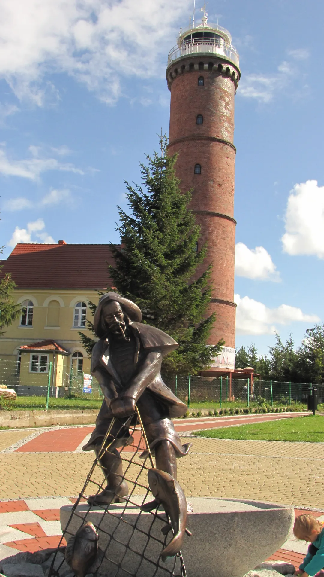
Jarosławiec Lighthouse Martawodnik97 · CC BY-SA 3.0 pl

Climate of Gmina Postomino
Best months for sightseeingBest months for sightseeing: June–August.
This month · November
A cold month
Day 6° · Night 2° · Rain 58 mm
- Hottest month
- August (day 21°)
- Coldest month
- January (night -3°)
- Wettest month
- July (75 mm)
- Driest month
- February (31 mm)
Bars: average monthly low and high temperature. Below: precipitation. Monthly averages for 1970–2000 at about 18 km resolution, adjusted for elevation. Highlighted months are mild and relatively dry. Source: WorldClim 2.1 (CC BY 4.0).
Show values as a table
| Month | Jan | Feb | Mar | Apr | May | Jun | Jul | Aug | Sep | Oct | Nov | Dec |
|---|---|---|---|---|---|---|---|---|---|---|---|---|
| Average high (°C) | 2° | 2° | 6° | 11° | 16° | 19° | 21° | 21° | 17° | 12° | 6° | 3° |
| Average low (°C) | -3° | -3° | 0° | 3° | 7° | 11° | 13° | 13° | 10° | 6° | 2° | -1° |
| Precipitation (mm) | 43 | 31 | 39 | 36 | 46 | 67 | 75 | 64 | 68 | 59 | 58 | 53 |
How to get to Gmina Postomino
The nearest airport is Gdańsk Lech Wałęsa Airport (GDN), 118 km to the east as the crow flies. The nearest large city is Malmö, 265 km to the northwest.
Airports
- Gdańsk Lech Wałęsa Airport (GDN) Gdańsk 118 kmeast
- Bornholm Airport (RNN) Rønne 138 kmnorthwest
- Solidarity Szczecin–Goleniów Airport (SZZ) Szczecin(Glewice) 153 kmsouthwest
Nearby large cities
- Malmö Population: 362.1K 265 kmnorthwest
- Copenhagen Population: 1.2M 293 kmnorthwest
- Rostock Population: 198.3K 297 kmwest
- Helsingborg Population: 104.2K 306 kmnorthwest
- Berlin Population: 3.4M 307 kmsouthwest
Straight-line distances; road distances are longer. Airport data: OurAirports.
Day trips from Gmina Postomino
Within 100 km: 11 historic and cultural sites, 12 natural sites.
0–25 km2 places
- Stolp Concentration Camp Historic site 24 kmE
- Jarosławiec Lighthouse Landmark 9 kmNW
25–60 km1 place
- Gąski Lighthouse Landmark 58 kmSW
60–100 km20 places
- Kolkau Concentration Camp Historic site 94 kmE
- Rieben-Althammer Concentration Camp Historic site 95 kmE
- Stilo Lighthouse Landmark 77 kmNE
- Dąbrowa Góra Mountain 83 kmE
Straight-line distances.
Places in Gmina Postomino
15 places- 1 Królewo 706
- 2 Postomino 625
- 3 Pieszcz 544
- 4 Staniewice 446
- 5 Nacmierz 363
- 6 Jarosławiec 329
- 7 Rusinowo 282
- 8 Łacko 231
- 9 Marszewo 216
- 10 Jezierzany 204
- 11 Złakowo 193
- 12 Masłowice 146
- 13 Górsko 95
- 14 Wicko Morskie 55
Bar: population relative to the most populous place in this list.
Heritage & sights1
- Jarosławiec Lighthouse · Landmark
Other cities and towns in Sławno County
Sources & licences
Data last updated: