São Mateus
Located in São Mateus da Calheta, Angra do Heroísmo Municipality Coordinates: 38°39′23″ N 27°16′10″ W
- Population
- 3,757
- 3.8K
- Elevation
- 20 m
- above sea level
- Local time
- UTC−01:00
- Atlantic/Azores · UTC−01:00
- Airports
- TER Lajes Airport19 km
- SJZ São Jorge Airport79 km
About São Mateus
São Mateus is a village. Location: São Mateus da Calheta, Angra do Heroísmo Municipality. Population: 3,757. Elevation: 20 m. The best months to visit are April–July, October–November. The nearest airport is Lajes Airport (19 km). Nearby sights include Serra do Morião and Pico da Catarina Vieira.
Climate of São Mateus
Best months for sightseeingBest months for sightseeing: April–July, October–November.
This month · November
A good month to visit
Day 22° · Night 16° · Rain 129 mm
- Hottest month
- August (day 27°)
- Coldest month
- February (night 13°)
- Wettest month
- December (136 mm)
- Driest month
- July (38 mm)
Bars: average monthly low and high temperature. Below: precipitation. Monthly averages for 1970–2000 at about 18 km resolution, adjusted for elevation. Highlighted months are mild and relatively dry. Source: WorldClim 2.1 (CC BY 4.0).
Show values as a table
| Month | Jan | Feb | Mar | Apr | May | Jun | Jul | Aug | Sep | Oct | Nov | Dec |
|---|---|---|---|---|---|---|---|---|---|---|---|---|
| Average high (°C) | 19° | 19° | 19° | 20° | 22° | 24° | 26° | 27° | 27° | 24° | 22° | 20° |
| Average low (°C) | 13° | 13° | 14° | 14° | 16° | 18° | 20° | 21° | 20° | 18° | 16° | 15° |
| Precipitation (mm) | 134 | 106 | 96 | 75 | 66 | 48 | 38 | 57 | 92 | 118 | 129 | 136 |
Other places to visit in this season: April May June July October November
How to get to São Mateus
The nearest airport is Lajes Airport (TER), 19 km to the northeast as the crow flies.
Airports
- Lajes Airport (TER) Praia da Vitória 19 kmnortheast
- São Jorge Airport (SJZ) Velas 79 kmwest
- Graciosa Airport (GRW) Santa Cruz da Graciosa 82 kmnorthwest
Straight-line distances; road distances are longer. Airport data: OurAirports.
Day trips from São Mateus
Within 100 km: 4 historic and cultural sites, 90 natural sites, 2 lakes, rivers and coasts.
0–25 km11 places
- Forte da Greta Historic site 17 kmE
- Forte de São Fernando Historic site 18 kmE
- Ponta das Contendas Lighthouse Landmark 16 kmE
- Pico Agudo Mountain 10 kmNE
60–100 km85 places
- Cabeço da Rochinha Mountain 79 kmW
- Cabeço do Caminho Escuro Mountain 76 kmW
- Cabeço da Hera Mountain 73 kmW
- Cabeço da Junca Mountain 73 kmW
Straight-line distances.
Nearby attractions & nature
Everything nearby-
Serra do Morião Mountain, Azores6.7 km NE
-
Pico da Catarina Vieira Mountain, Santa Bárbara7.9 km NW
-
Pico do Malhão Mountain, Porto Judeu10 km NE
-
Pico Agudo Mountain, Quatro Ribeiras9.7 km NE
-
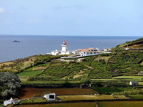 Ponta das Contendas Lighthouse Landmark, Vila de São Sebastião16 km E
-
Pico Rachado Mountain, Altares11 km N
Sources & licences
Data last updated: