Achada
Located in Nordeste Municipality, Azores Coordinates: 37°49′49″ N 25°15′22″ W
- Population
- 436
- 436
- Elevation
- 512 m
- above sea level
- Local time
- UTC−01:00
- Atlantic/Azores · UTC−01:00
About Achada
Achada is a municipality. Location: Nordeste Municipality, Azores. Population: 436. Elevation: 512 m.
Achada is a freguesia ("civil parish") in the municipality Nordeste on the island of São Miguel in the Azores. The population in 2011 was 436, in an area of 11.89 km2.
Read more on Wikipedia Text: Wikipedia contributors · CC BY-SA 4.0 · shortened
At a glance
- Area
- 11.2 km²
Source: Wikidata
In comparison
- No. 6 of 9 places in Nordeste Municipality by population
- Nearest larger town: Santana, 1 km E
- 3 sights and natural places within 10 km Pico da Senhora, Bartholomeu
Climate of Achada
Best months for sightseeing: June–September.
| Month | Jan | Feb | Mar | Apr | May | Jun | Jul | Aug | Sep | Oct | Nov | Dec |
|---|---|---|---|---|---|---|---|---|---|---|---|---|
| Average high (°C) | 14° | 14° | 15° | 15° | 17° | 19° | 22° | 23° | 22° | 19° | 17° | 15° |
| Average low (°C) | 10° | 10° | 10° | 11° | 12° | 14° | 16° | 17° | 16° | 15° | 13° | 11° |
| Precipitation (mm) | 121 | 103 | 100 | 83 | 67 | 48 | 40 | 59 | 96 | 121 | 139 | 129 |
Monthly averages for 1970–2000 at about 18 km resolution, adjusted for elevation. Highlighted months are mild and relatively dry. Source: WorldClim 2.1 (CC BY 4.0).
Other places to visit in this season: June · July · August · September
Airports nearest to Achada
- João Paulo II Airport (PDL) Ponta Delgada 40 km
- Santa Maria Airport (SMA) Vila do Porto 96 km
- Lajes Airport (TER) Praia da Vitória 191 km
Straight-line distance; airports with scheduled flights only. Source: OurAirports (public domain).
Nearby attractions & nature
Everything nearby-
Pico da Senhora Mountain, Lomba da Maia7 km W
-
Ferro Mountain, Furnas9.8 km SW
-
Bartholomeu Mountain, Nordeste9.4 km SE
-
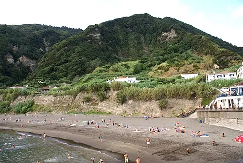 Praia do Fogo Beach, Ribeira Quente12 km SW
-
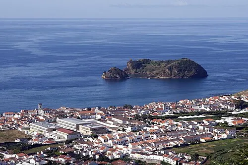 Ilhéu de Vila Franca Island, Vila Franca do Campo (São Pedro)22 km SW
Sources & licences
Data last updated: · 2 independent sources