Cerro do Corvo
Located in São Barnabé, Almodôvar Municipality Coordinates: 37°22′00″ N 8°12′00″ W
- Elevation
- 283 m
- above sea level
- Local time
- UTC+00:00
- Europe/Lisbon · UTC+00:00
- Airports
- PRM Portimão Airport42 km
- FAO Faro - Gago Coutinho International Airport44 km
About Cerro do Corvo
Cerro do Corvo is a mountain. Location: São Barnabé, Almodôvar Municipality. Elevation: 283 m. The best months to visit are May–June, September–October. The nearest airport is Portimão Airport (42 km). Nearby sights include Cabeço do Ramalho and Cerro de Malhinverde.
Climate of Cerro do Corvo
Best months for sightseeingBest months for sightseeing: May–June, September–October.
This month · November
Outside the best season
Day 18° · Night 10° · Rain 85 mm
- Hottest month
- July (day 29°)
- Coldest month
- January (night 6°)
- Wettest month
- December (108 mm)
- Driest month
- July (2 mm)
Bars: average monthly low and high temperature. Below: precipitation. Monthly averages for 1970–2000 at about 18 km resolution, adjusted for elevation. Highlighted months are mild and relatively dry. Source: WorldClim 2.1 (CC BY 4.0).
Show values as a table
| Month | Jan | Feb | Mar | Apr | May | Jun | Jul | Aug | Sep | Oct | Nov | Dec |
|---|---|---|---|---|---|---|---|---|---|---|---|---|
| Average high (°C) | 14° | 15° | 17° | 19° | 22° | 26° | 29° | 29° | 26° | 22° | 18° | 15° |
| Average low (°C) | 6° | 7° | 8° | 9° | 11° | 14° | 16° | 16° | 15° | 13° | 10° | 8° |
| Precipitation (mm) | 84 | 67 | 50 | 55 | 35 | 15 | 2 | 4 | 21 | 64 | 85 | 108 |
Other places to visit in this season: May June September October
How to get to Cerro do Corvo
The nearest airport is Portimão Airport (PRM), 42 km to the southwest as the crow flies. For international flights: Faro - Gago Coutinho International Airport (FAO) (44 km). The nearest large city is Huelva, 112 km to the east.
Airports
- Portimão Airport (PRM) Portimão 42 kmsouthwest
- Faro - Gago Coutinho International Airport (FAO) Faro 44 kmsoutheast
- Lisbon Humberto Delgado Airport (LIS) Lisbon 177 kmnorthwest
Nearby large cities
- Huelva Population: 144.3K 112 kmeast
- Setúbal Population: 118.2K 142 kmnorthwest
- Lisbon Population: 517.8K 172 kmnorthwest
- Cadiz Population: 117K 194 kmsoutheast
- Seville Population: 686.7K 197 kmeast
Straight-line distances; road distances are longer. Airport data: OurAirports.
Day trips from Cerro do Corvo
Within 100 km: 75 historic and cultural sites, 43 natural sites, 52 lakes, rivers and coasts.
0–25 km9 places
- Cabeço do Ramalho Mountain 2 kmNW
- Cerro de Malhinverde Mountain 2 kmNE
- Serra do Malhão Mountain 18 kmE
- Cerro da Madeira Mountain 4 kmN
25–60 km39 places
- Praia da Amoreira Beach 57 kmW
- Praia da Arrifana Beach 60 kmW
- Cerro do Vale Chão Mountain 27 kmW
- Cerro da Fontainha Mountain 34 kmE
60–100 km122 places
- Playa Isla Cristina Beach 81 kmE
- Teatro Municipal Horacio Noguera Attraction 80 kmE
- Playa Giralda Beach 82 kmE
- Playa Islantilla Beach 87 kmE
Straight-line distances.
Nearest towns and villages
-
São Bartolomeu de Messines Municipality, Silves Municipality12 km SW
-
Alte Municipality, Loulé Municipality12 km S
-
Santa Clara-A-Nova Municipality, Almodôvar Municipality12 km NE
-
São Marcos da Serra Municipality, Silves Municipality13 km W
-
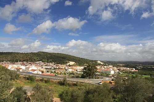 São Bartolomeu de Messines Town, São Bartolomeu de Messines14 km SW
-
Gomes Aires Municipality, Almodôvar Municipality14 km N
Nearby attractions & nature
Everything nearby-
Cabeço do Ramalho Mountain, São Barnabé2.4 km NW
-
Cerro de Malhinverde Mountain, São Barnabé2.4 km NE
-
Cerro da Madeira Mountain, São Barnabé3.7 km N
-
Cerro do Açor Mountain, São Barnabé3.7 km N
-
Cerro do Brusco Mountain, Alte4.7 km SE
-
Cerro da Cabanita Mountain, Santa Cruz13 km E
-
Serra do Malhão Mountain, Faro District18 km E
-
Cerro da Vegueira Mountain, Salir18 km SE
Sources & licences
Data last updated: · 2 independent sources