Calvos
Located in Guimarães Municipality, Braga District Coordinates: 41°24′16″ N 8°14′43″ W
- Population
- 1,082
- 1.1K
- Elevation
- 315 m
- above sea level
- Local time
- UTC+00:00
- Europe/Lisbon · UTC+00:00
- Airports
- OPO Francisco de Sá Carneiro Airport40 km
- VRL Vila Real Airport46 km
About Calvos
Calvos is a municipality. Location: Guimarães Municipality, Braga District. Population: 1,082. Elevation: 315 m. The best months to visit are June–September. The nearest airport is Francisco de Sá Carneiro Airport (40 km). Nearby sights include Monastery of Santa Maria de Pombeiro and Cabeço do Moço.
Climate of Calvos
Best months for sightseeingBest months for sightseeing: June–September.
This month · November
A wet month
Day 15° · Night 7° · Rain 163 mm
- Hottest month
- July (day 25°)
- Coldest month
- January (night 4°)
- Wettest month
- December (202 mm)
- Driest month
- July (20 mm)
Bars: average monthly low and high temperature. Below: precipitation. Monthly averages for 1970–2000 at about 18 km resolution, adjusted for elevation. Highlighted months are mild and relatively dry. Source: WorldClim 2.1 (CC BY 4.0).
Show values as a table
| Month | Jan | Feb | Mar | Apr | May | Jun | Jul | Aug | Sep | Oct | Nov | Dec |
|---|---|---|---|---|---|---|---|---|---|---|---|---|
| Average high (°C) | 12° | 13° | 15° | 17° | 19° | 23° | 25° | 25° | 23° | 19° | 15° | 12° |
| Average low (°C) | 4° | 5° | 6° | 7° | 10° | 13° | 14° | 14° | 13° | 10° | 7° | 5° |
| Precipitation (mm) | 188 | 170 | 118 | 113 | 101 | 60 | 20 | 24 | 70 | 142 | 163 | 202 |
Other places to visit in this season: June July August September
How to get to Calvos
The nearest airport is Francisco de Sá Carneiro Airport (OPO), 40 km to the southwest as the crow flies. The nearest large city is Braga, 22 km to the northwest.
Airports
- Francisco de Sá Carneiro Airport (OPO) Porto 40 kmsouthwest
- Vila Real Airport (VRL) Vila Real 46 kmeast
- Aerodromo Goncalves Lobato (Viseu Airport) (VSE) Viseu 81 kmsouth
Nearby large cities
- Braga Population: 193.3K 22 kmnorthwest
- Porto Population: 252.7K 42 kmsouthwest
- Vigo Population: 293.6K 100 kmnorthwest
- Ourense Population: 105.2K 108 kmnorth
- A Coruña Population: 250.4K 219 kmnorth
Straight-line distances; road distances are longer. Airport data: OurAirports.
Day trips from Calvos
Within 100 km: 70 historic and cultural sites, 193 natural sites, 114 lakes, rivers and coasts.
0–25 km31 places
- Monte de Lijó Mountain 13 kmN
- Serra da Infesta Mountain 18 kmE
- Serra de Galegos Mountain 18 kmN
- Monte Fojo Mountain 15 kmN
25–60 km89 places
- Serra de Santa Eufemia Mountain 51 kmN
- Río de Casal River 58 kmN
- Río Caldo River 56 kmN
- Río Cabaleiros River 55 kmN
60–100 km257 places
- Serra da Garraia Mountain 72 kmE
- Praia dos Muíños Beach 98 kmNW
- Praia América Beach 94 kmNW
- Areal de Menduíña Beach 99 kmNW
Straight-line distances.
Nearby attractions & nature
Everything nearby-
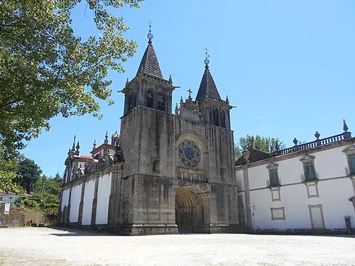 Monastery of Santa Maria de Pombeiro Attraction, Pombeiro de Ribavizela2.9 km SE
-
Cabeço do Moço Mountain, União das freguesias de Atães e Rendufe7 km N
-
Serra dos Campelos Mountain, Lustosa10 km SW
-
Monte do Telégrafo Mountain, União das freguesias de Silvares, Pias, Nogueira e Alvarenga12 km S
-
Monte das Penas Aldas Mountain, União de freguesias de Freitas e Vila Cova13 km N
-
Monte de Lijó Mountain, União de freguesias de Freitas e Vila Cova13 km N
-
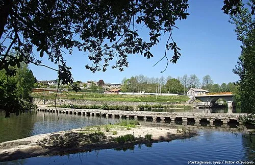 Ponte das Taipas Landmark, Caldelas12 km NW
-
Monte de Barbosa Mountain, União de freguesias de Moreira do Rei e Várzea Cova14 km NE
Sources & licences
Data last updated: