Estádio José Arcanjo
Located in Olhão, Olhão Municipality Coordinates: 37°01′44″ N 7°50′54″ W
- Local time
- UTC+00:00
- Europe/Lisbon · UTC+00:00
- Elevation
- 8 m
- above sea level
- Airports
- FAO Faro - Gago Coutinho International Airport11 km
- PRM Portimão Airport67 km
About Estádio José Arcanjo
Estádio José Arcanjo is a landmark. Location: Olhão, Olhão Municipality.
Estadio José Arcanjo is a multi-purpose stadium in Olhão, Portugal. It is currently used mostly for football matches and is the home stadium of Olhanense. The stadium was able to hold 11,622 people and was built in 1984. Currently the capacity is 5,661 people after renovations in 2009 in order to comply with the minimum requirements of the Portuguese first league.
Source: Wikipedia · CC BY-SA 4.0
At a glance
- Built
- 1984
- Opened
- 1984
Source: Wikidata
Photos of Estádio José Arcanjo
-
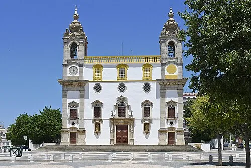
Igreja do Carmo Kjell Vikanes · CC BY-SA 3.0 -
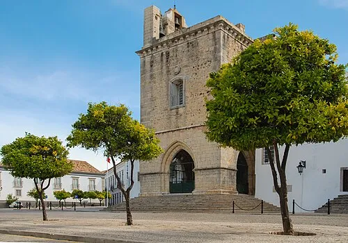
Cathedral of Faro Abrget47j · CC BY-SA 3.0 -
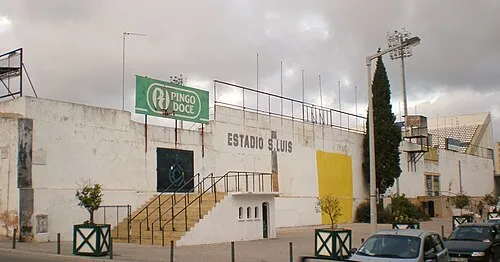
Estádio de São Luís PauloMoreira · Public domain


Climate of Estádio José Arcanjo
Best months for sightseeingBest months for sightseeing: April–June, October.
This month · November
Outside the best season
Day 20° · Night 11° · Rain 79 mm
- Hottest month
- July (day 31°)
- Coldest month
- January (night 8°)
- Wettest month
- December (112 mm)
- Driest month
- July (2 mm)
Bars: average monthly low and high temperature. Below: precipitation. Monthly averages for 1970–2000 at about 18 km resolution, adjusted for elevation. Highlighted months are mild and relatively dry. Source: WorldClim 2.1 (CC BY 4.0).
Show values as a table
| Month | Jan | Feb | Mar | Apr | May | Jun | Jul | Aug | Sep | Oct | Nov | Dec |
|---|---|---|---|---|---|---|---|---|---|---|---|---|
| Average high (°C) | 16° | 17° | 19° | 21° | 23° | 27° | 31° | 31° | 28° | 24° | 20° | 17° |
| Average low (°C) | 8° | 8° | 9° | 11° | 13° | 16° | 19° | 19° | 17° | 14° | 11° | 9° |
| Precipitation (mm) | 80 | 60 | 43 | 47 | 29 | 11 | 2 | 4 | 17 | 62 | 79 | 112 |
Other places to visit in this season: April May June October
How to get to Estádio José Arcanjo
The nearest airport is Faro - Gago Coutinho International Airport (FAO), 11 km to the west as the crow flies. The nearest large city is Huelva, 85 km to the east.
Airports
- Faro - Gago Coutinho International Airport (FAO) Faro 11 kmwest
- Portimão Airport (PRM) Portimão 67 kmwest
- Jerez Airport (XRY) Jerez de la Frontera 163 kmeast
Nearby large cities
- Huelva Population: 144.3K 85 kmeast
- Cadiz Population: 117K 150 kmeast
- Jerez de la Frontera Population: 212.9K 157 kmeast
- Seville Population: 686.7K 171 kmeast
- Dos Hermanas Population: 122.9K 174 kmeast
Straight-line distances; road distances are longer. Airport data: OurAirports.
Day trips from Estádio José Arcanjo
Within 100 km: 100 historic and cultural sites, 40 natural sites, 108 lakes, rivers and coasts.
0–25 km8 places
- Igreja do Carmo Attraction 8 kmW
- Estádio de São Luís Landmark 7 kmW
- Cathedral of Faro Attraction 8 kmW
- Estádio Algarve Landmark 13 kmNW
25–60 km86 places
- Playa Taray Beach 55 kmE
- Cerro da Vegueira Mountain 31 kmNW
- Praia dos Caneiros Beach 60 kmW
- Praia dos Aveiros Beach 35 kmW
60–100 km154 places
- Playa de Mazagón Beach 94 kmE
- Playa de Rompeculos Beach 97 kmE
- Laguna de las Madres Lake 89 kmE
- Laguna de la Mujer Lake 87 kmE
Straight-line distances.
Nearby attractions & nature
Everything nearby-
Estádio de São Luís Landmark, União das freguesias de Faro (Sé e São Pedro)7.1 km W
-
Cathedral of Faro Attraction, União das freguesias de Faro (Sé e São Pedro)7.9 km W
-
Igreja do Carmo Attraction, União das freguesias de Faro (Sé e São Pedro)7.7 km W
-
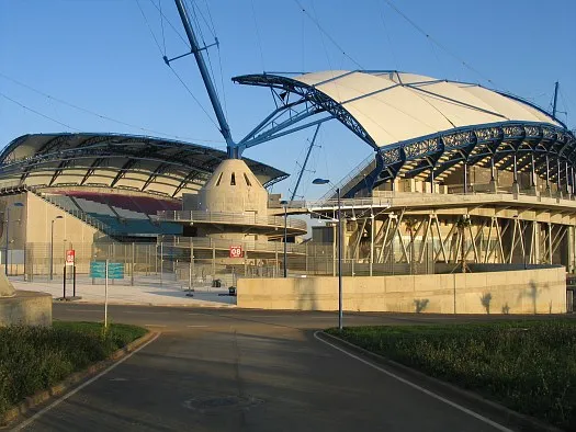 Estádio Algarve Landmark, Almancil13 km NW
-
Serro de Monte Figo Mountain, Faro District8.2 km N
-
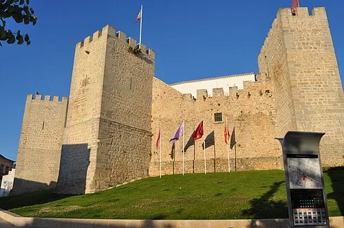 Castelo de Loulé Historic site, Loulé (São Sebastião)20 km NW
-
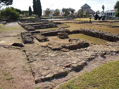 Roman ruins of Cerro da Vila Historic site, Quarteira25 km W
-
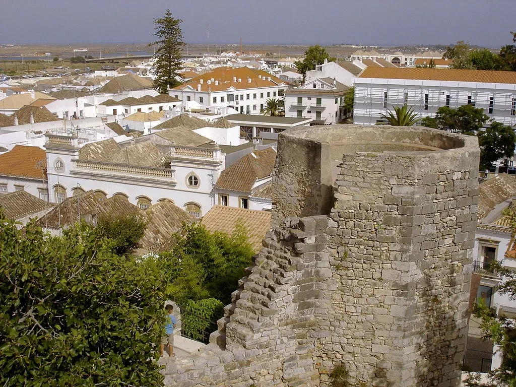 Tavira Castle Historic site, União das freguesias de Tavira (Santa Maria e Santiago)21 km NE
Nearest towns and villages
-
Pechão Municipality, Olhão Municipality2.2 km NW
-
Quelfes Municipality, Olhão Municipality3 km NE
-
Quelfes Town, Quelfes4.2 km NE
-
União das freguesias de Faro (Sé e São Pedro) Municipality, Faro Municipality5.9 km SW
Sources & licences
Data last updated: · 2 independent sources