Estádio Algarve
Located in Almancil, Loulé Municipality Coordinates: 37°05′19″ N 7°58′28″ W
- Local time
- UTC+00:00
- Europe/Lisbon · UTC+00:00
- Elevation
- 50 m
- above sea level
- Airports
- FAO Faro - Gago Coutinho International Airport8 km
- PRM Portimão Airport55 km
About Estádio Algarve
Estádio Algarve is a landmark. Location: Almancil, Loulé Municipality.
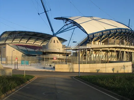
The Estádio Algarve (English: Algarve Stadium) is an association football stadium located between Faro and Loulé municipalities, in the Algarve region of Portugal. The stadium has a total capacity of 30,305 spectators and was purposely built for the UEFA Euro 2004 championship. Since 2023, only 22,000 seats are made available for football matches due to security concerns.
Source: Wikipedia · CC BY-SA 4.0
At a glance
- Built
- 2003
- Opened
- 2003
- Architect
- Populous
- Official website
- estadioalgarve.pt
Source: Wikidata
Photos of Estádio Algarve
-

Vitor Oliveira from Torres Vedras, PORTUGAL · CC BY-SA 2.0 -

Kolforn · CC BY-SA 4.0 -

Kolforn · CC BY-SA 4.0 -
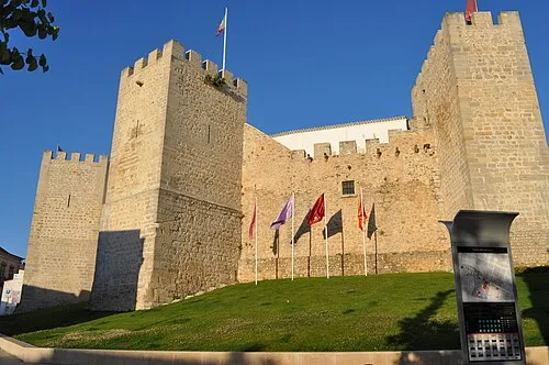
Castelo de Loulé Lídia Maria Faria · CC BY-SA 4.0


Climate of Estádio Algarve
Best months for sightseeingBest months for sightseeing: April–June, October.
This month · November
Outside the best season
Day 20° · Night 11° · Rain 79 mm
- Hottest month
- July (day 31°)
- Coldest month
- January (night 7°)
- Wettest month
- December (112 mm)
- Driest month
- July (2 mm)
Bars: average monthly low and high temperature. Below: precipitation. Monthly averages for 1970–2000 at about 18 km resolution, adjusted for elevation. Highlighted months are mild and relatively dry. Source: WorldClim 2.1 (CC BY 4.0).
Show values as a table
| Month | Jan | Feb | Mar | Apr | May | Jun | Jul | Aug | Sep | Oct | Nov | Dec |
|---|---|---|---|---|---|---|---|---|---|---|---|---|
| Average high (°C) | 16° | 17° | 19° | 20° | 23° | 27° | 31° | 30° | 28° | 23° | 20° | 17° |
| Average low (°C) | 7° | 8° | 9° | 10° | 13° | 16° | 19° | 18° | 17° | 14° | 11° | 9° |
| Precipitation (mm) | 80 | 60 | 43 | 47 | 29 | 11 | 2 | 4 | 17 | 62 | 79 | 112 |
Other places to visit in this season: April May June October
How to get to Estádio Algarve
The nearest airport is Faro - Gago Coutinho International Airport (FAO), 8 km to the south as the crow flies. The nearest large city is Huelva, 94 km to the east.
Airports
- Faro - Gago Coutinho International Airport (FAO) Faro 8 kmsouth
- Portimão Airport (PRM) Portimão 55 kmwest
- Jerez Airport (XRY) Jerez de la Frontera 175 kmeast
Nearby large cities
- Huelva Population: 144.3K 94 kmeast
- Cadiz Population: 117K 163 kmeast
- Jerez de la Frontera Population: 212.9K 170 kmeast
- Setúbal Population: 118.2K 179 kmnorthwest
- Seville Population: 686.7K 181 kmeast
Straight-line distances; road distances are longer. Airport data: OurAirports.
Day trips from Estádio Algarve
Within 100 km: 92 historic and cultural sites, 40 natural sites, 96 lakes, rivers and coasts.
0–25 km10 places
- Serro de Monte Figo Mountain 12 kmE
- Cerro da Vegueira Mountain 19 kmNW
- Cathedral of Faro Attraction 9 kmSE
- Roman ruins of Cerro da Vila Historic site 13 kmW
25–60 km81 places
- Playa Isla Cristina Beach 59 kmE
- Teatro Municipal Horacio Noguera Attraction 59 kmE
- Playa de Caiman Beach 58 kmE
- Barranco de los Hierros River 60 kmNE
60–100 km137 places
- Playa de Castilla Beach 99 kmE
- Playa Giralda Beach 61 kmE
- Playa Islantilla Beach 67 kmE
- Cebollar Mountain 85 kmE
Straight-line distances.
Nearby attractions & nature
Everything nearby-
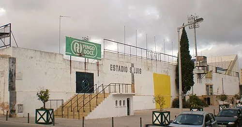 Estádio de São Luís Landmark, União das freguesias de Faro (Sé e São Pedro)8.4 km SE
-
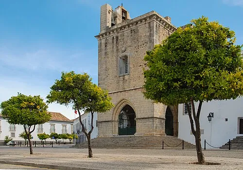 Cathedral of Faro Attraction, União das freguesias de Faro (Sé e São Pedro)9.1 km SE
-
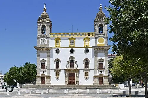 Igreja do Carmo Attraction, União das freguesias de Faro (Sé e São Pedro)8.4 km SE
-
Castelo de Loulé Historic site, Loulé (São Sebastião)7.2 km NW
-
Estádio José Arcanjo Landmark, Olhão13 km SE
-
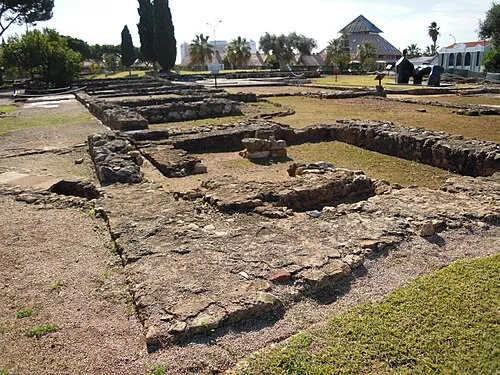 Roman ruins of Cerro da Vila Historic site, Quarteira13 km W
-
Serro de Monte Figo Mountain, Faro District12 km E
-
Cerro da Vegueira Mountain, Salir19 km NW
Nearest towns and villages
-
Santa Bárbara de Nexe Village, Santa Bárbara de Nexe2.1 km N
-
Santa Bárbara de Nexe Municipality, Faro Municipality2.8 km NE
-
Almancil Town, Almancil5 km W
-
Loulé (São Clemente) Municipality, Loulé Municipality5.9 km NW
Sources & licences
Data last updated: · 2 independent sources