Manta Rota
Located in Vila Nova de Cacela, Vila Real de Santo António Municipality Coordinates: 37°10′07″ N 7°31′05″ W

- Population
- 1,200
- 1.2K
- Elevation
- 17 m
- above sea level
- Local time
- UTC+00:00
- Europe/Lisbon · UTC+00:00
- Airports
- FAO Faro - Gago Coutinho International Airport44 km
- PRM Portimão Airport95 km
About Manta Rota
Manta Rota is a village. Location: Vila Nova de Cacela, Vila Real de Santo António Municipality. Population: 1,200. Elevation: 17 m.
Manta Rota is a small seaside town in the civil parish of Vila Nova de Cacela, municipality of Vila Real de Santo António, in the Algarve, Portugal. Manta Rota is an important tourist destination due to its sandy beaches by the Atlantic Ocean.
Source: Wikipedia · CC BY-SA 4.0
Photos of Manta Rota
-

Jose A · CC BY 2.0 -

Milton Ferreira · CC BY-SA 4.0 -

José Carlos Casimiro from Maia, Portugal · CC BY-SA 2.0 -

Manuel Correia · Public domain


Climate of Manta Rota
Best months for sightseeingBest months for sightseeing: March–May, October.
This month · November
Outside the best season
Day 20° · Night 11° · Rain 78 mm
- Hottest month
- July (day 33°)
- Coldest month
- January (night 7°)
- Wettest month
- December (102 mm)
- Driest month
- July (2 mm)
Bars: average monthly low and high temperature. Below: precipitation. Monthly averages for 1970–2000 at about 18 km resolution, adjusted for elevation. Highlighted months are mild and relatively dry. Source: WorldClim 2.1 (CC BY 4.0).
Show values as a table
| Month | Jan | Feb | Mar | Apr | May | Jun | Jul | Aug | Sep | Oct | Nov | Dec |
|---|---|---|---|---|---|---|---|---|---|---|---|---|
| Average high (°C) | 16° | 17° | 19° | 21° | 24° | 29° | 33° | 32° | 29° | 24° | 20° | 17° |
| Average low (°C) | 7° | 8° | 9° | 10° | 13° | 16° | 19° | 19° | 17° | 14° | 11° | 9° |
| Precipitation (mm) | 78 | 56 | 43 | 50 | 31 | 13 | 2 | 4 | 18 | 62 | 78 | 102 |
Other places to visit in this season: March April May October
How to get to Manta Rota
The nearest airport is Faro - Gago Coutinho International Airport (FAO), 44 km to the southwest as the crow flies. The nearest large city is Huelva, 52 km to the east.
Airports
- Faro - Gago Coutinho International Airport (FAO) Faro 44 kmsouthwest
- Portimão Airport (PRM) Portimão 95 kmwest
- Jerez Airport (XRY) Jerez de la Frontera 138 kmeast
Nearby large cities
- Huelva Population: 144.3K 52 kmeast
- Cadiz Population: 117K 131 kmsoutheast
- Jerez de la Frontera Population: 212.9K 134 kmsoutheast
- Seville Population: 686.7K 139 kmeast
- Dos Hermanas Population: 122.9K 142 kmeast
Straight-line distances; road distances are longer. Airport data: OurAirports.
Day trips from Manta Rota
Within 100 km: 110 historic and cultural sites, 46 natural sites, 192 lakes, rivers and coasts.
0–25 km61 places
- Punta del Caiman Beach 17 kmE
- Playa Los Cisnes Beach 14 kmE
- Arroyo Pedreza River 12 kmNE
- Templo de las Mercedes Attraction 11 kmNE
25–60 km133 places
- Serro de Monte Figo Mountain 30 kmW
- Cerro da Parra Mountain 33 kmNW
- Cerro da Masseira Mountain 36 kmNW
- Cerro das Hortas Mountain 37 kmNW
60–100 km154 places
- Arroyo del Lagarto River 79 kmNE
- Arroyo Carrasco River 75 kmNE
- Rivera del Agua Agria River 65 kmNE
- Playa de Matalascañas Beach 88 kmE
Straight-line distances.
Nearby attractions & nature
Everything nearby-
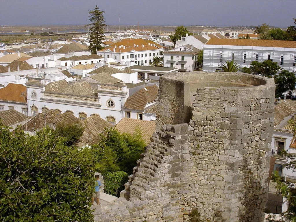 Tavira Castle Historic site, União das freguesias de Tavira (Santa Maria e Santiago)13 km W
-
Ermita Nuestra Señora del Carmen Attraction, Ayamonte11 km E
-
Teatro Cadenio Attraction, Ayamonte11 km NE
-
Parroquia De Nuestra Señora De Las Angustias Attraction, Ayamonte11 km NE
-
Estadio Blas Infante Ayamonte Landmark, Ayamonte11 km E
-
Templo de las Mercedes Attraction, Ayamonte11 km NE
Sources & licences
Data last updated: · 2 independent sources