Carriço
Located in Pombal Municipality, Leiria District Coordinates: 39°59′50″ N 8°51′06″ W
- Population
- 3,330
- 3.3K
- Elevation
- 52 m
- above sea level
- Local time
- UTC+00:00
- Europe/Lisbon · UTC+00:00
- Airports
- VSE Aerodromo Goncalves Lobato (Viseu Airport)115 km
- LIS Lisbon Humberto Delgado Airport137 km
About Carriço
Carriço is a municipality. Location: Pombal Municipality, Leiria District. Population: 3,330. Elevation: 52 m. The best months to visit are June–September. The nearest airport is Aerodromo Goncalves Lobato (Viseu Airport) (115 km). Nearby sights include Estádio Municipal José Bento Pessoa and Serra da Bonha.
Climate of Carriço
Best months for sightseeingBest months for sightseeing: June–September.
This month · November
Outside the best season
Day 17° · Night 10° · Rain 97 mm
- Hottest month
- August (day 25°)
- Coldest month
- January (night 7°)
- Wettest month
- January (109 mm)
- Driest month
- July (9 mm)
Bars: average monthly low and high temperature. Below: precipitation. Monthly averages for 1970–2000 at about 18 km resolution, adjusted for elevation. Highlighted months are mild and relatively dry. Source: WorldClim 2.1 (CC BY 4.0).
Show values as a table
| Month | Jan | Feb | Mar | Apr | May | Jun | Jul | Aug | Sep | Oct | Nov | Dec |
|---|---|---|---|---|---|---|---|---|---|---|---|---|
| Average high (°C) | 14° | 15° | 17° | 19° | 20° | 23° | 25° | 25° | 24° | 21° | 17° | 15° |
| Average low (°C) | 7° | 7° | 9° | 10° | 12° | 14° | 16° | 15° | 15° | 13° | 10° | 8° |
| Precipitation (mm) | 109 | 86 | 64 | 63 | 60 | 29 | 9 | 11 | 34 | 84 | 97 | 107 |
Other places to visit in this season: June July August September
How to get to Carriço
The nearest airport is Aerodromo Goncalves Lobato (Viseu Airport) (VSE), 115 km to the northeast as the crow flies. For international flights: Lisbon Humberto Delgado Airport (LIS) (137 km). The nearest large city is Porto, 129 km to the north.
Airports
- Aerodromo Goncalves Lobato (Viseu Airport) (VSE) Viseu 115 kmnortheast
- Lisbon Humberto Delgado Airport (LIS) Lisbon 137 kmsouth
- Francisco de Sá Carneiro Airport (OPO) Porto 140 kmnorth
Nearby large cities
- Porto Population: 252.7K 129 kmnorth
- Lisbon Population: 517.8K 144 kmsouth
- Setúbal Population: 118.2K 164 kmsouth
- Braga Population: 193.3K 176 kmnorth
- Badajoz Population: 150.5K 204 kmsoutheast
Straight-line distances; road distances are longer. Airport data: OurAirports.
Day trips from Carriço
Within 100 km: 16 historic and cultural sites, 109 natural sites.
0–25 km2 places
- Serra da Bonha Mountain 24 kmSE
- Estádio Municipal José Bento Pessoa Landmark 18 kmN
25–60 km38 places
- Botanical Garden of the University of Coimbra Attraction 43 kmNE
- Cabeço Gordo Mountain 50 kmS
- Cabeço do Vento Mountain 47 kmS
- Cabeço Vedeiro Mountain 49 kmS
60–100 km85 places
- Castelo de Avô Historic site 87 kmNE
- Alto da Lousa Mountain 74 kmNE
- Alto da Louriceira Mountain 73 kmNE
- Cabeço das Lamas Mountain 86 kmE
Straight-line distances.
Nearby attractions & nature
Everything nearby-
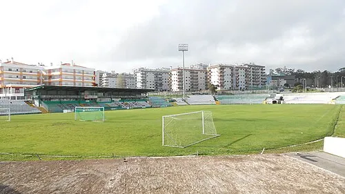 Estádio Municipal José Bento Pessoa Landmark, Tavarede18 km N
-
Serra da Bonha Mountain, Leiria District24 km SE
Sources & licences
Data last updated: