Arronches Municipality
Located in Portalegre District, Portugal Coordinates: 39°08′18″ N 7°14′59″ W
- Population
- 3,165
- 3.2K
- Elevation
- 323 m
- above sea level
- Local time
- UTC+00:00
- Europe/Lisbon · UTC+00:00
- Places inside
- 3
- listed under Arronches Municipality
About Arronches Municipality
Arronches Municipality is a district. Location: Portalegre District, Portugal. Population: 3,165.
In comparison
- 5 sights and natural places within 10 km Castelo de Arronches, Cabeço do Mourato
- Listed here: Municipality: 3
Places in Arronches Municipality
3 placesNature and heritage in Arronches Municipality
-
Serra da Pedra Torta Mountain, Esperança
-
Cabeço do Mourato Mountain, Assunção
-
Serra da Chugueira Mountain, Esperança
-
Castelo de Arronches Historic site, Assunção
Nearby attractions & nature
Everything nearby-
Serra da Mina Mountain, Alegrete10 km N
-
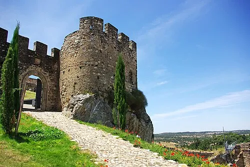 Castelo de Alegrete Historic site, Alegrete13 km NW
-
Castillo de La Beltraneja Historic site, Codosera, La9.8 km NE
-
Parroquia Nuestra Señora de la Piedad Attraction, Codosera, La10 km NE
-
Campo de Fútbol Municipal "El Potril" Landmark, Codosera, La10 km NE
-
Cabeço Alto Mountain, União das freguesias de Reguengo e São Julião18 km NW
Sources & licences
Data last updated: