Elvas Municipality
Local name: Elvas
Located in Portalegre District, Portugal Coordinates: 38°53′55″ N 7°13′27″ W
- Population
- 23,078
- 23.1K
- Elevation
- 363 m
- above sea level
- Local time
- UTC+00:00
- Europe/Lisbon · UTC+00:00
- Places inside
- 8
- listed under Elvas Municipality
About Elvas Municipality
Elvas Municipality is a district. Location: Portalegre District, Portugal. Population: 23,078.
Elvas (Portuguese pronunciation: [ˈɛlvɐʃ] ), officially the City of Elvas (Portuguese: Cidade de Elvas), is a Portuguese municipality, former episcopal city and frontier fortress of easternmost central Portugal, located in the district of Portalegre in Alentejo. It is situated about 200 kilometres (120 mi) east of Lisbon, and about 8 kilometres (5.0 mi) west of the Spanish fortress of Badajoz, by the Madrid-Badajoz-Lisbon railway.
Read more on Wikipedia Text: Wikipedia contributors · CC BY-SA 4.0 · shortened
At a glance
- Area
- 631 km²
Source: Wikidata
In comparison
- Listed here: Municipality: 8
Places in Elvas Municipality
8 places-
Assunção, Ajuda, Salvador e Santo Ildefonso Municipality9.1K
-
Caia, São Pedro e Alcáçova Municipality5.4K
-
São Brás e São Lourenço Municipality1.6K
-
Terrugem Municipality1.3K
-
Vila Boim Municipality1.2K
-
Santa Eulália Municipality1K
-
União das freguesias de Barbacena e Vila Fernando Municipality801
-
São Vicente e Ventosa Municipality732
Nature and heritage in Elvas Municipality
-
Forte de Santa Luzia Historic site, Assunção, Ajuda, Salvador e Santo Ildefonso
-
Alto da Esparregueira Mountain, Santa Eulália
Nearby attractions & nature
Everything nearby-
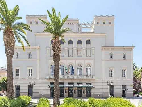 Teatro López de Ayala Attraction, Badajoz22 km E
-
Alto dos Ripados Mountain, Monforte16 km NW
-
Arroyo de Hinojales River, Badajoz13 km SE
-
Rio Caia River, Spain14 km SE
-
Río de Olivenza River, Olivenza14 km SE
-
Estadio Nuevo Vivero Landmark, Badajoz19 km E
Sources & licences
Data last updated: · 2 independent sources