São Brás e São Lourenço
Located in Elvas Municipality, Portalegre District Coordinates: 38°52′39″ N 7°13′31″ W
- Population
- 1,629
- 1.6K
- Elevation
- 378 m
- above sea level
- Local time
- UTC+00:00
- Europe/Lisbon · UTC+00:00
- Airports
- BJZ Badajoz Airport35 km
- LIS Lisbon Humberto Delgado Airport166 km
About São Brás e São Lourenço
São Brás e São Lourenço is a municipality. Location: Elvas Municipality, Portalegre District. Population: 1,629. Elevation: 378 m. The best months to visit are May–June, September–October. The nearest airport is Badajoz Airport (35 km). Nearby sights include Forte de Santa Luzia and Teatro López de Ayala.
Photos of São Brás e São Lourenço
-
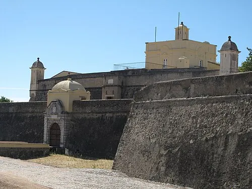
Forte de Santa Luzia Dafema · CC BY-SA 3.0

Climate of São Brás e São Lourenço
Best months for sightseeingBest months for sightseeing: May–June, September–October.
This month · November
Outside the best season
Day 16° · Night 8° · Rain 83 mm
- Hottest month
- July (day 31°)
- Coldest month
- January (night 4°)
- Wettest month
- December (85 mm)
- Driest month
- July (5 mm)
Bars: average monthly low and high temperature. Below: precipitation. Monthly averages for 1970–2000 at about 18 km resolution, adjusted for elevation. Highlighted months are mild and relatively dry. Source: WorldClim 2.1 (CC BY 4.0).
Show values as a table
| Month | Jan | Feb | Mar | Apr | May | Jun | Jul | Aug | Sep | Oct | Nov | Dec |
|---|---|---|---|---|---|---|---|---|---|---|---|---|
| Average high (°C) | 13° | 14° | 17° | 18° | 22° | 27° | 31° | 31° | 28° | 22° | 16° | 13° |
| Average low (°C) | 4° | 5° | 6° | 8° | 10° | 13° | 16° | 16° | 14° | 11° | 8° | 5° |
| Precipitation (mm) | 73 | 68 | 57 | 57 | 49 | 25 | 5 | 6 | 31 | 66 | 83 | 85 |
Other places to visit in this season: May June September October
How to get to São Brás e São Lourenço
The nearest airport is Badajoz Airport (BJZ), 35 km to the east as the crow flies. For international flights: Lisbon Humberto Delgado Airport (LIS) (166 km). The nearest large city is Badajoz, 22 km to the east.
Airports
- Badajoz Airport (BJZ) Badajoz 35 kmeast
- Lisbon Humberto Delgado Airport (LIS) Lisbon 166 kmwest
- Cascais Airport (CAT) Cascais 186 kmwest
Nearby large cities
- Badajoz Population: 150.5K 22 kmeast
- Setúbal Population: 118.2K 150 kmwest
- Lisbon Population: 517.8K 168 kmwest
- Huelva Population: 144.3K 181 kmsouth
- Seville Population: 686.7K 199 kmsoutheast
Straight-line distances; road distances are longer. Airport data: OurAirports.
Day trips from São Brás e São Lourenço
Within 100 km: 114 historic and cultural sites, 85 natural sites, 132 lakes, rivers and coasts.
0–25 km29 places
- Parque de Castelar Natural site 22 kmE
- Parque de La Legión Natural site 23 kmE
- Alcazaba Park Natural site 22 kmE
- Rio Caia River 13 kmE
25–60 km84 places
- Pantano de la Peña del Águila Lake 46 kmNE
- Laguna Grande Lake 47 kmSE
- Alpotreque Mountain 53 kmNE
- Sierra Morena Mountain 47 kmSE
60–100 km218 places
- Sapateira Grande Mountain 66 kmN
- Vale do Corvo Natural site 93 kmW
- Vale Costado Natural site 93 kmW
- Pantano de Proserpina Lake 76 kmE
Straight-line distances.
Nearby attractions & nature
Everything nearby-
Forte de Santa Luzia Historic site, Assunção, Ajuda, Salvador e Santo Ildefonso5.8 km E
-
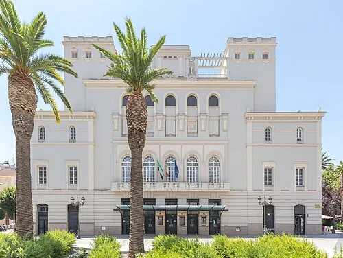 Teatro López de Ayala Attraction, Badajoz22 km E
-
Arroyo de Hinojales River, Badajoz12 km SE
-
Río de Olivenza River, Olivenza12 km SE
-
Alto da Esparregueira Mountain, Santa Eulália16 km NW
-
Rio Caia River, Spain13 km E
-
Alto dos Ripados Mountain, Monforte17 km NW
-
Estadio Nuevo Vivero Landmark, Badajoz19 km E
Sources & licences
Data last updated: