Bem Viver
Located in Marco de Canaveses Municipality, Porto District Coordinates: 41°06′25″ N 8°13′24″ W
- Population
- 3,542
- 3.5K
- Elevation
- 335 m
- above sea level
- Local time
- UTC+00:00
- Europe/Lisbon · UTC+00:00
- Places inside
- 1
- listed under Bem Viver
- Airports
- OPO Francisco de Sá Carneiro Airport42 km
- VRL Vila Real Airport46 km
About Bem Viver
Bem Viver is a municipality. Location: Marco de Canaveses Municipality, Porto District. Population: 3,542. Elevation: 335 m. The best months to visit are June–September. The nearest airport is Francisco de Sá Carneiro Airport (42 km). Nearby sights include Serra de Luzim and Alto do Picoto.
Climate of Bem Viver
Best months for sightseeingBest months for sightseeing: June–September.
This month · November
A wet month
Day 15° · Night 7° · Rain 153 mm
- Hottest month
- August (day 25°)
- Coldest month
- January (night 4°)
- Wettest month
- December (193 mm)
- Driest month
- July (18 mm)
Bars: average monthly low and high temperature. Below: precipitation. Monthly averages for 1970–2000 at about 18 km resolution, adjusted for elevation. Highlighted months are mild and relatively dry. Source: WorldClim 2.1 (CC BY 4.0).
Show values as a table
| Month | Jan | Feb | Mar | Apr | May | Jun | Jul | Aug | Sep | Oct | Nov | Dec |
|---|---|---|---|---|---|---|---|---|---|---|---|---|
| Average high (°C) | 12° | 13° | 15° | 16° | 19° | 22° | 25° | 25° | 23° | 19° | 15° | 12° |
| Average low (°C) | 4° | 5° | 6° | 7° | 10° | 13° | 14° | 14° | 13° | 10° | 7° | 5° |
| Precipitation (mm) | 192 | 171 | 116 | 110 | 98 | 57 | 18 | 20 | 62 | 136 | 153 | 193 |
Other places to visit in this season: June July August September
How to get to Bem Viver
The nearest airport is Francisco de Sá Carneiro Airport (OPO), 42 km to the west as the crow flies. The nearest large city is Porto, 33 km to the west.
Airports
- Francisco de Sá Carneiro Airport (OPO) Porto 42 kmwest
- Vila Real Airport (VRL) Vila Real 46 kmnortheast
- Aerodromo Goncalves Lobato (Viseu Airport) (VSE) Viseu 51 kmsoutheast
Nearby large cities
- Porto Population: 252.7K 33 kmwest
- Braga Population: 193.3K 52 kmnorth
- Vigo Population: 293.6K 132 kmnorth
- Ourense Population: 105.2K 140 kmnorth
- Salamanca Population: 144.8K 216 kmeast
Straight-line distances; road distances are longer. Airport data: OurAirports.
Day trips from Bem Viver
Within 100 km: 36 historic and cultural sites, 140 natural sites, 18 lakes, rivers and coasts.
0–25 km23 places
- Serra de Luzim Mountain 8 kmNW
- Serra da Gralheira Mountain 23 kmSE
- Serra do Viso Mountain 23 kmS
- Monte do Telégrafo Mountain 22 kmN
25–60 km74 places
- Pedestrian bridge over the Pinhão river Landmark 57 kmE
- Monte de Lijó Mountain 46 kmN
- Serra de Leomil Mountain 49 kmE
- Serra da Infesta Mountain 36 kmNE
60–100 km97 places
- Serra da Garraia Mountain 79 kmNE
- Monteagudo Mountain 92 kmN
- Penedo do Subiado Mountain 99 kmN
- Serra de Santa Eufemia Mountain 83 kmN
Straight-line distances.
Places in Bem Viver
1 placeMountains & nature1
- Alto de São Tiago · Mountain
Nearby attractions & nature
Everything nearby-
Serra de Luzim Mountain, Porto District7.6 km NW
-
Alto do Picoto Mountain, Abragão8.1 km N
-
Alto S. Gens Mountain, Santa Maria de Sardoura9.3 km SW
-
Alto S. Paul Mountain, Santa Maria de Sardoura9.9 km SW
-
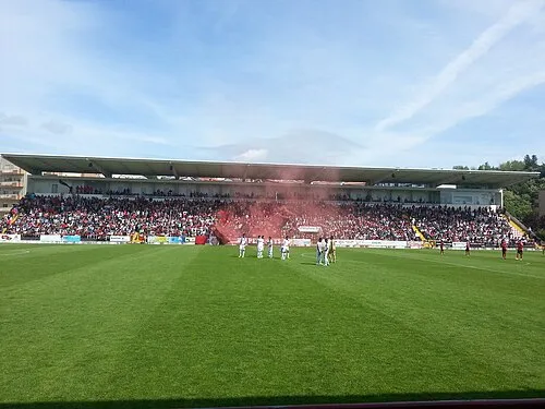 Estádio Municipal 25 de Abril Landmark, Penafiel12 km N
-
Serra da Boneca Mountain, Sebolido11 km SW
-
Serra da Raiva Mountain, Raiva12 km SW
-
Monte Senhora da Lapa Mountain, Real13 km SW
Sources & licences
Data last updated: