Vreia de Bornes
Located in Vila Pouca de Aguiar Municipality, Vila Real District Coordinates: 41°34′20″ N 7°33′41″ W
- Population
- 567
- 567
- Elevation
- 698 m
- above sea level
- Local time
- UTC+00:00
- Europe/Lisbon · UTC+00:00
- Airports
- VRL Vila Real Airport36 km
- BGC Bragança Airport78 km
About Vreia de Bornes
Vreia de Bornes is a municipality. Location: Vila Pouca de Aguiar Municipality, Vila Real District. Population: 567. Elevation: 698 m. The best months to visit are June–September. The nearest airport is Vila Real Airport (36 km). Nearby sights include Serra da Padrela and Serra do Miradouro.
Climate of Vreia de Bornes
Best months for sightseeingBest months for sightseeing: June–September.
This month · November
A wet month
Day 12° · Night 5° · Rain 170 mm
- Hottest month
- August (day 25°)
- Coldest month
- January (night 2°)
- Wettest month
- January (189 mm)
- Driest month
- July (20 mm)
Bars: average monthly low and high temperature. Below: precipitation. Monthly averages for 1970–2000 at about 18 km resolution, adjusted for elevation. Highlighted months are mild and relatively dry. Source: WorldClim 2.1 (CC BY 4.0).
Show values as a table
| Month | Jan | Feb | Mar | Apr | May | Jun | Jul | Aug | Sep | Oct | Nov | Dec |
|---|---|---|---|---|---|---|---|---|---|---|---|---|
| Average high (°C) | 9° | 10° | 13° | 14° | 17° | 22° | 25° | 25° | 22° | 17° | 12° | 10° |
| Average low (°C) | 2° | 2° | 4° | 5° | 8° | 11° | 13° | 13° | 12° | 8° | 5° | 3° |
| Precipitation (mm) | 189 | 166 | 112 | 117 | 101 | 58 | 20 | 23 | 73 | 132 | 170 | 189 |
Other places to visit in this season: June July August September
How to get to Vreia de Bornes
The nearest airport is Vila Real Airport (VRL), 36 km to the south as the crow flies. The nearest large city is Braga, 72 km to the west.
Airports
- Vila Real Airport (VRL) Vila Real 36 kmsouth
- Bragança Airport (BGC) Bragança 78 kmnortheast
- Aerodromo Goncalves Lobato (Viseu Airport) (VSE) Viseu 98 kmsouth
Nearby large cities
- Braga Population: 193.3K 72 kmwest
- Ourense Population: 105.2K 89 kmnorth
- Porto Population: 252.7K 100 kmsouthwest
- Vigo Population: 293.6K 121 kmnorthwest
- Salamanca Population: 144.8K 173 kmeast
Straight-line distances; road distances are longer. Airport data: OurAirports.
Day trips from Vreia de Bornes
Within 100 km: 47 historic and cultural sites, 239 natural sites, 163 lakes, rivers and coasts.
0–25 km21 places
- Serra da Garraia Mountain 20 kmSE
- Serra de Leiranco Mountain 20 kmNW
- Serra da Falperra Mountain 18 kmS
- Alto da Ursa Mountain 18 kmS
25–60 km136 places
- Sierra de Larouca Mountain 39 kmN
- Monteagudo Mountain 41 kmNW
- Monte Uzal Mountain 49 kmN
- Penedo do Subiado Mountain 47 kmNW
60–100 km292 places
- Lago de Sanabria Lake 93 kmNE
- Sierra de Casica Mountain 95 kmE
- Sierra de la Gamoneda Mountain 77 kmNE
- Serra do Invernadoiro Mountain 67 kmN
Straight-line distances.
Nearby attractions & nature
Everything nearby-
Serra da Padrela Mountain, Vila Real District2.2 km SE
-
Serra do Miradouro Mountain, Bragado4.5 km NW
-
Serra do Alvão - Monte Minhéu Mountain, União das freguesias de Pensalvos e Parada de Monteiros11 km W
-
Alto da Soreira de Cima Mountain, Tresminas13 km SE
-
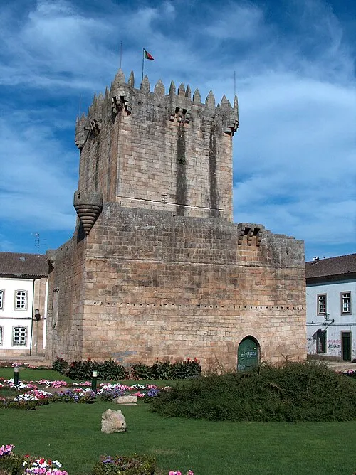 Castelo de Chaves Historic site, Santa Maria Maior20 km N
-
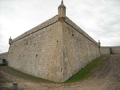 Forte de São Neutel Historic site, Santa Maria Maior21 km N
-
Vale das Carvas de Cima Natural site, Vila Real District17 km SE
-
Alto da Ursa Mountain, Fiolhoso18 km S
Sources & licences
Data last updated: