- Population
- 119,614
- 119.6K
- Elevation
- 1,572 m
- above sea level
- Local time
- UTC+03:00
- Europe/Istanbul · UTC+03:00
- Places inside
- 154
- listed under Doğubayazıt District
- Airports
- IGD Iğdır Airport50 km
- EVN Zvartnots International Airport71 km
About Doğubayazıt District
Doğubayazıt District is a district. Location: Ağrı Province, Turkey. Population: 119,614. The best months to visit are May–June, September. The nearest airport is Iğdır Airport (50 km). Nearby sights include Balıkgölü Deresi and Kula Pınarı.
Photos of Doğubayazıt District
-
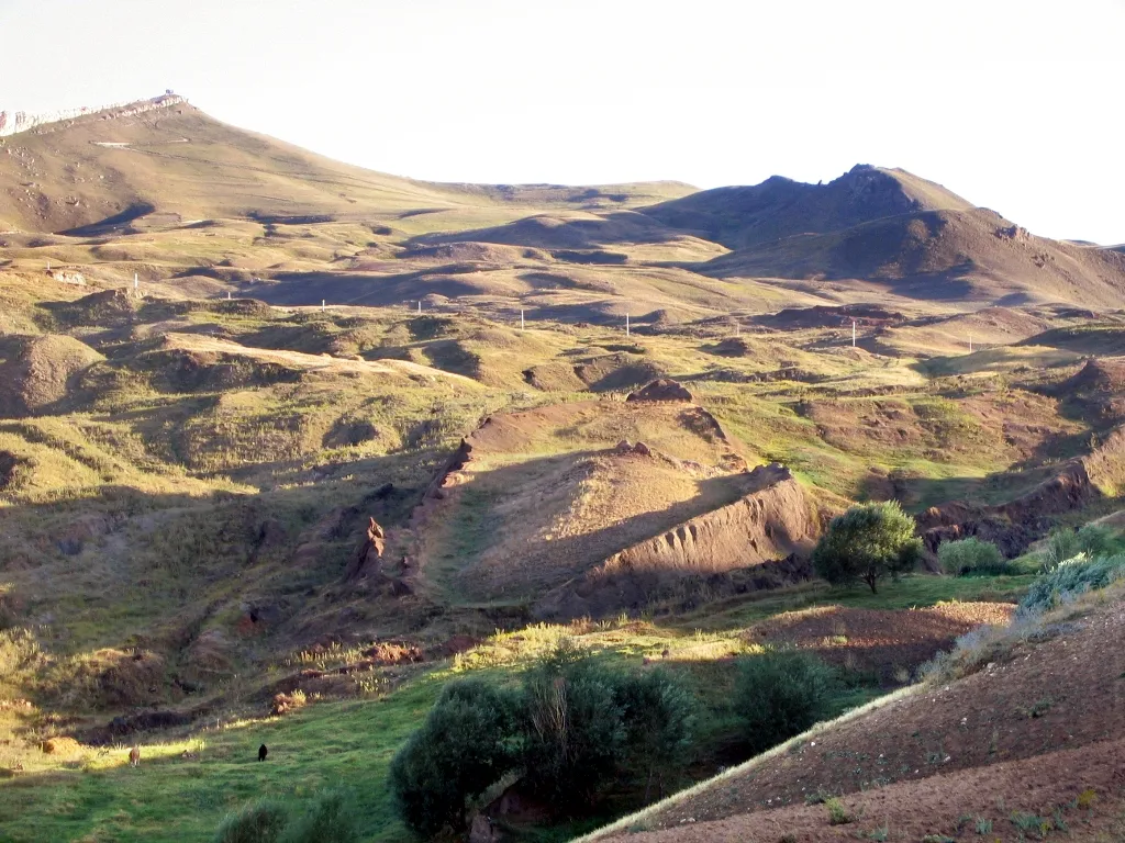
Tendürek Dağı Mfikretyilmaz · CC BY 3.0 -
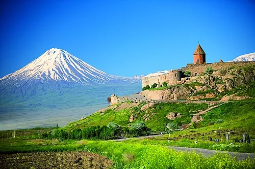
Little Ararat uncredited · CC BY-SA 3.0


Climate of Doğubayazıt District
Best months for sightseeingBest months for sightseeing: May–June, September.
This month · November
A cold month
Day 10° · Night 0° · Rain 25 mm
Better nearby cities in November
- Silopi · 294 km southwest20°
- Cizre · 298 km southwest20°
- Hottest month
- July (day 29°)
- Coldest month
- January (night -9°)
- Wettest month
- May (59 mm)
- Driest month
- August (14 mm)
Bars: average monthly low and high temperature. Below: precipitation. Monthly averages for 1970–2000 at about 18 km resolution, adjusted for elevation. Highlighted months are mild and relatively dry. Source: WorldClim 2.1 (CC BY 4.0).
Show values as a table
| Month | Jan | Feb | Mar | Apr | May | Jun | Jul | Aug | Sep | Oct | Nov | Dec |
|---|---|---|---|---|---|---|---|---|---|---|---|---|
| Average high (°C) | 0° | 1° | 7° | 14° | 20° | 25° | 29° | 29° | 25° | 17° | 10° | 3° |
| Average low (°C) | -9° | -7° | -2° | 4° | 8° | 12° | 16° | 15° | 11° | 5° | 0° | -5° |
| Precipitation (mm) | 20 | 25 | 28 | 43 | 59 | 41 | 18 | 14 | 14 | 36 | 25 | 21 |
How to get to Doğubayazıt District
The nearest airport is Iğdır Airport (IGD), 50 km to the north as the crow flies. For international flights: Zvartnots International Airport (EVN) (71 km). The nearest large city is Iğdır, 41 km to the north.
Airports
- Iğdır Airport (IGD) Iğdır 50 kmnorth
- Zvartnots International Airport (EVN) Yerevan 71 kmnorth
- Ağrı Airport (AJI) Ağrı 92 kmwest
Nearby large cities
- Iğdır Population: 101.7K 41 kmnorth
- Ağrı Population: 124.5K 92 kmwest
- Van Population: 525K 133 kmsouthwest
- Ganja Population: 330.7K 231 kmnortheast
- Rustavi Population: 128.2K 235 kmnorth
Straight-line distances; road distances are longer. Airport data: OurAirports.
Day trips from Doğubayazıt District
Within 100 km: 12 historic and cultural sites, 172 natural sites, 134 lakes, rivers and coasts.
0–25 km31 places
- Saz Gölü Lake 13 kmN
- Gölyüzü Gölü Lake 7 kmNE
- Yalıntaşdağı Tepesi Mountain 9 kmNW
- Pamukdağı Tepe Mountain 23 kmN
25–60 km98 places
- Erhacı Gölü Lake 38 kmN
- Lake Balık Lake 51 kmNW
- Kazlıgöl Lake 35 kmS
- Abbasgöl Lake 51 kmNW
60–100 km189 places
- Lim Island Island 100 kmSW
- Süphan Gölü Lake 68 kmS
- Hasantimur Gölü Lake 84 kmS
- Ziyaret Tepe Mountain 66 kmNW
Straight-line distances.
Places in Doğubayazıt District
154 places- 1 Doğubeyazıt 81.1K
- 2 Ahmedihani 13.2K
- 3 Çiftepınar 9.6K
- 4 İshakpaşa 7K
- 5 Yeni 6.6K
- 6 Hasankeyf 6.6K
- 7 Uluyol 6.3K
- 8 Sanayi 5.6K
- 9 Büyük Ağrı 5.4K
- 10 Hürriyet 5K
- 11 Koçkıran 4.7K
- 12 Barış 3.6K
- 13 Vatan 3.1K
- 14 Sarıgül 3.1K
- 15 Yılanlı 2.2K
- 16 Gürbulak 1.9K
- 17 Karabulak 1.6K
- 18 Çiftlikköy 1.4K
- 19 Telçeker 1.3K
- 20 Bardaklı 1.2K
- 21 Esnemez 1.2K
- 22 Abdigör 1.2K
- 23 Sağdıç 1.1K
- 24 Ortadirek 864
- 25 Güngören 800
- 26 Tutak 731
- 27 Dalbahçe 691
- 28 Çetenli 677
- 29 Uzunyazı 637
- 30 Somkaya 627
- 31 Suluçem 573
- 32 Karakent 561
- 33 Atabakan 531
- 34 Güllüce 515
- 35 Sağlıksuyu 486
- 36 Yaygınyurt 470
- 37 Kutlubulak 465
- 38 Dolaklı 454
- 39 Topçatan 441
- 40 Sarıbıyık 440
- 41 Ayrancı 439
- 42 Tanıktepe 419
- 43 Subeşiği 411
- 44 Kalecik 390
- 45 Ortaköy 365
- 46 İncesu 351
- 47 Hallaç 335
- 48 Gültepe 332
- 49 Yanoba 326
- 50 Golyuzu 321
- 51 Kızılkaya 311
- 52 Günyolu 302
- 53 Ortulu 295
- 54 Gözükara 287
- 55 Üzengili 285
- 56 Karaburun 253
- 57 Binkaya 228
- 58 Karaca 221
- 59 Demirtepe 219
- 60 Buyuretti 217
Bar: population relative to the most populous place in this list.
Nearby attractions & nature
Everything nearby-
Balıkgölü Deresi River, Ağrı Province3.6 km NW
-
Kula Pınarı Natural site, Ağrı Province6 km SE
-
Gölyüzü Gölü Lake, Ağrı Province7.1 km NE
-
Gernaoksuyu River, Ağrı Province7.1 km N
-
T’ezharruyg Mountain, Ağrı Province8.3 km SE
-
Akyayla Dağı Mountain, Ağrı Province16 km SE
Sources & licences
Data last updated: