- Elevation
- 1,066 m
- above sea level
- Local time
- UTC+03:00
- Europe/Istanbul · UTC+03:00
- Airports
- NAV Nevşehir Kapadokya Airport109 km
- KYA Konya Airport109 km
About Oyuklu Boğaz
Oyuklu Boğaz is a natural site. Location: Aksaray Province, Turkey. The best months to visit are May–June, September–October. The nearest airport is Nevşehir Kapadokya Airport (109 km). Nearby sights include Kocaboğaz Deresi and Kale Tepe.
Climate of Oyuklu Boğaz
Best months for sightseeingBest months for sightseeing: May–June, September–October.
This month · November
Outside the best season
Day 13° · Night 0° · Rain 41 mm
Better nearby cities in November
- Mersin · 150 km southeast22°
- Tarsus · 153 km southeast22°
- Adana · 174 km southeast21°
- Hottest month
- July (day 30°)
- Coldest month
- January (night -5°)
- Wettest month
- December (55 mm)
- Driest month
- July (4 mm)
Bars: average monthly low and high temperature. Below: precipitation. Monthly averages for 1970–2000 at about 18 km resolution, adjusted for elevation. Highlighted months are mild and relatively dry. Source: WorldClim 2.1 (CC BY 4.0).
Show values as a table
| Month | Jan | Feb | Mar | Apr | May | Jun | Jul | Aug | Sep | Oct | Nov | Dec |
|---|---|---|---|---|---|---|---|---|---|---|---|---|
| Average high (°C) | 4° | 6° | 11° | 17° | 22° | 26° | 30° | 30° | 26° | 20° | 13° | 6° |
| Average low (°C) | -5° | -4° | -1° | 4° | 7° | 10° | 13° | 12° | 8° | 4° | 0° | -3° |
| Precipitation (mm) | 53 | 45 | 48 | 49 | 41 | 20 | 4 | 4 | 7 | 26 | 41 | 55 |
Other places to visit in this season: May June September October
How to get to Oyuklu Boğaz
The nearest airport is Nevşehir Kapadokya Airport (NAV), 109 km to the northeast as the crow flies. The nearest large city is Aksaray, 48 km to the northeast.
Airports
- Nevşehir Kapadokya Airport (NAV) Nevşehir 109 kmnortheast
- Konya Airport (KYA) Konya 109 kmwest
- Çukurova International Airport (COV) Tarsus 165 kmsoutheast
Nearby large cities
- Aksaray Population: 327.6K 48 kmnortheast
- Heraclea Population: 156.3K 57 kmsoutheast
- Karaman Population: 175.4K 103 kmsouthwest
- Konya Population: 1.4M 116 kmwest
- Kırşehir Population: 150.7K 133 kmnorth
Straight-line distances; road distances are longer. Airport data: OurAirports.
Day trips from Oyuklu Boğaz
Within 100 km: 7 historic and cultural sites, 257 natural sites, 119 lakes, rivers and coasts.
0–25 km15 places
- Kale Tepe Mountain 8 kmSE
- Arısama Dağı Mountain 10 kmSE
- Ziyaret Tepe Mountain 21 kmS
- Bayırbaşı Tepe Mountain 21 kmSW
25–60 km75 places
- Akgöl Lake 50 kmNW
- Meyil Gölü Lake 39 kmW
- Lake Meke Lake 36 kmSW
- Yarık Tepe Mountain 37 kmE
60–100 km293 places
- Lake Tuz Lake 90 kmNW
- Tersakan Gölü Lake 92 kmNW
- Musalar Gölü Lake 92 kmNW
- Lake Bolluk Lake 97 kmNW
Straight-line distances.
Nearest towns and villages
-
Kolak Yaylası Village, Aksaray Province5.7 km NW
-
Emirgazi City, Emirgazi İlçesi9.6 km S
-
Çandır Village, Emirgazi İlçesi4.7 km SW
-
Akören Yaylası Village, Emirgazi İlçesi7.2 km NE
-
Emirgazi Bucağı Municipality, Konya Province9.7 km S
-
Kozin Village, Emirgazi İlçesi9.5 km SW
Nearby attractions & nature
Everything nearby-
Kocaboğaz Deresi River, Konya Province5.7 km N
-
Kale Tepe Mountain, Mersin Province7.7 km SE
-
Demirci Deresi River, Aksaray Province8.2 km E
-
Arısama Dağı Mountain, Mersin Province9.8 km SE
-
Mennekikalesi Tepe Mountain, Karapınar İlçesi24 km S
-
Memberhöyüğü Tepesi Mountain, Emirgazi İlçesi14 km NW
-
Büyükkaraoğlan Tepe Mountain, Konya Province24 km E
-
Ziyaret Tepe Mountain, Ereğli İlçesi21 km S
More nature in Turkey
-
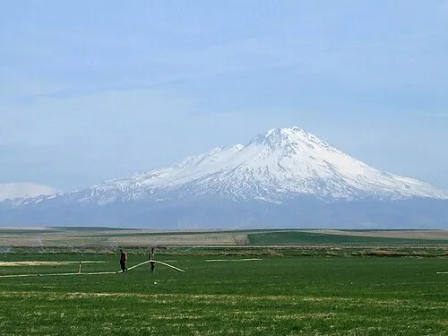 Mount Hasan Mountain, Aksaray36 km NE
-
Kılavuz Tepesi Mountain, Aksaray20 km NE
-
Deliağılkuyusu Tepesi Mountain, Aksaray28 km N
-
Obruk Platosu Natural site, Aksaray Province32 km W
-
Kızıl Tepe Mountain, Aksaray39 km NE
-
Bal Tepe Mountain, Eskil İlçesi28 km NW
Sources & licences
Data last updated: