- Population
- 12,794
- 12.8K
- Elevation
- 700 m
- above sea level
- Local time
- UTC+03:00
- Europe/Istanbul · UTC+03:00
- Places inside
- 63
- listed under Kalecik District
- Airports
- ESB Esenboğa International Airport36 km
- KFS Kastamonu Airport138 km
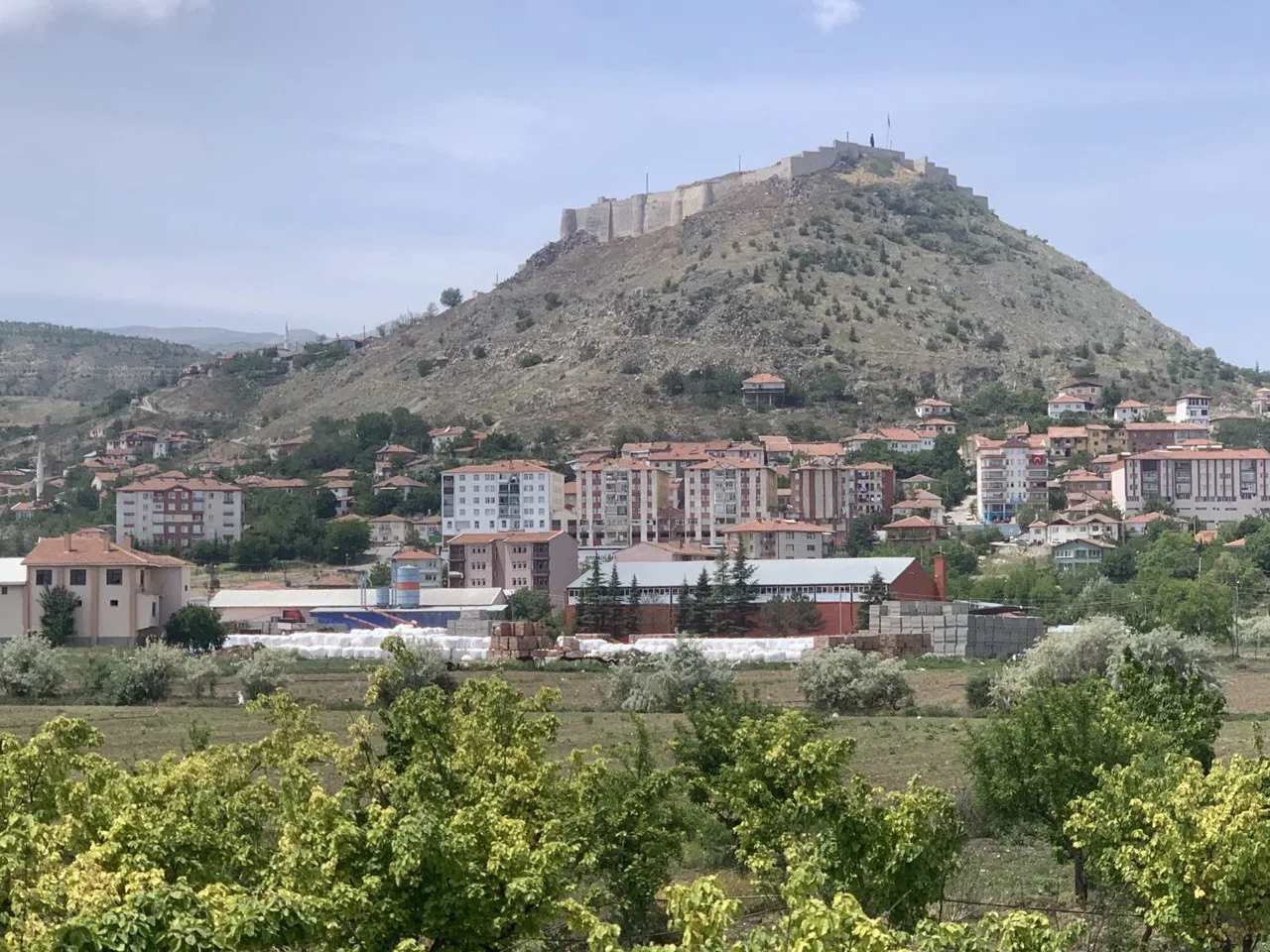
About Kalecik District
Kalecik District is a district. Location: Ankara Province, Turkey. Population: 12,794. The best months to visit are May, September–October. The nearest airport is Esenboğa International Airport (36 km). Nearby sights include Körpınar Çeşmesi and Bostanözü Çayı.
Climate of Kalecik District
Best months for sightseeingBest months for sightseeing: May, September–October.
This month · November
Outside the best season
Day 13° · Night 3° · Rain 30 mm
Better nearby cities in November
- Tarsus · 377 km south22°
- Mersin · 381 km south22°
- Adana · 384 km southeast21°
- Hottest month
- July (day 31°)
- Coldest month
- January (night -3°)
- Wettest month
- May (58 mm)
- Driest month
- August (11 mm)
Bars: average monthly low and high temperature. Below: precipitation. Monthly averages for 1970–2000 at about 18 km resolution, adjusted for elevation. Highlighted months are mild and relatively dry. Source: WorldClim 2.1 (CC BY 4.0).
Show values as a table
| Month | Jan | Feb | Mar | Apr | May | Jun | Jul | Aug | Sep | Oct | Nov | Dec |
|---|---|---|---|---|---|---|---|---|---|---|---|---|
| Average high (°C) | 5° | 7° | 13° | 19° | 23° | 28° | 31° | 31° | 27° | 21° | 13° | 7° |
| Average low (°C) | -3° | -1° | 2° | 6° | 10° | 14° | 16° | 16° | 12° | 7° | 3° | 0° |
| Precipitation (mm) | 48 | 38 | 37 | 47 | 58 | 36 | 15 | 11 | 17 | 28 | 30 | 53 |
How to get to Kalecik District
The nearest airport is Esenboğa International Airport (ESB), 36 km to the west as the crow flies. The nearest large city is Kirikkale, 30 km to the south.
Airports
- Esenboğa International Airport (ESB) Ankara 36 kmwest
- Kastamonu Airport (KFS) Kastamonu 138 kmnorth
- Nevşehir Kapadokya Airport (NAV) Nevşehir 177 kmsoutheast
Nearby large cities
- Kirikkale Population: 187K 30 kmsouth
- Çankaya Population: 792.2K 52 kmsouthwest
- Ankara Population: 3.5M 53 kmsouthwest
- Gölbaşı Population: 165.2K 63 kmsouthwest
- Kırşehir Population: 150.7K 124 kmsoutheast
Straight-line distances; road distances are longer. Airport data: OurAirports.
Day trips from Kalecik District
Within 100 km: 72 historic and cultural sites, 634 natural sites, 185 lakes, rivers and coasts.
0–25 km28 places
- Boz Tepe Mountain 21 kmNE
- Dedekaya Tepesi Mountain 18 kmW
- Aktaş Tepesi Mountain 17 kmNW
- Tekahlat Tepesi Mountain 20 kmNW
25–60 km180 places
- Büklükale Historic site 58 kmS
- İnandıktepe Historic site 32 kmN
- Lake Eymir Lake 60 kmSW
- Pazar Barajı Lake 59 kmNW
60–100 km683 places
- Lake Mogan Lake 66 kmSW
- Yunus Emre Göleti Lake 72 kmW
- Elekçi Gölü Lake 64 kmE
- Eğrekkaya Barajı Lake 77 kmNW
Straight-line distances.
Places in Kalecik District
63 places- 1 Kalecik 12.9K
- 2 Keklicek 694
- 3 Yeşilöz 419
- 4 Samanlıkköy 418
- 5 Karahüyük 409
- 6 Çandır 366
- 7 Hasayaz 297
- 8 Yılanlı 259
- 9 Gökdere 254
- 10 Eskiköy 245
- 11 Hacıköy 236
- 12 Yeniçöte 228
- 13 Değirmenkaya 216
- 14 Gölköy 215
- 15 Kılçak 208
- 16 Satılarköy 206
- 17 Kınık 198
- 18 Demirtaş 197
- 19 Mahmutlar 180
- 20 Çaykaya 179
- 21 Alibeyli 171
- 22 Çiftlikköy 165
- 23 Koyunbaba 151
- 24 Buğra 138
- 25 Yurtyenice 130
- 26 Akkuzulu 129
- 27 Akkaynak 122
- 28 Gümüşpınar 120
- 29 Beykavağı 115
- 30 Kuyucak 109
- 31 Arkbörk 98
- 32 Altıntaş 95
- 33 Gökçeören 91
- 34 Şemsettinköy 90
- 35 Elmapınar 89
- 36 Tavşancık 78
- 37 Dağdemir 78
- 38 Yüzbeyli 74
- 39 Aktepe 71
- 40 Akçataş 70
- 41 Eşmedere 70
- 42 Kızılkaya 69
- 43 Afşar 67
- 44 Karalar 67
- 45 Uyurca 59
- 46 Hancılı 56
- 47 Kargın 52
- 48 Karatepe 38
- 49 Tilki 33
- 50 Yalımköy 25
- 51 Şeyhmahmut 12
Bar: population relative to the most populous place in this list.
Cities & villages2
- Değirmenocaçğı · Village
- Orcan · Village
Mountains & nature7
- Azı Tepe · Mountain
- Bozkır Dağı · Mountain
- Boz Tepe · Mountain
- Çal Tepe · Mountain
- Fincankaya Tepesi · Mountain
- İdris Dağı · Mountain
- Seyran Tepesi · Mountain
Nearby attractions & nature
Everything nearby-
Körpınar Çeşmesi Natural site, Ankara Province9.4 km NW
-
Bostanözü Çayı River, Ankara Province8.5 km W
-
Taşavlağı Çeşmesi Natural site, Ankara Province9.7 km NE
-
Mal Boğazı Natural site, Ankara Province15 km NE
-
Halilin Çeşmesi Natural site, Ankara Province16 km W
-
Kışlabağ Tepesi Mountain, Kırıkkale Province12 km SE
Sources & licences
Data last updated: