Demirkent Bucağı
Located in Artvin Province, Turkey Coordinates: 40°53′07″ N 41°44′15″ E
- Elevation
- 720 m
- above sea level
- Local time
- UTC+03:00
- Europe/Istanbul · UTC+03:00
- Airports
- BUS Alexander Kartveli Batumi International Airport81 km
- RZV Rize–Artvin Airport82 km
About Demirkent Bucağı
Demirkent Bucağı is a municipality. Location: Artvin Province, Turkey. Elevation: 720 m. The best months to visit are May–June, September–October. The nearest airport is Alexander Kartveli Batumi International Airport (81 km). Nearby sights include Zinahor Deresi and Sağısol Tepesi.
Climate of Demirkent Bucağı
Best months for sightseeingBest months for sightseeing: May–June, September–October.
This month · November
Outside the best season
Day 13° · Night 4° · Rain 67 mm
Better nearby cities in November
- Cizre · 397 km south20°
- Hottest month
- July (day 30°)
- Coldest month
- January (night -3°)
- Wettest month
- June (76 mm)
- Driest month
- August (45 mm)
Bars: average monthly low and high temperature. Below: precipitation. Monthly averages for 1970–2000 at about 18 km resolution, adjusted for elevation. Highlighted months are mild and relatively dry. Source: WorldClim 2.1 (CC BY 4.0).
Show values as a table
| Month | Jan | Feb | Mar | Apr | May | Jun | Jul | Aug | Sep | Oct | Nov | Dec |
|---|---|---|---|---|---|---|---|---|---|---|---|---|
| Average high (°C) | 5° | 7° | 11° | 18° | 23° | 26° | 30° | 30° | 27° | 20° | 13° | 7° |
| Average low (°C) | -3° | -2° | 2° | 8° | 11° | 14° | 17° | 17° | 14° | 9° | 4° | 0° |
| Precipitation (mm) | 56 | 50 | 47 | 59 | 70 | 76 | 50 | 45 | 47 | 70 | 67 | 66 |
Other places to visit in this season: May June September October
How to get to Demirkent Bucağı
The nearest airport is Alexander Kartveli Batumi International Airport (BUS), 81 km to the north as the crow flies. The nearest large city is Batumi, 84 km to the north.
Airports
- Alexander Kartveli Batumi International Airport (BUS) Batumi 81 kmnorth
- Rize–Artvin Airport (RZV) Rize 82 kmnorthwest
- Erzurum International Airport (ERZ) Erzurum 114 kmsouthwest
Nearby large cities
- Batumi Population: 186.9K 84 kmnorth
- Rize Population: 119.8K 103 kmwest
- Erzurum Population: 767.8K 115 kmsouth
- Trabzon Population: 244.1K 170 kmwest
- Ağrı Population: 124.5K 171 kmsoutheast
Straight-line distances; road distances are longer. Airport data: OurAirports.
Day trips from Demirkent Bucağı
Within 100 km: 15 historic and cultural sites, 437 natural sites, 340 lakes, rivers and coasts.
0–25 km77 places
- Tuzlu Tepesi Mountain 24 kmNW
- Koç Dağı Mountain 10 kmNW
- Kemerli Dağ Mountain 23 kmSW
- Kel Dağ Mountain 17 kmN
25–60 km301 places
- Tortum Gölü Lake 30 kmS
- Kara Göl Lake 56 kmN
- Koca Göl Lake 41 kmNW
- Deriner Baraj Gölü Lake 30 kmNE
60–100 km414 places
- Arsianis K’edi Mountain 65 kmNE
- Kintrishi Reserve Natural site 97 kmN
- Bat’umis Qure Natural site 86 kmN
- Mtirala National Park Natural site 91 kmN
Straight-line distances.
Nearby attractions & nature
Everything nearby-
Zinahor Deresi River, Artvin Province2.1 km W
-
Sağısol Tepesi Mountain, Yusufeli İlçesi3 km S
-
Hev Deresi River, Artvin Province3.6 km SW
-
Kirazalan Deresi River, Artvin Province4.2 km NE
-
Lükeset Deresi River, Artvin Province4.4 km NE
-
Avres Deresi. River, Artvin Province5.6 km SW
-
Terzigilin Tepesi Mountain, Yusufeli İlçesi8 km SW
-
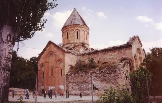 Ishkhani Monastery Attraction, Yusufeli İlçesi11 km S
Other cities and towns in Artvin Province
-
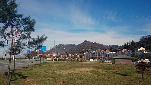 Arhavi City, Arhavi İlçesi63 km NW
-
Öğdem Bucağı Municipality, Artvin Province9.3 km W
-
Yusufeli City, Yusufeli İlçesi18 km SW
-
Yusufeli Bucağı Municipality, Artvin Province18 km SW
-
Sarıgöl Bucağı Municipality, Artvin Province22 km W
-
Artvin City, Artvin34 km N
Sources & licences
Data last updated: