Meydancık Bucağı
Located in Artvin Province, Turkey Coordinates: 41°25′10″ N 42°13′57″ E
- Elevation
- 1,385 m
- above sea level
- Local time
- UTC+03:00
- Europe/Istanbul · UTC+03:00
- Airports
- BUS Alexander Kartveli Batumi International Airport57 km
- KUT David the Builder Kutaisi International Airport87 km
About Meydancık Bucağı
Meydancık Bucağı is a municipality. Location: Artvin Province, Turkey. Elevation: 1,385 m. The best months to visit are June–September. The nearest airport is Alexander Kartveli Batumi International Airport (57 km). Nearby sights include Hasta Dağı and Göknar Deresi.
Climate of Meydancık Bucağı
Best months for sightseeingBest months for sightseeing: June–September.
This month · November
A cold month
Day 9° · Night 1° · Rain 96 mm
- Hottest month
- July (day 25°)
- Coldest month
- January (night -7°)
- Wettest month
- June (102 mm)
- Driest month
- March (61 mm)
Bars: average monthly low and high temperature. Below: precipitation. Monthly averages for 1970–2000 at about 18 km resolution, adjusted for elevation. Highlighted months are mild and relatively dry. Source: WorldClim 2.1 (CC BY 4.0).
Show values as a table
| Month | Jan | Feb | Mar | Apr | May | Jun | Jul | Aug | Sep | Oct | Nov | Dec |
|---|---|---|---|---|---|---|---|---|---|---|---|---|
| Average high (°C) | 2° | 3° | 7° | 13° | 17° | 22° | 25° | 25° | 22° | 16° | 9° | 4° |
| Average low (°C) | -7° | -6° | -3° | 3° | 7° | 9° | 13° | 12° | 9° | 5° | 1° | -4° |
| Precipitation (mm) | 84 | 72 | 61 | 73 | 91 | 102 | 71 | 74 | 75 | 98 | 96 | 100 |
Other places to visit in this season: June July August September
How to get to Meydancık Bucağı
The nearest airport is Alexander Kartveli Batumi International Airport (BUS), 57 km to the west as the crow flies. The nearest large city is Batumi, 56 km to the northwest.
Airports
- Alexander Kartveli Batumi International Airport (BUS) Batumi 57 kmwest
- David the Builder Kutaisi International Airport (KUT) Kopitnari 87 kmnorth
- Rize–Artvin Airport (RZV) Rize 119 kmwest
Nearby large cities
- Batumi Population: 186.9K 56 kmnorthwest
- Kutaisi Population: 135.2K 102 kmnorth
- Rize Population: 119.8K 150 kmwest
- Erzurum Population: 767.8K 186 kmsouthwest
- Ağrı Population: 124.5K 201 kmsouth
Straight-line distances; road distances are longer. Airport data: OurAirports.
Day trips from Meydancık Bucağı
Within 100 km: 16 historic and cultural sites, 237 natural sites, 236 lakes, rivers and coasts.
0–25 km42 places
- Kaş Dağı Mountain 18 kmSW
- Kara Dağ Mountain 15 kmNW
- Köklü Dağı Mountain 23 kmW
- Bayrak Tepesi Mountain 25 kmSW
25–60 km179 places
- Meskhetis Kedi Mountain 54 kmNE
- Arsianis K’edi Mountain 32 kmSE
- Kintrishi Reserve Natural site 39 kmNW
- Bat’umis Qure Natural site 55 kmNW
60–100 km268 places
- Kumurdo Cathedral Attraction 94 kmE
- Vanis Kvabebi Attraction 90 kmE
- Tmogvi Castle Historic site 91 kmE
- Khertvisi Fortress Historic site 88 kmE
Straight-line distances.
Nearby attractions & nature
Everything nearby-
Hasta Dağı Mountain, Şavşat İlçesi2 km SW
-
Göknar Deresi River, Artvin Province1.9 km NW
-
Kelsarı Deresi River, Artvin Province5.2 km SE
-
Kalabir Deresi River, Artvin Province6.4 km NW
-
Detobensuyu River, Artvin Province6.5 km SE
-
Salasiyet Deresi River, Artvin Province7.4 km SE
-
Gaciyon Deresi River, Artvin Province8.1 km NW
-
Kül Dağı Mountain, Şavşat İlçesi8 km N
Other cities and towns in Artvin Province
-
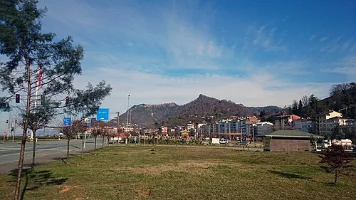 Arhavi City, Arhavi İlçesi78 km W
-
Şavşat City, Şavşat İlçesi21 km SE
-
Veliköy Bucağı Municipality, Artvin Province21 km SE
-
Şavşat Bucağı Municipality, Artvin Province21 km SE
-
Ortaköy Bucağı Municipality, Artvin Province26 km SW
-
Aşağı Irmaklar Bucağı Municipality, Artvin Province26 km S
Sources & licences
Data last updated: