- Elevation
- 1,811 m
- above sea level
- Local time
- UTC+03:00
- Europe/Istanbul · UTC+03:00
- Airports
- ERZ Erzurum International Airport63 km
- RZV Rize–Artvin Airport100 km
About Gökderesuyu
Gökderesuyu is a river. Location: Erzurum Province, Turkey. The best months to visit are June–September. The nearest airport is Erzurum International Airport (63 km). Nearby sights include Çorman Deresi and Yassı Tepe.
Climate of Gökderesuyu
Best months for sightseeingBest months for sightseeing: June–September.
This month · November
A cold month
Day 7° · Night -3° · Rain 48 mm
Better nearby cities in November
- Cizre · 351 km south20°
- Silopi · 365 km south20°
- Kızıltepe · 372 km south19°
- Hottest month
- August (day 27°)
- Coldest month
- January (night -11°)
- Wettest month
- May (80 mm)
- Driest month
- August (31 mm)
Bars: average monthly low and high temperature. Below: precipitation. Monthly averages for 1970–2000 at about 18 km resolution, adjusted for elevation. Highlighted months are mild and relatively dry. Source: WorldClim 2.1 (CC BY 4.0).
Show values as a table
| Month | Jan | Feb | Mar | Apr | May | Jun | Jul | Aug | Sep | Oct | Nov | Dec |
|---|---|---|---|---|---|---|---|---|---|---|---|---|
| Average high (°C) | -1° | 0° | 4° | 12° | 17° | 22° | 26° | 27° | 22° | 15° | 7° | 1° |
| Average low (°C) | -11° | -10° | -6° | 1° | 5° | 8° | 12° | 11° | 7° | 2° | -3° | -8° |
| Precipitation (mm) | 33 | 35 | 41 | 62 | 80 | 64 | 38 | 31 | 31 | 55 | 48 | 38 |
Other places to visit in this season: June July August September
How to get to Gökderesuyu
The nearest airport is Erzurum International Airport (ERZ), 63 km to the southwest as the crow flies. For international flights: Alexander Kartveli Batumi International Airport (BUS) (129 km). The nearest large city is Erzurum, 64 km to the south.
Airports
- Erzurum International Airport (ERZ) Erzurum 63 kmsouthwest
- Rize–Artvin Airport (RZV) Rize 100 kmnorthwest
- Alexander Kartveli Batumi International Airport (BUS) Batumi 129 kmnorth
Nearby large cities
- Erzurum Population: 767.8K 64 kmsouth
- Rize Population: 119.8K 106 kmnorthwest
- Batumi Population: 186.9K 132 kmnorth
- Ağrı Population: 124.5K 152 kmsoutheast
- Trabzon Population: 244.1K 165 kmnorthwest
Straight-line distances; road distances are longer. Airport data: OurAirports.
Day trips from Gökderesuyu
Within 100 km: 15 historic and cultural sites, 678 natural sites, 414 lakes, rivers and coasts.
0–25 km59 places
- Tortum Gölü Lake 22 kmNE
- Yazyurdu Tepesi Mountain 14 kmW
- Karadağ Mountain 23 kmE
- Karaçağıl Dağı Mountain 24 kmSW
25–60 km252 places
- Yedi Göller Lake 59 kmW
- Ziyaret Tepesi Mountain 41 kmS
- Yayla Tepesi Mountain 51 kmSW
- Verçenik Tepesi Mountain 58 kmNW
60–100 km796 places
- Şenyurt Plajı Beach 95 kmNW
- Pazar Kirazlık Plajı Beach 97 kmNW
- Kara Göl Lake 100 kmW
- Koca Göl Lake 79 kmN
Straight-line distances.
Nearest towns and villages
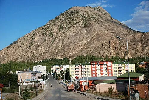
Nearby attractions & nature
Everything nearby-
Çorman Deresi River, Erzurum Province2.3 km SW
-
Yassı Tepe Mountain, Tortum İlçesi3.6 km S
-
Kaleboynu Çayı River, Erzurum Province3.9 km SW
-
Akkütük Tepesi Mountain, Tortum İlçesi4.8 km NE
-
Kılıç Tepesi Mountain, Tortum İlçesi4 km E
-
Uzunkavak Çayı River, Erzurum Province5 km N
-
Kugans Deresi River, Erzurum Province5.6 km S
-
Vihik Deresi River, Erzurum Province5.7 km N
Sources & licences
Data last updated: