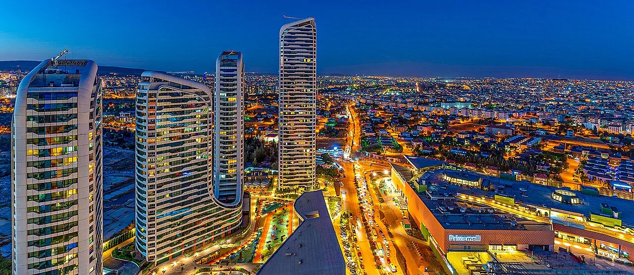
- Population
- 2,154,051
- 2.2M
- Elevation
- 897 m
- above sea level
- Local time
- UTC+03:00
- Europe/Istanbul · UTC+03:00
- Places inside
- 181
- listed under Gaziantep Province
- Airports
- GZT Gaziantep Oğuzeli International Airport20 km
- KCM Kahramanmaraş Airport61 km
About Gaziantep Province
Gaziantep Province is a region. Location: Turkey. Population: 2,154,051.
Gaziantep Province (Turkish: Gaziantep ili) is a province and metropolitan municipality in south-central Turkey. It is located in the westernmost part of Turkey's Southeastern Anatolia Region and partially in the Mediterranean Region. Its area is 6,803 km2, and its population is 2,154,051 (2022). Its capital is the city of Gaziantep. It neighbours Adıyaman to the northeast, Şanlıurfa to the east, Syria and Kilis to the south, Hatay to the southwest, Osmaniye to the west and Kahramanmaraş to the northwest.
Source: Wikipedia · CC BY-SA 4.0
Photos of Gaziantep Province
-

Volker Höhfeld · CC BY-SA 4.0 -

Murat Kaçiran · CC BY-SA 4.0 -

YG1 · CC BY 4.0 -

Carole Raddato · CC BY-SA 2.0 -

Volker Höhfeld · CC BY-SA 4.0


Places bordering Gaziantep Province
Climate of Gaziantep Province
Best months for sightseeingBest months for sightseeing: April–May, October.
This month · November
Outside the best season
Day 16° · Night 4° · Rain 63 mm
Better nearby cities in November
- Osmaniye · 96 km west21°
- Suruç · 98 km east20°
- İskenderun · 117 km southwest22°
- Hottest month
- August (day 36°)
- Coldest month
- January (night -2°)
- Wettest month
- January (102 mm)
- Driest month
- July (2 mm)
Bars: average monthly low and high temperature. Below: precipitation. Monthly averages for 1970–2000 at about 18 km resolution, adjusted for elevation. Highlighted months are mild and relatively dry. Source: WorldClim 2.1 (CC BY 4.0).
Show values as a table
| Month | Jan | Feb | Mar | Apr | May | Jun | Jul | Aug | Sep | Oct | Nov | Dec |
|---|---|---|---|---|---|---|---|---|---|---|---|---|
| Average high (°C) | 8° | 9° | 14° | 20° | 26° | 32° | 35° | 36° | 32° | 25° | 16° | 10° |
| Average low (°C) | -2° | -1° | 2° | 7° | 11° | 16° | 19° | 19° | 15° | 9° | 4° | 0° |
| Precipitation (mm) | 102 | 83 | 80 | 55 | 36 | 7 | 2 | 2 | 5 | 36 | 63 | 102 |
How to get to Gaziantep Province
The nearest airport is Gaziantep Oğuzeli International Airport (GZT), 20 km to the southeast as the crow flies. The nearest large city is Gaziantep, 5 km to the southeast.
Airports
- Gaziantep Oğuzeli International Airport (GZT) Gaziantep 20 kmsoutheast
- Kahramanmaraş Airport (KCM) Kahramanmaraş 61 kmnorthwest
- Aleppo International Airport (ALP) Aleppo 101 kmsouth
Nearby large cities
- Gaziantep Population: 2.2M 5 kmsoutheast
- Kilis Population: 111.6K 45 kmsouthwest
- Kahramanmaraş Population: 385K 66 kmnorthwest
- Osmaniye Population: 202.8K 97 kmwest
- Suruç Population: 101.2K 98 kmeast
Straight-line distances; road distances are longer. Airport data: OurAirports.
Places in Gaziantep Province
181 places- 1 Gaziantep 2.2M
- 2 Şehitkamil 857.2K
- 3 Şahinbey İlçesi 817.3K
- 4 Nizip İlçesi 135.6K
- 5 İslahiye İlçesi 67.6K
- 6 Nurdağı İlçesi 37.6K
- 7 Oğuzeli İlçesi 33.4K
- 8 Araban 32.9K
- 9 Yavuzeli İlçesi 21.3K
- 10 Karkamış İlçesi 10.8K
Bar: population relative to the most populous place in this list.
Cities & villages6
- Araban Bucağı · Municipality
- Başçeşme · Village
- Bozkaya · Village
- Burç Bucağı · Municipality
- Çöçelli · Village
- Dedeler · Village
Mountains & nature14
- Akça Dağ · Mountain
- Alıman Kaynağı · Natural site
- Aşağı Pınar · Natural site
- Aynifarmenbaı · Natural site
- Aytancı Kaynağı · Natural site
- Bağlama Pınar · Natural site
- Başpınar · Natural site
- Çataloluk Pınarı · Natural site
- Çayırlık Pınar · Natural site
- Ceren Kaynağı · Natural site
- Cincilik Kaynağı · Natural site
- Çınarlı Pınar · Natural site
- Dedehaskı Pınarı · Natural site
- Deliabdullah Kaynağı · Natural site
Lakes, rivers & coasts30
- Akar Dere · River
- Akar Dere · River
- Akchinar · River
- Akdere · River
- Akmezraa Deresi · River
- Altıbağ Deresi · River
- Aodzhioluk · River
- Araplar Dere · River
- Arık Dere · River
- Aynafursuyu Çayı · River
- Bağırsak Dere · River
- Bahra Deresi · River
- Balık Suyu · River
- Batmantaşı · River
- Battal Deresi · River
- Bey Pınar · River
- Bostanlık Dere · River
- Bozalioğlu Çayı · River
- Bozguney Deresi · River
- Bulak Deresi · River
- Burç Göleti · Lake
- Büyük Dere · River
- Büyükpazar Deresi · River
- Çallıbogaz Dere · River
- Çanakcı Deresi · River
- Çayıroluk Dere · River
- Çelgan Deresi · River
- Değirmencik Deresi · River
- Değirmentaşı Dere · River
- Deli Çay · River
Largest cities and towns
Nature and heritage in Gaziantep Province
Sources & licences
Data last updated: · 2 independent sources