Kızmezarı Tepesi
Located in Iğdır İlçesi, Iğdır Province Coordinates: 39°54′17″ N 43°53′55″ E
- Elevation
- 1,182 m
- above sea level
- Local time
- UTC+03:00
- Europe/Istanbul · UTC+03:00
- Airports
- IGD Iğdır Airport8 km
- EVN Zvartnots International Airport51 km
About Kızmezarı Tepesi
Kızmezarı Tepesi is a mountain. Location: Iğdır İlçesi, Iğdır Province. Elevation: 1,182 m. The best months to visit are May–June, September–October. The nearest airport is Iğdır Airport (8 km). Nearby sights include Kanber Deresi and Zorköy Deresi.
Climate of Kızmezarı Tepesi
Best months for sightseeingBest months for sightseeing: May–June, September–October.
This month · November
A cold month
Day 10° · Night 0° · Rain 20 mm
Better nearby cities in November
- Silopi · 321 km southwest20°
- Cizre · 323 km southwest20°
- Hottest month
- July (day 31°)
- Coldest month
- January (night -9°)
- Wettest month
- May (53 mm)
- Driest month
- September (12 mm)
Bars: average monthly low and high temperature. Below: precipitation. Monthly averages for 1970–2000 at about 18 km resolution, adjusted for elevation. Highlighted months are mild and relatively dry. Source: WorldClim 2.1 (CC BY 4.0).
Show values as a table
| Month | Jan | Feb | Mar | Apr | May | Jun | Jul | Aug | Sep | Oct | Nov | Dec |
|---|---|---|---|---|---|---|---|---|---|---|---|---|
| Average high (°C) | 0° | 2° | 8° | 16° | 21° | 27° | 31° | 31° | 27° | 18° | 10° | 3° |
| Average low (°C) | -9° | -7° | -2° | 4° | 8° | 12° | 16° | 15° | 11° | 5° | 0° | -5° |
| Precipitation (mm) | 17 | 22 | 24 | 37 | 53 | 38 | 18 | 13 | 12 | 30 | 20 | 16 |
Other places to visit in this season: May June September October
How to get to Kızmezarı Tepesi
The nearest airport is Iğdır Airport (IGD), 8 km to the north as the crow flies. For international flights: Zvartnots International Airport (EVN) (51 km). The nearest large city is Iğdır, 13 km to the east.
Airports
- Iğdır Airport (IGD) Iğdır 8 kmnorth
- Zvartnots International Airport (EVN) Yerevan 51 kmnortheast
- Ağrı Airport (AJI) Ağrı 80 kmwest
Nearby large cities
- Iğdır Population: 101.7K 13 kmeast
- Ağrı Population: 124.5K 76 kmwest
- Van Population: 525K 163 kmsouth
- Rustavi Population: 128.2K 205 kmnortheast
- Tbilisi Population: 1M 214 kmnorth
Straight-line distances; road distances are longer. Airport data: OurAirports.
Day trips from Kızmezarı Tepesi
Within 100 km: 57 historic and cultural sites, 178 natural sites, 141 lakes, rivers and coasts.
0–25 km27 places
- Erhacı Gölü Lake 19 kmE
- Abbasgöl Lake 25 kmW
- Sıçanlı Dağ Mountain 16 kmS
- Pamukdağı Tepe Mountain 22 kmSE
25–60 km108 places
- Saz Gölü Lake 30 kmSE
- Gölyüzü Gölü Lake 39 kmSE
- Lake Balık Lake 32 kmSW
- Ziyaret Tepe Mountain 46 kmW
60–100 km241 places
- Ani Historic site 72 kmN
- Turna Gölü Lake 87 kmNW
- Papak Gölü Lake 91 kmW
- Mustafa Gölü Lake 99 kmNW
Straight-line distances.
Nearest towns and villages
-
Hoşhaber Municipality Village, Iğdır İlçesi5.8 km E
-
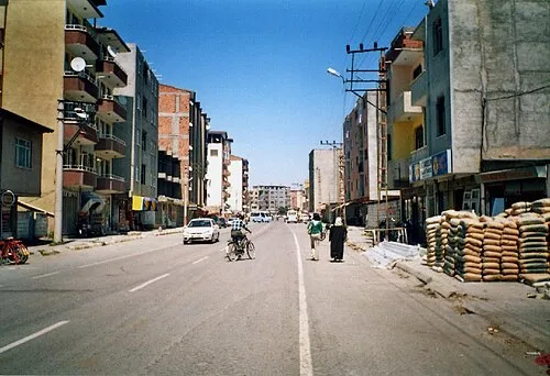 Halfeli Municipality Town, Iğdır İlçesi7.9 km E
-
Faruktoka Mahallesi Neighbourhood, Iğdır İlçesi5.4 km E
-
Yeni Mahallesi Neighbourhood, Iğdır İlçesi5.8 km E
-
Aşağı Çarıkçı Village, Iğdır İlçesi5.6 km NE
-
 Yaycı Village, Iğdır İlçesi7.7 km NE
Nearby attractions & nature
Everything nearby-
Kanber Deresi River, Iğdır Province2.6 km E
-
Zorköy Deresi River, Karabük Province5.3 km SE
-
Oyuklu Dağ Mountain, Tuzluca İlçesi10 km W
-
Aşma Deresi River, Iğdır Province7.4 km W
-
Çarşela Tepesi Mountain, Iğdır İlçesi11 km S
-
Zor Dağ Mountain, Doğubayazıt District19 km S
-
Toptaş Tepesi Mountain, Tuzluca İlçesi20 km W
-
Çerkezağıl Deresi River, Iğdır Province9.4 km N
Sources & licences
Data last updated: