- Elevation
- 142 m
- above sea level
- Local time
- UTC+03:00
- Europe/Istanbul · UTC+03:00
- Airports
- SAW Istanbul Sabiha Gökçen International Airport15 km
- IST İstanbul Airport50 km
About Basibuyuk
Basibuyuk is a village. Location: Maltepe, Istanbul. Elevation: 142 m. The best months to visit are May–September. The nearest airport is Istanbul Sabiha Gökçen International Airport (15 km). Nearby sights include Kayış Dağı and Tema Nezahat Gokyigit Park.
Photos of Basibuyuk
-
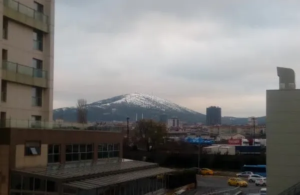
Kayış Dağı Mirada · CC BY-SA 2.5

Climate of Basibuyuk
Best months for sightseeingBest months for sightseeing: May–September.
This month · November
Outside the best season
Day 14° · Night 7° · Rain 87 mm
Better nearby cities in November
- Aydin · 364 km south19°
- Hottest month
- July (day 27°)
- Coldest month
- February (night 2°)
- Wettest month
- December (111 mm)
- Driest month
- July (26 mm)
Bars: average monthly low and high temperature. Below: precipitation. Monthly averages for 1970–2000 at about 18 km resolution, adjusted for elevation. Highlighted months are mild and relatively dry. Source: WorldClim 2.1 (CC BY 4.0).
Show values as a table
| Month | Jan | Feb | Mar | Apr | May | Jun | Jul | Aug | Sep | Oct | Nov | Dec |
|---|---|---|---|---|---|---|---|---|---|---|---|---|
| Average high (°C) | 8° | 9° | 11° | 16° | 21° | 25° | 27° | 27° | 24° | 19° | 14° | 10° |
| Average low (°C) | 3° | 2° | 4° | 7° | 12° | 16° | 18° | 18° | 15° | 11° | 7° | 5° |
| Precipitation (mm) | 93 | 67 | 64 | 48 | 37 | 30 | 26 | 33 | 43 | 78 | 87 | 111 |
Other places to visit in this season: May June July August September
How to get to Basibuyuk
The nearest airport is Istanbul Sabiha Gökçen International Airport (SAW), 15 km to the southeast as the crow flies. The nearest large city is Maltepe, 2 km to the south.
Airports
- Istanbul Sabiha Gökçen International Airport (SAW) Pendik, Istanbul 15 kmsoutheast
- İstanbul Airport (IST) Istanbul 50 kmnorthwest
- Bursa Yenişehir Airport (YEI) Yenişehir 85 kmsoutheast
Nearby large cities
- Maltepe Population: 427K 2 kmsouth
- Ataşehir Population: 361.6K 4 kmnorthwest
- Ümraniye Population: 573.3K 7 kmnorth
- Sancaktepe Population: 489.8K 9 kmnortheast
- Sultanbeyli Population: 358.2K 10 kmeast
Straight-line distances; road distances are longer. Airport data: OurAirports.
Day trips from Basibuyuk
Within 100 km: 157 historic and cultural sites, 158 natural sites, 248 lakes, rivers and coasts.
0–25 km163 places
- Andirovitha Island Island 12 kmS
- Pita Island Island 10 kmSW
- Princes Islands Island 10 kmSW
- Proti Island Island 10 kmSW
25–60 km172 places
- Karaburun Plajı Beach 56 kmNW
- Karaburun Sahili Plaj Beach 59 kmNW
- Yeniköy Plajı Beach 55 kmNW
- Kara Burun Plaji Beach 57 kmNW
60–100 km228 places
- Yeniköy Plaj Beach 90 kmSW
- Mutlu Adası Island 98 kmSW
- Kefken Adası Island 98 kmE
- İmralı Adası Island 69 kmSW
Straight-line distances.
Nearby attractions & nature
Everything nearby-
Kayış Dağı Mountain, Maltepe2.1 km NE
-
Tema Nezahat Gokyigit Park Natural site, Ümraniye5.2 km NW
-
Bakır Dağı Mountain, Ümraniye5.7 km NE
-
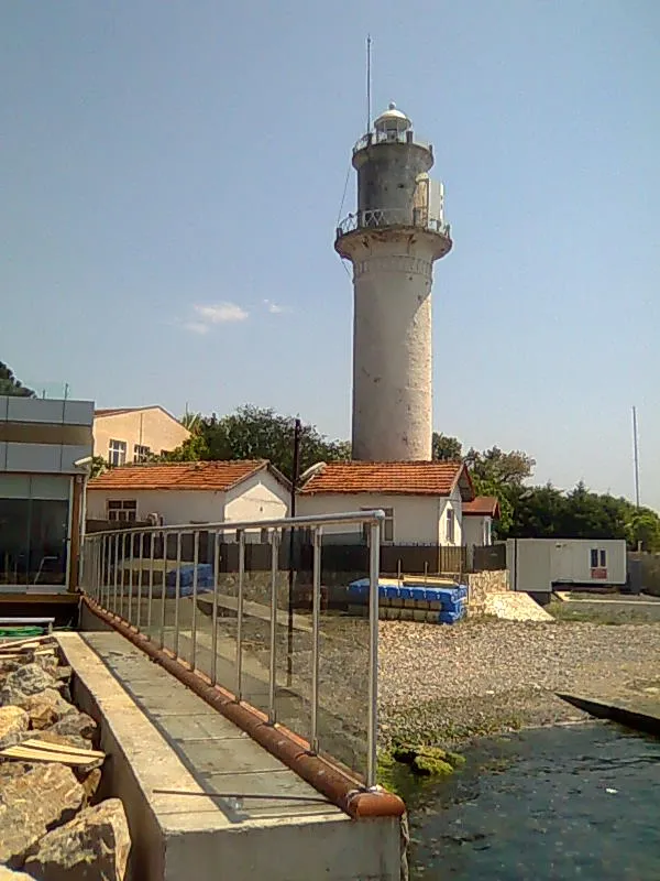 Fenerbahçe Lighthouse Landmark, Kadıköy9.9 km W
-
 Topkapı Palace Historic site, Fatih15 km NW
-
Damatrys Palace / Samandira Summer Palace Historic site, Sancaktepe7.5 km NE
Sources & licences
Data last updated: