Karabük Province
Local name: Karabük ili
Located in Turkey Coordinates: 41°15′00″ N 32°30′00″ E
- Population
- 252,058
- 252.1K
- Elevation
- 1,019 m
- above sea level
- Local time
- UTC+03:00
- Europe/Istanbul · UTC+03:00
- Places inside
- 68
- listed under Karabük Province
- Airports
- ONQ Zonguldak Çaycuma Airport45 km
- KFS Kastamonu Airport109 km
About Karabük Province
Karabük Province is a region. Location: Turkey. Population: 252,058.
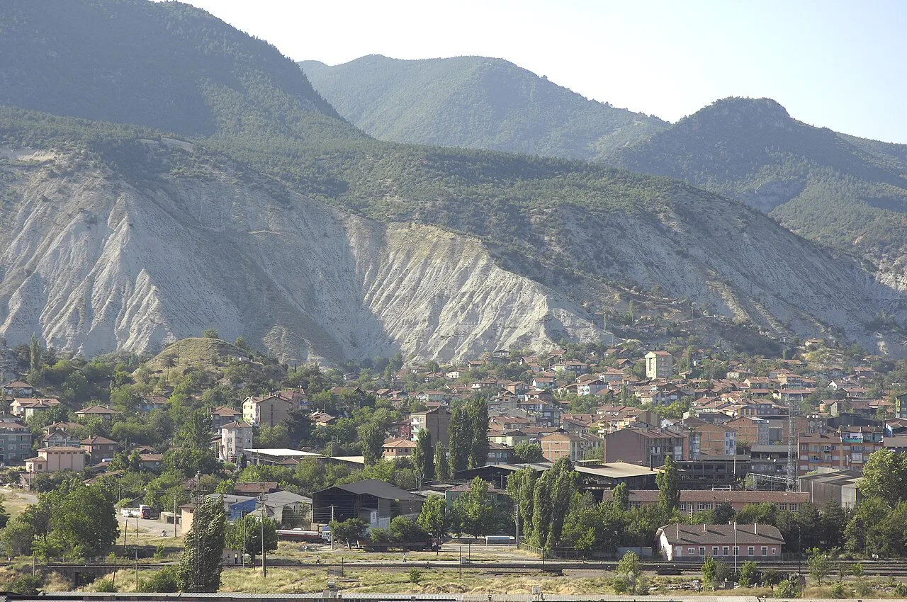
Karabük Province (Turkish: Karabük ili) is a landlocked province in the northern part of Anatolia (northern central Turkey), located about 200 km (124 mi) north of Ankara, 115 km (71 mi) away from Zonguldak and 113 km (70 mi) away from Kastamonu. Its area is 4,142 km2, and its population is 252,058 (2022). The main city is Karabük which is located about 100 km (62 mi) south of the Black Sea coast.
Source: Wikipedia · CC BY-SA 4.0
Places bordering Karabük Province
- Bolu Province
- Zonguldak Province
- Bartın Province
- Kastamonu Province
- Çankırı Province
Climate of Karabük Province
Best months for sightseeingBest months for sightseeing: June–September.
This month · November
A cold month
Day 9° · Night 1° · Rain 68 mm
- Hottest month
- July (day 24°)
- Coldest month
- January (night -4°)
- Wettest month
- December (93 mm)
- Driest month
- September (32 mm)
Bars: average monthly low and high temperature. Below: precipitation. Monthly averages for 1970–2000 at about 18 km resolution, adjusted for elevation. Highlighted months are mild and relatively dry. Source: WorldClim 2.1 (CC BY 4.0).
Show values as a table
| Month | Jan | Feb | Mar | Apr | May | Jun | Jul | Aug | Sep | Oct | Nov | Dec |
|---|---|---|---|---|---|---|---|---|---|---|---|---|
| Average high (°C) | 2° | 4° | 8° | 14° | 18° | 22° | 24° | 24° | 21° | 16° | 9° | 4° |
| Average low (°C) | -4° | -3° | -1° | 4° | 7° | 10° | 12° | 12° | 9° | 5° | 1° | -2° |
| Precipitation (mm) | 81 | 61 | 63 | 69 | 82 | 57 | 41 | 35 | 32 | 51 | 68 | 93 |
Other places to visit in this season: June July August September
How to get to Karabük Province
The nearest airport is Zonguldak Çaycuma Airport (ONQ), 45 km to the northwest as the crow flies. For international flights: Esenboğa International Airport (ESB) (131 km). The nearest large city is Karabük, 12 km to the southeast.
Airports
- Zonguldak Çaycuma Airport (ONQ) Zonguldak 45 kmnorthwest
- Kastamonu Airport (KFS) Kastamonu 109 kmeast
- Esenboğa International Airport (ESB) Ankara 131 kmsouth
Nearby large cities
- Karabük Population: 125.4K 12 kmsoutheast
- Zonguldak Population: 101.7K 63 kmwest
- Bolu Population: 184.7K 94 kmsouthwest
- Kastamonu Population: 125.6K 108 kmeast
- Düzce Population: 194.1K 121 kmwest
Straight-line distances; road distances are longer. Airport data: OurAirports.
Places in Karabük Province
68 places- 1 Safranbolu District 58.4K
- 2 Yenice District 21.7K
- 3 Eskipazar District 12.7K
- 4 Eflani District 9.3K
- 5 Ovacık District 3.4K
- 6 Pazarlıoğlu 497
- 7 Yenidoğanlar 418
- 8 Avgölü 197
- 9 Ermekoğlu 167
- 10 Ovatekkeönü 155
Bar: population relative to the most populous place in this list.
Countries & regions1
- Karabuk · District
Cities & villages18
- Aşağı Sarmaşık · Village
- Başaran · Village
- Boyacıoğlu · Village
- Çamlık · Village
- Eflani Bucağı · Municipality
- Erenler · Village
- Esenköy · Village
- Eskipazar Bucağı · Municipality
- Güzelyurt · Village
- İslamköy · Village
- Kanatlı · Village
- Kaşbaşı · Village
- Kuloğlu · Village
- Kurtlar · Village
- Madenler · Village
- Nuhuoğlu · Village
- Ovacuma Bucağı · Municipality
- Safranbolu Bucağı · Municipality
Mountains & nature1
- Akkayahamamı · Natural site
Lakes, rivers & coasts30
- Acısu Deresi · River
- Aksu Deresi · River
- Araç Çayı · River
- Araç Çayı · River
- Ayrık Dere · River
- Bağırsak Deresi · River
- Belen Deresi · River
- Bolu Çayı · River
- Çit Deresi · River
- Çungul Deresi · River
- Dalgu Deresi · River
- Değirmencik Deresi · River
- Değirmen Deresi · River
- Doksan Dere · River
- Domuz Deresi · River
- Elcik Deresi · River
- Eskipazar Çayı · River
- Gerede Çayı · River
- İnce Dere · River
- Karaağaç Deresi · River
- Karaçakıl Deresi · River
- Karaçay Deresi · River
- Karandualtı Deresi · River
- Kelesen Deresi · River
- Kirpe Deresi · River
- Kırk Deresi · River
- Kızılkaya Deresi · River
- Körük Deresi · River
- Malagöz Deresi · River
- Öküz Deresi · River
Largest cities and towns
-
 Karabük City, Karabuk125.4K
-
Ovacık City, Ovacık District5.1K
-
Safranbolu City, Safranbolu District35.2K
-
Bostanbükü Town, Safranbolu District5.6K
-
Cumayanı Village, Karabuk3.1K
-
Yazıköy Village, Safranbolu District4.2K
-
Zopran Village, Karabuk2.5K
-
Tokatlı Village, Safranbolu District2.1K
Nature and heritage in Karabük Province
Sources & licences
Data last updated: · 2 independent sources