- Population
- 5,000
- 5K
- Elevation
- 3 m
- above sea level
- Local time
- UTC+03:00
- Europe/Istanbul · UTC+03:00
- Airports
- DLM Dalaman International Airport19 km
- RHO Rhodes International Airport "Diagoras"69 km
About Dalyan
Dalyan is a town. Location: Ortaca İlçesi, Muğla Province. Population: 5,000. Elevation: 3 m.
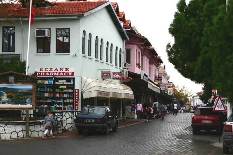
Dalyan is a neighbourhood of the municipality and district of Ortaca, Muğla Province, Turkey. Its population is 5,829 (2022). Before the 2013 reorganisation, it was a town (belde). It is located between Marmaris and Fethiye on the south-west coast of Turkey. Dalyan achieved international fame in 1987 when developers wanted to build a luxury hotel on the nearby İztuzu Beach, a breeding ground for the endangered loggerhead sea turtle species.
Source: Wikipedia · CC BY-SA 4.0
Photos of Dalyan
-

Dosseman · CC BY-SA 4.0 -

Satirdan kahraman · CC0 -

Satirdan kahraman · CC0 -

Tolga Alan · CC BY-SA 4.0 -

karel291 · CC BY 3.0


Travel notes for Dalyan
From Wikivoyage
This page describes Dalyan in Muğla Province of Turkey, not the city of Dalian in China.
For Dalyan village in the Troad Peninsula south of Çanakkale, see Geyikli.
Dalyan is a small resort town in Lycia on the Mediterranean coast of Turkey. It's administratively part of Muğla province and in 2020 had a population of 5564. The main attraction is the ancient port of Kaunos, which silted up and lost its importance when a sandbar formed across the river estuary. This turned the navigable bay into a reedy wetland, and the site was abandoned in the 15th century AD.
Get in+
Dalyan is 29 km west of Dalaman Airport. Most visitors arrive on package flights from Europe, and the coach transfer takes about 40 minutes.
Buses from Istanbul and Izmir towards Fethiye follow Highway D400 and stop in Ortaca village and Dalaman's edge of town bus station - from those take a bus or dolmuş into Dalyan. The Havaş bus from Dalaman Airport to Marmaris also stops there, but charges the full fare to Marmaris.
Muttaş is the regional bus company, run by Muğla district council. Bus 8-8 runs every 15 min between Ortaca and Dalyan via Okçular, and Bus 8-9 is a less frequent service via Eskiköy.
Buses and dolmuşes stop along Atatürk Cd the main boulevard in Dalyan, there isn't a bus station.
Source: Wikivoyage · CC BY-SA 4.0 · abridged
Climate of Dalyan
Best months for sightseeingBest months for sightseeing: April–May, October.
This month · November
A wet month
Day 20° · Night 12° · Rain 143 mm
Better nearby cities in November
- Aydin · 133 km northwest19°
- Alanya · 301 km east21°
- Hottest month
- July (day 34°)
- Coldest month
- January (night 8°)
- Wettest month
- December (231 mm)
- Driest month
- July (6 mm)
Bars: average monthly low and high temperature. Below: precipitation. Monthly averages for 1970–2000 at about 18 km resolution, adjusted for elevation. Highlighted months are mild and relatively dry. Source: WorldClim 2.1 (CC BY 4.0).
Show values as a table
| Month | Jan | Feb | Mar | Apr | May | Jun | Jul | Aug | Sep | Oct | Nov | Dec |
|---|---|---|---|---|---|---|---|---|---|---|---|---|
| Average high (°C) | 15° | 15° | 18° | 22° | 26° | 31° | 34° | 34° | 31° | 26° | 20° | 16° |
| Average low (°C) | 8° | 8° | 9° | 12° | 16° | 20° | 23° | 23° | 20° | 16° | 12° | 9° |
| Precipitation (mm) | 208 | 158 | 98 | 49 | 30 | 15 | 6 | 6 | 18 | 77 | 143 | 231 |
How to get to Dalyan
The nearest airport is Dalaman International Airport (DLM), 19 km to the southeast as the crow flies. The nearest large city is Denizli, 111 km to the north.
Airports
- Dalaman International Airport (DLM) Dalaman 19 kmsoutheast
- Rhodes International Airport "Diagoras" (RHO) Rhodes 69 kmsouthwest
- Milas Bodrum International Airport (BJV) Bodrum 99 kmnorthwest
Nearby large cities
- Denizli Population: 313.2K 111 kmnorth
- Merkezefendi Population: 280.3K 113 kmnorth
- Nazilli Population: 119.4K 123 kmnorth
- Aydin Population: 163K 133 kmnorthwest
- Antalya Population: 1.3M 183 kmeast
Straight-line distances; road distances are longer. Airport data: OurAirports.
Day trips from Dalyan
Within 100 km: 33 historic and cultural sites, 343 natural sites, 250 lakes, rivers and coasts.
0–25 km78 places
- Papas Island Island 16 kmS
- Delikada Island 6 kmSW
- Sülüngür Gölü Lake 5 kmS
- Lake Köyceğiz Lake 9 kmN
25–60 km242 places
- Çalış Beach Beach 46 kmSE
- Uzunyalı Plajı Beach 34 kmW
- Ölüdeniz Plajı Beach 53 kmSE
- Kidrak Beach Beach 55 kmSE
60–100 km306 places
- Taşlık Plajı Beach 86 kmW
- Kumluk Plajı Beach 86 kmW
- Hastanealtı Plajı Beach 86 kmW
- Yıldız Adaları Island 90 kmW
Straight-line distances.
Nearby attractions & nature
Everything nearby-
Caunos Tombs of the Kings Historic site, Köyceğiz İlçesi0.8 km W
-
Kavnos Harabe Historic site, Köyceğiz İlçesi2.2 km SW
-
Evlemez Dağı Mountain, Köyceğiz İlçesi4.3 km NW
-
Kızılkaya Tepesi Mountain, Köyceğiz İlçesi4.5 km SW
-
Gezbil Tepesi Mountain, Köyceğiz İlçesi4.9 km W
-
Bozburun Tepesi Mountain, Ortaca İlçesi6.7 km S
-
Dalyan Deresi River, Muğla Province4.1 km SW
-
Çobandağı Tepesi Mountain, Ortaca İlçesi7.2 km S
Sources & licences
Data last updated: · 2 independent sources