Kızılkaya Tepesi
Located in Köyceğiz İlçesi, Muğla Province Coordinates: 36°48′50″ N 28°36′05″ E
- Elevation
- 200 m
- above sea level
- Local time
- UTC+03:00
- Europe/Istanbul · UTC+03:00
- Airports
- DLM Dalaman International Airport20 km
- RHO Rhodes International Airport "Diagoras"65 km
About Kızılkaya Tepesi
Kızılkaya Tepesi is a mountain. Location: Köyceğiz İlçesi, Muğla Province. Elevation: 200 m. The best months to visit are April–May, October. The nearest airport is Dalaman International Airport (20 km). Nearby sights include Gezbil Tepesi and Ekincik Tepesi.
Climate of Kızılkaya Tepesi
Best months for sightseeingBest months for sightseeing: April–May, October.
This month · November
A wet month
Day 19° · Night 11° · Rain 144 mm
Better nearby cities in November
- Aydin · 133 km northwest19°
- Alanya · 305 km east21°
- Hottest month
- July (day 32°)
- Coldest month
- January (night 7°)
- Wettest month
- December (233 mm)
- Driest month
- July (5 mm)
Bars: average monthly low and high temperature. Below: precipitation. Monthly averages for 1970–2000 at about 18 km resolution, adjusted for elevation. Highlighted months are mild and relatively dry. Source: WorldClim 2.1 (CC BY 4.0).
Show values as a table
| Month | Jan | Feb | Mar | Apr | May | Jun | Jul | Aug | Sep | Oct | Nov | Dec |
|---|---|---|---|---|---|---|---|---|---|---|---|---|
| Average high (°C) | 14° | 14° | 16° | 20° | 24° | 29° | 32° | 31° | 29° | 24° | 19° | 15° |
| Average low (°C) | 7° | 7° | 8° | 11° | 15° | 19° | 22° | 22° | 19° | 15° | 11° | 8° |
| Precipitation (mm) | 212 | 160 | 96 | 46 | 26 | 12 | 5 | 5 | 19 | 80 | 144 | 233 |
How to get to Kızılkaya Tepesi
The nearest airport is Dalaman International Airport (DLM), 20 km to the southeast as the crow flies. The nearest large city is Denizli, 115 km to the north.
Airports
- Dalaman International Airport (DLM) Dalaman 20 kmsoutheast
- Rhodes International Airport "Diagoras" (RHO) Rhodes 65 kmsouthwest
- Milas Bodrum International Airport (BJV) Bodrum 96 kmnorthwest
Nearby large cities
- Denizli Population: 313.2K 115 kmnorth
- Merkezefendi Population: 280.3K 117 kmnorth
- Nazilli Population: 119.4K 125 kmnorth
- Aydin Population: 163K 133 kmnorthwest
- Antalya Population: 1.3M 187 kmeast
Straight-line distances; road distances are longer. Airport data: OurAirports.
Day trips from Kızılkaya Tepesi
Within 100 km: 32 historic and cultural sites, 338 natural sites, 243 lakes, rivers and coasts.
0–25 km78 places
- Papas Island Island 16 kmSE
- Delikada Island 2 kmS
- Sülüngür Gölü Lake 5 kmSE
- Lake Köyceğiz Lake 13 kmN
25–60 km243 places
- Çalış Beach Beach 48 kmE
- Uzunyalı Plajı Beach 31 kmW
- Ölüdeniz Plajı Beach 55 kmSE
- Kidrak Beach Beach 57 kmSE
60–100 km292 places
- Taşlık Plajı Beach 82 kmW
- Kumluk Plajı Beach 82 kmW
- Hastanealtı Plajı Beach 82 kmW
- Kabak Beach Beach 61 kmSE
Straight-line distances.
Nearest towns and villages
-
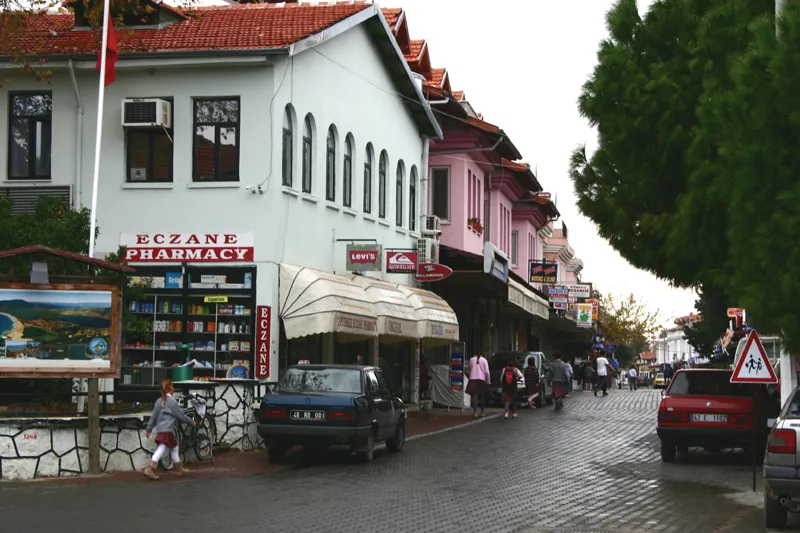 Dalyan Town, Ortaca İlçesi4.5 km NE
-
Çandır Village, Köyceğiz İlçesi1.7 km NE
-
Küçükkaraağaç Village, Köyceğiz İlçesi7.5 km N
-
Horozlar Village, Köyceğiz İlçesi4.3 km NE
-
Ova Mevkii Village, Köyceğiz İlçesi5.2 km NW
-
Ekincik Village, Köyceğiz İlçesi5.6 km NW
Nearby attractions & nature
Everything nearby-
Gezbil Tepesi Mountain, Köyceğiz İlçesi2.7 km NW
-
Ekincik Tepesi Mountain, Köyceğiz İlçesi3.4 km NW
-
Dalyan Deresi River, Muğla Province1.9 km SE
-
Delikada Island, Muğla Province2 km S
-
Evlemez Dağı Mountain, Köyceğiz İlçesi4 km N
-
Kavnos Harabe Historic site, Köyceğiz İlçesi2.3 km NE
-
Bozburun Tepesi Mountain, Ortaca İlçesi5.6 km SE
-
Kızılburun Tepesi Mountain, Köyceğiz İlçesi6.5 km W
Sources & licences
Data last updated: · 2 independent sources