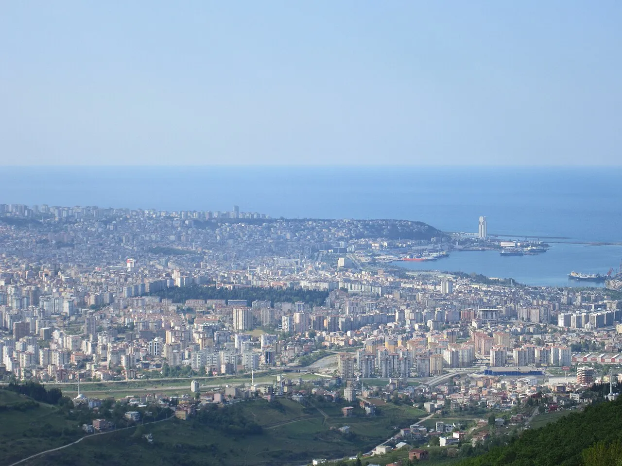
- Population
- 394,050
- 394K
- Elevation
- 64 m
- above sea level
- Local time
- UTC+03:00
- Europe/Istanbul · UTC+03:00
- Airports
- SZF Samsun-Çarşamba Airport20 km
- MZH Amasya Merzifon Airport85 km
About Samsun
Samsun is a city. Location: Samsun Province, Turkey. Population: 394,050. Elevation: 64 m. The best months to visit are May–September. The nearest airport is Samsun-Çarşamba Airport (20 km). Nearby sights include Mert River and Samsun Kalesi.
Photos of Samsun
-

Cobija · CC BY-SA 4.0 -

Lfckartal · CC BY-SA 4.0 -

Chidgk1 · CC BY-SA 4.0 -

sami yılmaz · CC BY 3.0 -

sami yılmaz · CC BY 3.0


Travel notes for Samsun
From Wikivoyage
Samsun, in the Central Karadeniz region of Turkey, is the largest city on the Turkish Black Sea coast. In 2021 it had a population of 710,000, with about as many more in its surrounding province. Mustafa Kemal Atatürk landed here with his ship Bandırma and its crew on 19 May 1919, and hence where the Turkish War of Independence began. The city is very proud of this, and loves to commemorate the landing any chance it gets.
Understand+
Samsun in antiquity was Sampsounta or Amisos. A long line of conquests culminated in the Ottoman takeover in 1420. The city traded around the Black Sea and beyond, and still does, and in the 19th century it exported the local tobacco, described as a pungent but premium product. Its mosques were stone-built but its wooden secular buildings burnt again and again, notoriously in the great fire of 1869. This plus earth tremors means that the city lacks an "Old Town" and is mostly 20th century medium-rise.
Samsun has a special place in the republican history of Turkey. In 1919 Mustafa Kemal Pasha and some 50 officers and soldiers were sent in the ship Bandırma to supervise the disbanding of defeated Ottoman troops in the east. Meanwhile the Greeks were seizing Turkish territory and looked likely to capture Ankara. He landed on 19 May 1919 and proclaimed that the fight-back had begun; he rallied the troops, drove back the Greeks and secured Turkish independence on far better terms that the original peace deal. For this he became revered as Atatürk, "father of the Turks", and 19 May is celebrated nationally as "Atatürk's birthday".
In the late 20th century Samsun became a beach resort - mostly domestic tourism and weekend second homes, as western package tourists preferred the Med coast. The city nowadays sprawls for 20 km along the coast.
The climate is warm and oceanic. Summers are warm and showery, although Samsun doesn't have high mountains to draw the clouds so it avoids the heaviest of the rainfall. Spring and autumn are pleasant, winters are cool and wet and snow is uncommon.
Get in+
Samsun is 410 km northeast of Ankara by D795. The Black Sea coast highway runs east to Trabzon (325 km) and west to Zonguldak (530 km).
By plane:
1 Samsun-Çarşamba Airport (SZF IATA), Çınarlık Blv (23 km east of city), ☏ +90 362 844 8830. Flights are frequent from Istanbul (both IST and SAW), daily from other major Turkish cities, and a few international flights in summer, mainly from Germany. Buses and taxis run to city centre and to Bafra for the Kızılırmak Delta. (updated Oct 2024)
By bus:
Buses from Istanbul run every couple of hours, taking 12 hours via Ankara, Kirikkale and Çorum; some continue to Trabzon. Buses also run from Kayseri (6 hours), Antalya (15 hours) and Izmir (14 hours). Bus lines on these routes are Metro Turizm and Flix Bus.
2 Samsun Bus Terminal is at the D795 / D010 junction 5 km west of city centre. Frequent dolmuşes run downtown.
By train:
The Hattı train runs once a day from Sivas, which has fast trains from Ankara, and slow trains from the east of Turkey. Trains each way set off around 08:30 and take 8 hours via Amasya and Havza. One other train leaves Amasya early morning and takes 3 hours to Samsun, returning late afternoon - this is shown on the regional or Bölgesel part of TCDD timetables, while the Hattı is a mainline or Anahat train.
The first couple of hours out of Samsun are a slow scenic winding wooded climb crossing and recrossing the small Mert River.
This line was closed for years for track upgrading, with the promise of speedy journeys once the work was complete. Passenger services resumed in 2023 but are as slow as ever.
3 Samsun railway station (Samsun Garı) is central, next to the harbour.
Source: Wikivoyage · CC BY-SA 4.0 · abridged
Climate of Samsun
Best months for sightseeingBest months for sightseeing: May–September.
This month · November
Outside the best season
Day 15° · Night 8° · Rain 73 mm
- Hottest month
- July (day 27°)
- Coldest month
- January (night 3°)
- Wettest month
- October (79 mm)
- Driest month
- July (31 mm)
Bars: average monthly low and high temperature. Below: precipitation. Monthly averages for 1970–2000 at about 18 km resolution, adjusted for elevation. Highlighted months are mild and relatively dry. Source: WorldClim 2.1 (CC BY 4.0).
Show values as a table
| Month | Jan | Feb | Mar | Apr | May | Jun | Jul | Aug | Sep | Oct | Nov | Dec |
|---|---|---|---|---|---|---|---|---|---|---|---|---|
| Average high (°C) | 9° | 10° | 12° | 16° | 20° | 24° | 27° | 27° | 23° | 19° | 15° | 11° |
| Average low (°C) | 3° | 3° | 4° | 8° | 12° | 16° | 19° | 19° | 16° | 12° | 8° | 5° |
| Precipitation (mm) | 60 | 49 | 54 | 63 | 56 | 51 | 31 | 31 | 48 | 79 | 73 | 75 |
Other places to visit in this season: May June July August September
How to get to Samsun
The nearest airport is Samsun-Çarşamba Airport (SZF), 20 km to the east as the crow flies. The nearest large city is Amasya, 81 km to the southwest.
Airports
- Samsun-Çarşamba Airport (SZF) Samsun 20 kmeast
- Amasya Merzifon Airport (MZH) Amasya 85 kmsouthwest
- Tokat Airport (TJK) Tokat 106 kmsouth
Nearby large cities
- Amasya Population: 114.9K 81 kmsouthwest
- Turhal Population: 110.9K 101 kmsouth
- Tokat Province Population: 129.7K 109 kmsouth
- Ordu Population: 229.2K 135 kmeast
- Çorum Population: 269.6K 142 kmsouthwest
Straight-line distances; road distances are longer. Airport data: OurAirports.
Day trips from Samsun
Within 100 km: 4 historic and cultural sites, 229 natural sites, 168 lakes, rivers and coasts.
0–25 km43 places
- Çatal Tepe Mountain 23 kmNW
- Alibey Tepe Mountain 7 kmS
- Kara Tepe Mountain 11 kmSE
- Üçpınar Tepesi Mountain 20 kmW
25–60 km192 places
- Uzun Gölü Lake 38 kmNW
- Tuzlu Göl Lake 56 kmNW
- Simenlik Göl Lake 50 kmE
- Liman Göl Lake 54 kmNW
60–100 km166 places
- Karaboğaz Gölü Lake 63 kmNW
- Altınkaya Baraj Gölü Lake 95 kmW
- Karlıgöl Lake 87 kmW
- Altınkaya Barajı Lake 73 kmW
Straight-line distances.
Samsun and similar cities
Side by side with cities of similar size in the same country: population, elevation and climate.
| Measure | Samsun | Antakya | Kahramanmaraş | Beylikduzu |
|---|---|---|---|---|
| Population | 394K | 399K | 385K | 415.3K |
| Elevation | 64 m | 104 m | 564 m | 102 m |
| Summer day (hottest month) | 27° | 33° | 35° | 28° |
| Winter night (coldest month) | 3° | 6° | 1° | 2° |
| Annual rainfall | 670 mm | 1,001 mm | 654 mm | 679 mm |
| Best months | May–Sep | Apr–May, Nov | Apr–May, Oct | May–Oct |
| Distance | — | 563 km | 413 km | 647 km |
Climate values are 1970–2000 monthly averages; straight-line distance.
Nearby attractions & nature
Everything nearby-
Mert River River, Samsun Province1.3 km E
-
Samsun Kalesi Historic site, İlkadım1.7 km N
-
Karaağaç Deresi River, Samsun Province5.2 km SE
-
Körtün Irmağı River, Samsun Province5.4 km N
-
Kilise Tepe Mountain, Canik6.1 km S
-
Bakacak Tepe Mountain, Canik6.4 km S
-
Karadağ Tepe Mountain, Tekkeköy6.4 km SE
-
Muskali Tepe Mountain, Canik7.4 km S
Sources & licences
Data last updated: