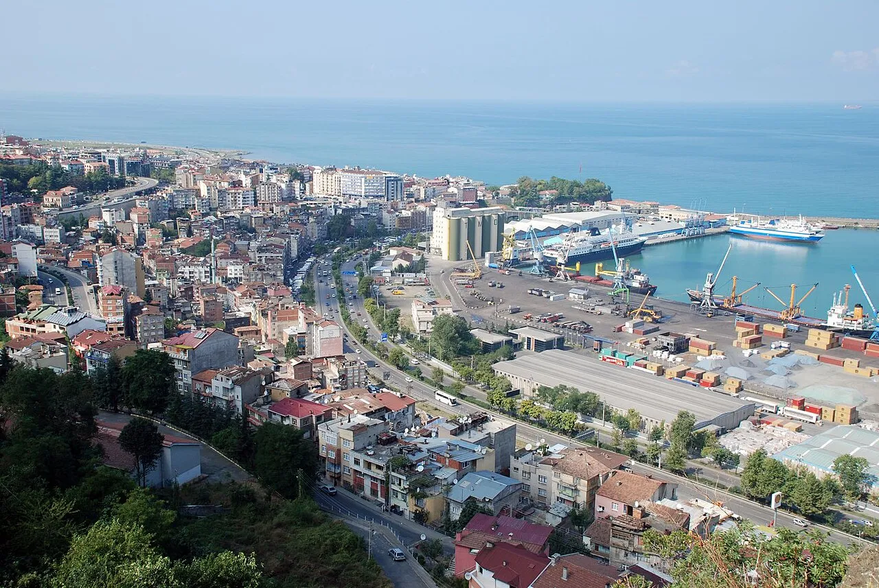
- Population
- 244,083
- 244.1K
- Elevation
- 39 m
- above sea level
- Local time
- UTC+03:00
- Europe/Istanbul · UTC+03:00
- Airports
- TZX Trabzon International Airport5 km
- RZV Rize–Artvin Airport96 km
About Trabzon
Trabzon is a city. Location: Ortahisar, Trabzon Province. Population: 244,083. Elevation: 39 m.
Trabzon (Turkish pronunciation: [tɾɑbzon]) is a city on the Black Sea coast of northeastern Turkey and the capital of Trabzon Province. Historically known as Trebizond, the city was founded in 756 BC as Trapezous (Greek: Τραπεζοῦς) by Greeks originating from Miletus. It was added into the Achaemenid Empire by Cyrus the Great and was later part of the independent Kingdom of Pontus that challenged Rome until 68 BC.
Source: Wikipedia · CC BY-SA 4.0
Photos of Trabzon
-

Scanning Dmitry Makeev , scan date - 2020 year · Public domain -

Hamdigumus · CC0 -

Hamdigumus · CC0


Travel notes for Trabzon
From Wikivoyage
Trabzon is the largest city in the Eastern Karadeniz region of Turkey, with a population of 323,000 in 2023, and another 500,000 in the outlying towns. It was once known as Trebizond, ruling an independent "Empire" around the eastern Black Sea. It's now a lively place with good visitor facilities and attractions.
Understand+
Trabzon was founded around 756 BC by Hellenistic settlers from Sinop further west. They found natural shelter for a port and a defensible tableland between two ravines, so they called it Trapezous meaning "table", and made it their citadel. The site’s other big advantage was a valley leading through the mountains to Anatolia, whereas other ports such as Sinop were pinned against the slopes. The city therefore grew into a cosmopolitan trading centre, predominantly Greek-speaking. The Romans conquered the area in 68 BC, building a new harbour and roads, and used it as a springboard for attacks on Persia.
The Romans’ eastern or Byzantine Empire was in decline after defeat at Manzikert in 1071, and its territories broke away to defend themselves, or make what peace they could. Trebizond became subject to the Mongols in 1243 but was able to continue trading east along the Silk Road from China and Persia, and west to Genoa and Venice – Marco Polo came this way. Its rulers gave themselves high-falutin’ titles as “Emperors of Trebizond” but fell to the Ottomans in 1461.
In the 18th and 19th centuries the new regional superpower was Russia, gobbling up Ottoman domains around the Black Sea, and from 1914 Turkey and Russia were adversaries in the First World War. Especially damaging to the city was the battle of Sarıkamış in the winter of 1914-15, when 80,000 young men were lost, more from the cold than Russian firepower. The city’s Armenians were wiped out in the genocide of 1915, and its Greeks were deported in the population exchange of 1923. The “Iron Curtain” of borders with the Soviet Union (which included Georgia, Armenia and Crimea) blighted trade links.
The city recovered slowly during the 1970s and more through the 1990s when the Soviet Union collapsed and those borders opened up. Its industries are based on agriculture, associated trades such as leather, plus metal, glass and IT.
Climate:
Get in+
Not by train: Trabzon is the largest city in Turkey to entirely lack a railway, which it needs for its Black Sea freight. They've been talking about building one for over a century and look set to continue.
Not by boat either: Black Sea ferries no longer sail here. A ferry from Sochi was supposed to start in 2025 but didn't.
By plane:
1 Trabzon Airport (TZX IATA), ☏ +90 462 3280940, infotrabzon@dhmi.gov.tr. This has flights from Saudi Arabia and the Gulf, and Ercan in Northern Cyprus; few from Europe beyond occasionally from Germany. Domestic connections are excellent: hourly from Istanbul (IST and SAW) and at least daily from Ankara, Izmir and Adana. The airport has the usual facilities including car hire. Havaş shuttle bus runs downtown, otherwise walk to the coastal highway (westbound) for a dolmuş. (updated Jul 2025)
By road:
D010 is the six-lane coastal highway. From Sarp on the border with Georgia takes 2½ hours and from Samsun takes 4½ hours.
E97 is the inland highway, crossing the mountains to Gümüşhane and then east to Bayburt and Erzurum.
D915 looks like a short-cut on the map, going inland from Of to Bayburt to join E97. It's scenic but scary, take it slow, and don't attempt it in winter.
By bus:
Buses from Istanbul run several times a day and take 18 hours via Gebze, Izmit, Samsun and multiple Black Sea coast towns. Several continue to Batumi in Georgia.
From Erzurum is 4 hours, ten per day; from Ankara they run hourly taking 12 hours. From Erzincan is 3 hr 30 min, from Adana 15 hr. Dolmuşes from Gümüşhane run hourly.
One bus a day is from Batumi, taking six hours via Sarp and Hopa. It has been known for the eastbound bus to give up at the border if the queue to cross is too long: walk across and pick up a dolmuş, see Batumi#Get in. Change there for Tbilisi and Baku.
Bus operators include Metro Turizm, Flixbus and Ulusoy.
Source: Wikivoyage · CC BY-SA 4.0 · abridged
Twin towns and sister cities of Trabzon
- Batumi· Georgia
Source: Wikidata. Only places with a page on this site are shown.
Population of Trabzon over time
| 2007 | 396,646 | |
|---|---|---|
| 2008 | 390,797 | |
| 2009 | 408,103 | |
| 2010 | 415,652 | |
| 2012 | 312,060 | |
| 2013 | 758,237 | |
| 2014 | 766,782 | |
| 2015 | 768,417 | |
| 2021 | 816,684 | |
| 2023 | 824,352 |
Censuses and official estimates; source: Wikidata.
Climate of Trabzon
Best months for sightseeingBest months for sightseeing: May–September.
This month · November
A wet month
Day 16° · Night 9° · Rain 105 mm
- Hottest month
- August (day 26°)
- Coldest month
- February (night 4°)
- Wettest month
- October (123 mm)
- Driest month
- July (51 mm)
Bars: average monthly low and high temperature. Below: precipitation. Monthly averages for 1970–2000 at about 18 km resolution, adjusted for elevation. Highlighted months are mild and relatively dry. Source: WorldClim 2.1 (CC BY 4.0).
Show values as a table
| Month | Jan | Feb | Mar | Apr | May | Jun | Jul | Aug | Sep | Oct | Nov | Dec |
|---|---|---|---|---|---|---|---|---|---|---|---|---|
| Average high (°C) | 10° | 10° | 12° | 16° | 19° | 24° | 26° | 26° | 23° | 20° | 16° | 12° |
| Average low (°C) | 4° | 4° | 5° | 9° | 13° | 17° | 20° | 20° | 17° | 13° | 9° | 6° |
| Precipitation (mm) | 84 | 71 | 65 | 63 | 58 | 69 | 51 | 63 | 89 | 123 | 105 | 92 |
Other places to visit in this season: May June July August September
How to get to Trabzon
The nearest airport is Trabzon International Airport (TZX), 5 km to the east as the crow flies. The nearest large city is Rize, 67 km to the east.
Airports
- Trabzon International Airport (TZX) Trabzon 5 kmeast
- Rize–Artvin Airport (RZV) Rize 96 kmeast
- Ordu–Giresun Airport (OGU) Ordu 138 kmwest
Nearby large cities
- Rize Population: 119.8K 67 kmeast
- Giresun Population: 125.7K 113 kmwest
- Erzincan Population: 150.7K 142 kmsouth
- Ordu Population: 229.2K 155 kmwest
- Batumi Population: 186.9K 174 kmnortheast
Straight-line distances; road distances are longer. Airport data: OurAirports.
Day trips from Trabzon
Within 100 km: 8 historic and cultural sites, 174 natural sites, 170 lakes, rivers and coasts.
0–25 km32 places
- Sera Gölü Lake 9 kmW
- Üçpınar Tepesi Mountain 23 kmS
- Kalakafa Tepesi Mountain 19 kmSE
- Çadır Dağı Mountain 12 kmW
25–60 km96 places
- Hıdırnebi Mountain 25 kmW
- Hidirnebi Plateau Natural site 25 kmW
- Çakır Gölü Lake 48 kmS
- Cos Dağı Mountain 51 kmE
60–100 km224 places
- Salyazı Barajı Lake 84 kmS
- Beş Göller Lake 87 kmSW
- Kara Göl Lake 76 kmSE
- Zilfo Dağı Mountain 65 kmS
Straight-line distances.
Trabzon and similar cities
Side by side with cities of similar size in the same country: population, elevation and climate.
| Measure | Trabzon | Manisa | Balıkesir | İskenderun |
|---|---|---|---|---|
| Population | 244.1K | 244K | 238.2K | 251.7K |
| Elevation | 39 m | 77 m | 139 m | 9 m |
| Summer day (hottest month) | 26° | 34° | 31° | 35° |
| Winter night (coldest month) | 4° | 4° | 0° | 7° |
| Annual rainfall | 933 mm | 744 mm | 646 mm | 892 mm |
| Best months | May–Sep | Apr–May, Oct | Apr–May, Sep–Oct | Apr–May, Nov |
| Distance | — | 1,085 km | 1,017 km | 579 km |
Climate values are 1970–2000 monthly averages; straight-line distance.
Nearby attractions & nature
Everything nearby-
Trabzon Limanı Natural site, Trabzon Province2 km E
-
Koştul Deresi River, Trabzon Province1.8 km SW
-
Hagia Sophia Museum, Ortahisar2.6 km W
-
Deliktas Mediumwave Transmitter Landmark, Ortahisar3.9 km SE
-
Maçka Dere River, Trabzon Province3.4 km E
-
Kisarna Madensuyu Natural site, Trabzon Province4.4 km SW
-
Kovaga Bay Natural site, Trabzon Province10 km E
-
Sera Gölü Lake, Trabzon Province9.5 km W
Sources & licences
Data last updated: · 2 independent sources