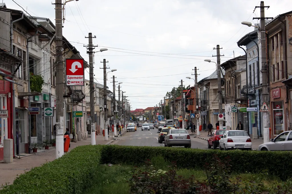
- Population
- 54,551
- 54.6K
- Elevation
- 27 m
- above sea level
- Local time
- UTC+02:00
- Europe/Bucharest · UTC+02:00
- Airports
- BBU Bucharest Băneasa Aurel Vlaicu International Airport69 km
- OTP Bucharest Henri Coandă International Airport77 km
About Giurgiu
Giurgiu is a city. Location: Municipiul Giurgiu, Giurgiu County. Population: 54,551. Elevation: 27 m. The best months to visit are April–May, September–October. The nearest airport is Bucharest Băneasa Aurel Vlaicu International Airport (69 km).
Photos of Giurgiu
-

Tiia Monto · CC BY-SA 4.0 -

Tiia Monto · CC BY-SA 4.0 -

Mmoru · CC BY-SA 3.0 -

Tiia Monto · CC BY-SA 4.0 -

Tiia Monto · CC BY-SA 4.0


Travel notes for Giurgiu
From Wikivoyage
Giurgiu is a city in Muntenia, on the northern bank of the Danube river. It's a major crossing point between Romania and Bulgaria.
Get in+
By bus:
There are frequent buses from Bucharest (at least one per hour), trip takes about slightly over one hour.
There are also a few buses per day to/from Ruse, the Bulgarian city across the river (coming and heading to Bucharest), but note they practically pass on the outskirts of Giurgiu.
By train:
There are several direct trains daily to/from Bucharest (international trains linking the Romanian capital with Sofia, Istanbul, Thessaloniki); they're rather slow (at least 2½ hours to get to Bucharest).
1 Giurgiu railway station (Gara Giurgiu). Terminus station in the city centre. (updated Aug 2023)
2 Giurgiu Nord railway station (Gara Giurgiu Nord). International trains to and from Bulgaria and Turkey only call at this station. (updated Aug 2023)
By foot:
To cross from Bulgaria into Romania it is possible to walk the bridge connecting the two and not have to pay the border tax. ID is required to pass but there is no charge. Taxi or hitching will get you to and from the end of the bridge but avoid the price spike, which crossing by train, taxi and bus incur. The walk takes 15 minutes approx.
Source: Wikivoyage · CC BY-SA 4.0 · abridged
Climate of Giurgiu
Best months for sightseeingBest months for sightseeing: April–May, September–October.
This month · November
A cold month
Day 10° · Night 1° · Rain 45 mm
- Hottest month
- July (day 30°)
- Coldest month
- January (night -5°)
- Wettest month
- June (71 mm)
- Driest month
- February (31 mm)
Bars: average monthly low and high temperature. Below: precipitation. Monthly averages for 1970–2000 at about 18 km resolution, adjusted for elevation. Highlighted months are mild and relatively dry. Source: WorldClim 2.1 (CC BY 4.0).
Show values as a table
| Month | Jan | Feb | Mar | Apr | May | Jun | Jul | Aug | Sep | Oct | Nov | Dec |
|---|---|---|---|---|---|---|---|---|---|---|---|---|
| Average high (°C) | 2° | 5° | 12° | 18° | 24° | 28° | 30° | 30° | 26° | 19° | 10° | 4° |
| Average low (°C) | -5° | -3° | 1° | 6° | 11° | 15° | 17° | 16° | 12° | 6° | 1° | -3° |
| Precipitation (mm) | 33 | 31 | 37 | 50 | 65 | 71 | 63 | 49 | 41 | 42 | 45 | 39 |
Other places to visit in this season: April May September October
How to get to Giurgiu
The nearest airport is Bucharest Băneasa Aurel Vlaicu International Airport (BBU), 69 km to the north as the crow flies. The nearest large city is Rousse, 4 km to the south.
Airports
- Bucharest Băneasa Aurel Vlaicu International Airport (BBU) Bucharest 69 kmnorth
- Bucharest Henri Coandă International Airport (OTP) Otopeni 77 kmnorth
- Varna Airport (VAR) Varna 167 kmsoutheast
Nearby large cities
- Rousse Population: 121.2K 4 kmsouth
- Ploieşti Population: 180.5K 118 kmnorth
- Piteşti Population: 141.3K 138 kmnorthwest
- Buzău Population: 103.5K 157 kmnortheast
- Stara Zagora Population: 121.6K 164 kmsouth
Straight-line distances; road distances are longer. Airport data: OurAirports.
Day trips from Giurgiu
Within 100 km: 4 historic and cultural sites, 20 natural sites.
0–25 km1 place
- Rousse TV Tower Landmark 7 kmS
25–60 km3 places
- Valea Sapaturilor Natural site 34 kmNW
- Valea Salciei Natural site 50 kmN
- Valea Bălăriei Natural site 39 kmN
60–100 km20 places
- Valea Păuceasea Natural site 80 kmNW
- Valea Negreila Natural site 81 kmNW
- Valea Colentina Natural site 79 kmN
- Valea Câinelui Natural site 98 kmNW
Straight-line distances.
Giurgiu and similar cities
Side by side with cities of similar size in the same country: population, elevation and climate.
| Measure | Giurgiu | Mediaş | Zalău | Sfantu Gheorghe |
|---|---|---|---|---|
| Population | 54.6K | 53K | 52.4K | 50.1K |
| Elevation | 27 m | 301 m | 261 m | 552 m |
| Summer day (hottest month) | 30° | 25° | 26° | 23° |
| Winter night (coldest month) | -5° | -7° | -5° | -8° |
| Annual rainfall | 566 mm | 603 mm | 672 mm | 583 mm |
| Best months | Apr–May, Sep–Oct | May–Sep | May–Sep | Jun–Sep |
| Distance | — | 283 km | 433 km | 220 km |
Climate values are 1970–2000 monthly averages; straight-line distance.
Sources & licences
Data last updated: